


38 Horseback Trails near South, Bajada, Mule Deer Loop Trail
Showing Horseback Trails within 50 miles Distance miles of S Trail, Waddell, AZ 85355, USA City, Zip, or Address

Wildlife Trail
Waddell, Arizona
1.5 miles NA short trail which terminates at a small pond.
Hike, Horseback
Mule Deer Trail (Maricopa Trail)
Waddell, Arizona
1.5 miles NMule Deer trail is a 3.5 mile out-and-back trail that it part of the Maricopa Trail within White Tank Mountain Regional Park. This is a beginner to moderate friendly trail for both hikers and...
Hike, Horseback, Mountain Bike 1.0 mi
Quail Trail
Goodyear, Arizona
14.5 miles SEQuail Trail is the access trail from the Nature Center to the main trail system. It is a pretty steep climb, but smooth and steady. Quail Trail is a spur trail in the Estrella Mountain...
Hike, Horseback, Mountain Bike
Rainbow Valley to Toothaker Loop Trail
Goodyear, Arizona
15.4 miles SEEstrella Mountain Regional Park has many trails within it, a great beginner to intermediate friendly trail is the Rainbow Valley to Toothaker Loop Trail. This 6.6 mile hike is mostly flat with a few...
Hike, Horseback, Mountain Bike
Dysart Trail
Goodyear, Arizona
15.4 miles SE$6 entry fee per car.
Hike, Horseback, Mountain Bike 3.6 mi
Toothaker Trail
Goodyear, Arizona
15.4 miles SEToothaker is an easy roller coaster of a trail. It crosses numerous washes ranging from small to large and can be a tad loose and/or rocky in some sections. The end reward is a nice view of Rainbow...
Hike, Horseback, Mountain Bike 13.8 mi
Butterfield to Gadsen Loop Trail
Goodyear, Arizona
15.5 miles SEAs with other trails in Estrella, the trail is wide and the surface tends to be rather benign, varying from mostly smooth, to occasionally strewn with small rocks, sandy in the washes. Butterfield...
Hike, Horseback, Mountain Bike 2.9 mi
Coldwater Trail
Goodyear, Arizona
15.5 miles SEThe Cold Water Trail #27 is a seldom visited, remote backcountry destination along the backdrop of the rugged Verde Rim with healthy mixed vegetation and unique geology. The trail was originally used...
Hike, Horseback, Mountain Bike 8.3 mi
Estrella Mountains Competitive Track
Tolleson, Arizona
17.5 miles SEThe third competitive track in the Maricopa County Regional Park system, located in Estrella Mountain Regional Park, was completed in February 2000. The track consists of two loops totaling 13 miles....
Hike, Horseback, Mountain Bike

Glendale Canal
Glendale, Arizona
18.4 miles EHike, Horseback, and Mountain Bike near Glendale, Arizona
Hike, Horseback, Mountain Bike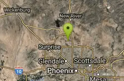
Deem Hills Circumference Trail
Phoenix, Arizona
22.4 miles NEDeem Hills s a 10.5 mile loop trail located near Phoenix, Arizona. The trail is rated as moderate and primarily used for mountain biking.
Hike, Horseback, Mountain Bike
Murphy Bridle Path Trail
Phoenix, Arizona
25.2 miles EHorseback near Phoenix, Arizona
Horseback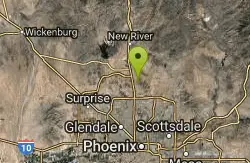
Hawk's Nest/Desert Tortoise/Dixie Mountain Loop
Phoenix, Arizona
26.3 miles NEA nice moderate trail through great desert scenery crossing creeks and twisting and turning around the hills. Provides a loop opportunity between Hawk's Nest Trail, Valle Verde Trail,...
Hike, Horseback, Mountain Bike
Hawk's Nest Trail and Dixie Mountain Loop
Phoenix, Arizona
26.3 miles NEModerate Trail providing access from the Car Park to all other trails. Directly links to Desert Tortoise Trail and Dixie Mountain Loop. Good hiking shoes/boots recommended....
Hike, Horseback, Mountain Bike
Dixie Mountain Loop with Two Summits
Phoenix, Arizona
26.3 miles NEHike, Horseback, and Mountain Bike near Phoenix, Arizona
Hike, Horseback, Mountain Bike
Dixie Mountain Loop Trail
Phoenix, Arizona
26.3 miles NEThe main loop trail at Phoenix's Sonoran Preserve provides plenty of options for either a short walk or a longer hike. The elevation gain is accumulated through small ups-and-downs along the...
Hike, Horseback, Mountain Bike 4.6 mi
Perl Charles Memorial Trail (#1A)
Phoenix, Arizona
26.6 miles EThis is a technical singletrack loop with some very steep up and down sections located in the Phoenix Mountain Preserves. This trail is for advanced riders who like to bleed and leave their skin on...
Hike, Horseback, Mountain Bike 1.3 mi
Dreamy Draw Loop Trail
Phoenix, Arizona
27.3 miles EThe Dreamy Draw Nature Trail is a short multi-access loop trail that provides a true Sonoran Desert experience. The trail crosses a number of desert washes and, at times, becomes somewhat rocky....
Hike, Horseback, Mountain Bike 1.2 mi
Ma-Ha-Tauk Trail
Phoenix, Arizona
27.6 miles SEMa-Ha-Tauk Trail can be found in South Mountain Park in Phoenix. This is a 2.5 mile, out-and-back trail. Aside from a short section of steeper incline in the first part of the hike, this is an...
Hike, Horseback
Arizona Canal Trail
Phoenix, Arizona
27.8 miles EMulti-purpose canal trails set apart from normal city traffic and noise. The Arizona Canal is one of the many canals used to supply the valley with its water needs (irrigation). These canals were...
Hike, Horseback


