


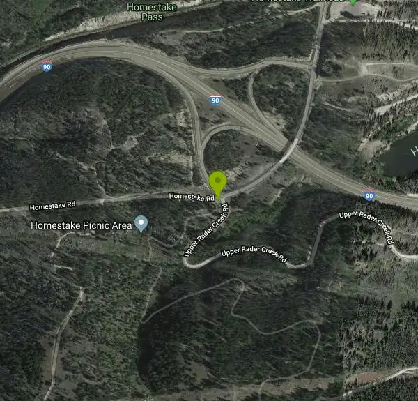
Homestake To Pipestone Pass
Butte, Montana
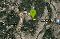
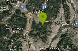
| Address: | ~756 Homestake Rd, Butte, MT 59701, USA |
| GPS: |
45°55'6.0"N 112°24'50.8"W Maps | Directions |
| State: | Montana |
| Trail Length: | 20.00 miles |
| MTB Difficulty: | Beginner |
| Trail Type: | Out & Back |
| MTB Trail Type: | Singletrack |
Mountain Bike
Buttery smooth singletrack with really fun rock features throughout, in a cool bouldery landscape. The trail is ~75% climbing for about 5 miles to the top, where there's a nice view of Butte. Climbs on the way out are intermediate-friendly but a decent workout. From the top, the trail drops down to Pipestone pass, merging with the Beaver Pond trail connector on the way and spitting you out on highway 2 just south of Pipestone pass (not to be confused with the Pipestone BLM trail area to the east). You can ride the whole thing as an out-and-back (19.5 miles) or turn around at the top for a 10 mile ride that's a lot of fun. The climb back up from the Pipestone pass side is pretty stout, so pack a lunch. Courtesy of Singletracks.com
More Information
Never modify trail features. Ride trails when they're dry enough that you won't leave ruts. Speak up when you see others on the trail and always yield to hikers, horses, and others coming uphill. Always ride on the established trail.
Read More- Plan Ahead and Prepare
- Travel & camp on durable surfaces
- Dispose of waste properly
- Leave what you find
- Minimize campfire impacts
- Respect wildlife
- Be considerate of other visitors
Directions
From Butte, Montana
- Head west on Iron St toward S Colorado St (0.2 mi)
- Turn left onto Montana St (0.4 mi)
- Continue straight to stay on Montana St (0.4 mi)
- Turn left onto La Salle St (367 ft)
- Take the Interstate 15 N/Interstate 90 E ramp on the left (0.2 mi)
- Merge onto I-90 (8.6 mi)
- Take exit 233 toward Homestake Rd (0.3 mi)
- Turn right onto Homestake RdDestination will be on the left(33 ft)
Other Mountain Bike Trails Nearby
Beaver Ponds
Butte, Montana
3.9 miles SStart by climbing just over a mile on the highway to a trailhead on the left. This is a seriously sweet piece of singletrack. The initial climb is brutal, but once on top, it turns...
Mountain Bike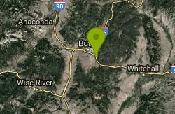
Maud S. Canyon
Butte, Montana
4.3 miles NWa fun easy fast ride. One of the most popular trails in Butte gives bikers and hikers excellent loop possibilities just minutes from town. The Maud S Canyon trail, located northeast of...
Mountain Bike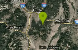
Toll Canyon
Butte, Montana
4.5 miles SStart with an extended climb at a moderate grade for a few miles. Be sure to take the short spurs to lookouts, first on the right, then on the left. Once back on the main trail,...
Mountain Bike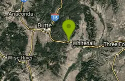
Spire Rock
Whitehall, Montana
6.9 miles EFrom the p-lot ride north on the main Delmoe Lake road for about 3.6 miles. This is a great warm-up. Turn right onto a wide four-wheelrer trail and ride up this until you come to a...
Mountain Bike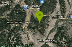
CDT: Highland
Butte, Montana
7.9 miles SThis is a new addition to the Continental Divide Trail. Go through the gate to the west with the CDT sign. There are a couple pieces of doubletrack--take the one with another CDT...
Mountain Bike 1.0 mi
Lewis & Clark Caverns
Whitehall, Montana
26.4 miles EThe Lewis & Clark Caverns State Park encompasses 3,015 acres that you can explore by foot, on a bike, in a canoe or in a tent. The most famous feature of the park is the Lewis & Clark...
Camp, Canoe, Cave, Hike, Mountain Bike 0.4-3.9 mi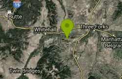
Lewis & Clark Caverns Trails
Whitehall, Montana
27.6 miles ELewis & Clark Caverns State Park is a 3,000-acre park with over 10 miles of trails open to hikers and mountain bikers. It is easy to be one with nature as you explore these adventurous trails....
Hike, Mountain Bike
Rawhide Creek
Boulder, Montana
31.1 miles NEThis is an all atv route out and back or can be looped with other trails and a lot of road. It passes by some impressive granite rock formations which, unfortunately, are not...
Mountain Bike
Muskrat Creek
Boulder, Montana
32.6 miles NEFrom the trail head, be ready to climb. It's just over a 7 mile climb to the turnaround point at the top. The climb is steep in sections with roots and some impressive rocks. There are...
Mountain Bike
Dry Creek Loop
Wise River, Montana
33.0 miles WThe loop follows MT274 to the north for about .5 mi, then joins a segment of the Continental Divide Trail through the Mt. Haggin WMA to the Dry Creek Rd. The loop then follows the Dry...
Mountain Bike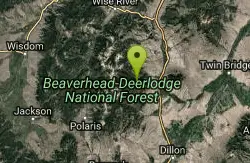
Lake Agnes
Glen, Montana
34.5 miles SWAgnes Lake Trail (122) is located in the Pioneer Mountains. The trail begins on the east side of Brownes Lake at the State campground and ends 0.5 mile east of Long Branch Lake on Willow Creek Road....
Camp, Hike, Mountain Bike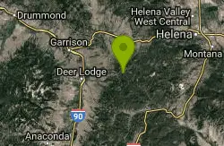
Little Blackfoot Meadows Loop
Elliston, Montana
35.3 miles NThis trail has very high quality singletrack, but that won't be apparent at first. Begin with a ride up the doubletrack on the Little Blackfoot Meadows trail (FST 329). After a while,...
Mountain Bike
Spring Hill Campground and Picnic Area
Anaconda, Montana
39.9 miles NWSpringhill Campground is located in Beaverhead-Deerlodge National Forest in southwestern Montana. Warm Springs Creek runs right next to the campground is popular among anglers who commonly catch...
Camp, Hike, Horseback, Mountain Bike, Swim
Mt Helena Ridge
Helena, Montana
45.4 miles NStart up the road. At 0.2 miles, you have your first decision point--you may turn left up the road (this the long way, but it takes you up untravelled road then gives you extra...
Mountain Bike
Mt Helena
Helena, Montana
45.4 miles NThis trail network is a fantastic asset, right next to town! There are dozens of miles of trails packed into this mountain, and you can also hook them up with the Mt Helena Ridge...
Mountain BikeNearby Campsites
Lewis & Clark Caverns
Whitehall, Montana
26.4 miles EThe Lewis & Clark Caverns State Park encompasses 3,015 acres that you can explore by foot, on a bike, in a canoe or in a tent. The most famous feature of the park is the Lewis & Clark...
Camp, Canoe, Cave, Hike, Mountain Bike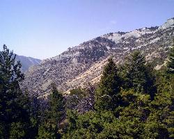
Lewis & Clark Caverns Campground
Whitehall, Montana
27.7 miles EThe Lewis & Clark Caverns Campground is a site that allows for a variety of different camping styles. With 40 campsites open for RV and tent camping, three cabins, and a tipi the Lewis &...
Camp
Lake Agnes
Glen, Montana
34.5 miles SWAgnes Lake Trail (122) is located in the Pioneer Mountains. The trail begins on the east side of Brownes Lake at the State campground and ends 0.5 mile east of Long Branch Lake on Willow Creek Road....
Camp, Hike, Mountain Bike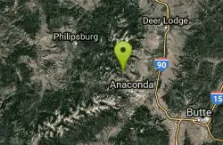
Lost Creek State Park
Anaconda, Montana
34.6 miles NWCamp near Anaconda, Montana
Camp
Spring Hill Campground and Picnic Area
Anaconda, Montana
39.9 miles NWSpringhill Campground is located in Beaverhead-Deerlodge National Forest in southwestern Montana. Warm Springs Creek runs right next to the campground is popular among anglers who commonly catch...
Camp, Hike, Horseback, Mountain Bike, Swim
Minneopa Lake
Polaris, Montana
45.1 miles SWThis is a beautiful short hike that is easily the start of a great trip between several lakes or just a nice easy kid hike. Length: .25 mile (.5 mile roundtrip)
Backpack, Camp, Hike
Flint Creek Campground
Philipsburg, Montana
47.7 miles NWFlint Creek campground is a free campground of 3 acres providing 15 camp sites next to the Flint Creek. It is located in the Beaverhead-Deerlodge National Forest. Every spot has a firepit....
Camp
Pintler Lake Campground and Picnic Area
Wise River, Montana
49.6 miles WCamp, Canoe, Kayak, and Swim near Wise River, Montana
Camp, Canoe, Kayak, Swim


