Map of 28 Hiking Trails near Springdale, Utah
first prev 1 2 next lastShowing Hiking Trails within 50 miles Distance miles of Springdale, UT, USA City, Zip, or Address

Dixie Sugarloaf / Dixie Rock
St. George, Utah
32.3 miles WHike near St. George, Utah
Hike 0.2-0.4 mi
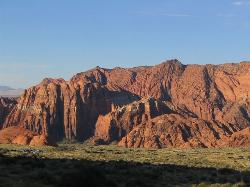
Snow Canyon State Park
St. George, Utah
35.4 miles WSnow Canyon State park is often described as a smaller version of Zion National park. While both offer similar beautiful landscapes, exciting trails for adventure seeking hikers, and family friendly...
Cave, Hike, Mountain Bike, Rock Climb 0.7 mi
Snow Canyon Lava Caves
St. George, Utah
35.5 miles WThese caves are located in Snow Canyon State Park near Dammeron Valley in Utah and it's one of the most unique places in southern Utah. Years ago, lava flowed through these caves until...
Cave, Hike 0.5-15.1 mi
Green Valley Trail System
St. George, Utah
35.9 miles WThe Green Valley trail system, located just outside of St. George, Utah, is a heavily trafficked trail system that features some of the more popular trails in Southern Utah. With trails such as the...
Hike, Mountain Bike
Montezuma Mines
Kanab, Utah
35.9 miles EA bunch of sand caves/mines. There are some pits with old ladders, and at least one pit in particular that you can descend with a rope.
Cave, Hike
Dixie National Forest
Cedar City, Utah
37.4 miles NEDixie National Forest is an often forgotten/hidden gem in Cedar City. It is over 2 million acres of beautiful red rock canyons and trees. Dixie Forest isn't only limited to rocks and...
Backpack, Camp, Hike 8.1 mi
Riggs Spring Loop Trail
Kanab, Utah
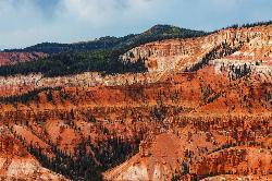
46.0 miles NERiggs Spring Loop Trail is the perfect trail for hikers wishing to escape to the wilderness. This is one of the least trafficked trails in Bryce Canyon and one of the most forested. The ponderosa...
Hike 1.0 mi
Bristlecone Loop
Kanab, Utah
46.1 miles NEBristlecone Loop is a one-mile trail from Rainbow Point. Rainbow Point is located at the southern end of Bryce Canyon National Park and is the highest point in the park. The spectacular views...
Hike


