


92 Hiking Trails near Mr. Bubbles Hot Spring
first prev 1 2 3 4 5 next lastShowing Hiking Trails within 50 miles Distance miles of Forest Rd 007, Yellowstone National Park, WY 82190, USA City, Zip, or Address
Cave Falls of Yellowstone
Ashton, Idaho
2.4 miles EThis campgrond is situated on the banks of Fall River in Wyoming along the south border of Yellowstone National Park. Cave Falls Campground has 23 single site units and a terrific area for...
Camp, Hike 15.9-16.6 mi
Union Falls & Ouzel Pool
Grant Village, Yellowstone National Park
5.3 miles EBackpack, Hike, Hot Springs, and Swim near Grant Village, Yellowstone National Park
Backpack, Hike, Hot Springs, Swim 1.1 mi
Fish Lake
Ashton, Idaho
5.3 miles EHike near Ashton, Idaho
Hike 17.5 mi
Tear Drop Lake
Ashton, Idaho
6.6 miles NWNestled in the Targhee National Forest just off of Ashton's Fish Creek Road, this tear drop shaped lake is a family adventure waiting to happen. The lake isn't very big but it is teeming with...
Camp, Canoe, Hike, Kayak, Mountain Bike, Swim 1.9 mi
Terraced Falls
Grant Village, Yellowstone National Park
9.9 miles E3.6 mile easy out and back trail. 430 ft Elevation gain. The trailhead is off Ashton-Flagg Ranch Road along Yellowstone's South border. Ashton-Flagg Ranch Road is closed during the winter.
Hike 0.3-0.6 mi
Bear Gulch
Ashton, Idaho
11.9 miles WBear Gulch is an abandoned ski hill out of operation since 1969. While the vegetation is beginning to take over, there's still some great sledding to be had. It's just far enough into the...
Camp, Cross-country Ski, Hike, Sled 3.2-47.0 mi
Yellowstone Branch Line Trail
Ashton, Idaho
13.3 miles WYellowstone branch line trail runs from Warm River to the Montana border totaling 39 miles. There are a few places to jump on and off the trail as well as a few smaller trails that branch off of this...
Backpack, Cross-country Ski, Hike, Horseback, Mountain Bike
Mesa Falls
Ashton, Idaho
14.2 miles WUpper Mesa Falls, aka Big Falls, is an absolutely awesome waterfall on the Henrys Fork of the Snake River. The falls drop 114 ft. and measure 300 ft. across. To get to the falls from the parking lot...
Cross-country Ski, Hike, Kayak
Bitch Creek Trestle
Tetonia, Idaho
14.6 miles SAs part of the Rails to Trails project, this old railroad bridge has been transformed into a very safe little viewing experience for the whole family. You can drive right up to the bridge where...
Hike
Sheep Falls on Henry's Fork
Island Park, Idaho
17.9 miles WSheep Falls cascades approximately 25' through a narrow basalt chute on the North Fork of the Snake River near Island Park, Idaho. Compared to nearby Lower and Upper Mesa Falls, that height may...
Hike 0.8 mi
Conant Creek Pegram Truss Railroad Bridge
Ashton, Idaho
18.1 miles SWAs part of the Rails to Trails project, this old railroad bridge has been transformed into a very safe little viewing experience for the whole family. You can drive right up to the bridge where there...
Hike
Badger Creek
Tetonia, Idaho
20.5 miles SBadger Creek is a stream located just 13.6 miles from Ashton, in Teton County, in the state of Idaho, United States, near France, ID. Whether you’re spinning, baitcasting or fly fishing your...
Camp, Cross-country Ski, Hike, Mountain Bike, Rock Climb 2.6 mi
Lone Star Geyser Trail
Old Faithful, Yellowstone National Park
22.0 miles NELone Geyser Star Trail is a hiking and mountain biking trail that leads through the forest to the colorful Lone Star Geyser. The Geyser here has beautiful white, yellow and orange colors in the...
Hike, Mountain Bike 6.2 mi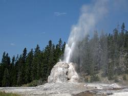
Howard Eaton Trail
Old Faithful, Yellowstone National Park
23.6 miles NEThe Howard Eaton Trail in the Old Faithful Area is a hike with incredible geothermic features and other natural views. This hike is a moderately difficult 6.5 mile there and back trail, that...
Hike 0.6-4.7 mi
Harriman State Park
Island Park, Idaho
23.7 miles NWHarriman State Park is found 38 miles from Yellowstone along Henry's Fork. This 11,000-acre wildlife refuge is open year round for most activities. In addition to having beautiful scenery and...
Cross-country Ski, Hike, Horseback, Mountain Bike, Snowshoe 14.8 mi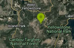
Biscuit Basin to Fairy Falls and Firehole Meadows
Old Faithful, Yellowstone National Park
23.9 miles NFreight Road trail is a almost 15 mile hike that leaves from Biscuit Basin or Fountain Flats Drive. This hike is a beautiful remote hike that passes several unique landmarks, breaking up this hike...
Backpack, Camp, Hike 1.5 mi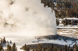
Observation Point Trail
Old Faithful, Yellowstone National Park
24.0 miles NEObservation Point Trail is an just over 2 mile loop that passes several geysers along the way to Solitary Geyser. Observation Point Trail provides up close views of several geysers as well as...
Hike 3.1 mi
Mallard Lake
Old Faithful, Yellowstone National Park
24.0 miles NEThe Mallard Lake trail is majestically lined with trees both old an new. This is a 5 mile leading to the beautiful Mallard lake, making it a 10 mile round trip. The trail is...
Hike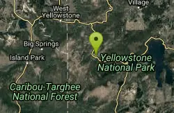
Old Faithful Geyser
Old Faithful, Yellowstone National Park
24.0 miles NEOld Faithful is a cone geyser located in Yellowstone National Park in Wyoming, United States. It was named in 1870 during the Washburn-Langford-Doane Expedition and was the first geyser in the park...
Hike 6.9 mi
Heart Lake Trail
Grant Village, Yellowstone National Park
25.0 miles NEThe trail is very clear and leads to a moderate eight mile hike to Heart Lake. This hike has many possibilities. Day hikers need to push their time to make sure they are on the trail early to allow...
Backpack, Camp, Hike, Hot Springs


