


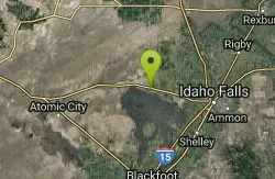
26 Hiking Trails near Hell's Half Acre Lava Walk
Showing Hiking Trails within 50 miles Distance miles of Hell's Half Acre Lava Walk, Blackfoot, ID 83221, USA City, Zip, or Address
17 Mile Cave
Idaho Falls, Idaho
4.5 miles ESeventeen Mile Cave is a lava tube, a cave created by the pocket in which lava used to flow and was left empty when the volcano became inactive. The cave gets its name from its location, just 17...
Cave, Hike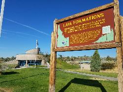
Hell's Half Acre Southbound Rest Stop
Blackfoot, Idaho
19.2 miles SEThis is a well maintained rest area with facilities to keep you happy as you travel through Idaho. This rest stop on Interstate 15 about 15 miles South of Idaho Falls has nice picnic tables and...
Hike
Hell's Half Acre Northbound Rest Stop
Blackfoot, Idaho
19.4 miles SEThis is a well maintained rest area with facilities to keep you happy as you travel through Idaho. This rest stop on Interstate 15 about 9 miles north of Blackfoot Idaho has nice picnic tables and...
Hike 1.0-7.5 mi
Idaho Falls Greenbelt
Idaho Falls, Idaho
20.5 miles EThe Idaho Falls Greenbelt is one of Idaho Falls charms located in the heart of Idaho Falls, next to the historic Idaho Falls downtown. The paved foot-trail is approximately 6 miles around,...
Hike
Firth River Bottoms
Firth, Idaho
21.0 miles SEWhether you like to ride horses, picnic, camp, fish, learn about the past, or play baseball, this park has something for everyone. The Parks & Recreation Department and the IDaho Education...
Camp, Canoe, Hike 2.1-2.3 mi
Market Lake Wildlife Management Area
Roberts, Idaho
21.4 miles NEMallards, Canada geese, canvasbacks, cinnamon and green-winged teal, northern shovelers and ruddy ducks are common waterfowl species nesting and raising broods on the WMA. Several thousand...
Hike, Horseback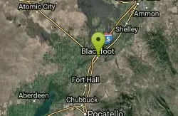
Blackfoot, ID 83221, United States
Blackfoot, Idaho
25.6 miles SHike and Mountain Bike near Blackfoot, Idaho
Hike, Mountain Bike 0.6-2.0 mi

North Menan Butte ('R' Mountain)
Menan, Idaho
27.6 miles NEThe North Menan Butte is more commonly known to the locals and college students as R Mountain. Many kids know it better as Ou'R' Mountain. The butte is a rare and unique geological area and provides...
Camp, Cave, Hike
Lorenzo Boat Ramp
Rigby, Idaho
30.7 miles NEHike and Kayak near Rigby, Idaho
Hike, Kayak 0.1 mi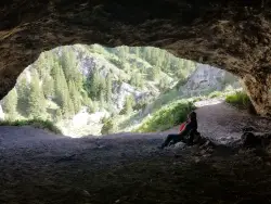
40 Horse Cave
Firth, Idaho
31.1 miles SEThe naming of the cave comes from a story of two men who were caught in a bad storm. Upon hiking, these two guys were able to find the cave. One of them commented to the other, "This cave could...
Cave, Hike 1.0-1.3 mi
Lorenzo Bridge
Rexburg, Idaho
31.3 miles NEThis is the old site of the Lorenzo Boat Launch, which has moved to the other side of the river a little further downstream. This spot sees very little traffic. There are beautiful, yet...
Airsoft, Hike, Paintball 0.3-0.6 mi
Cress Creek Nature Trail
Rexburg, Idaho
36.9 miles EMeandering along the scenic South Fork of the Snake River, the beautiful 1¼ mile Cress Creek Nature Trail will lead you on a journey through sagebrush-grass communities, over juniper covered...
Hike 0.1-0.5 mi
Eagle Park
Rexburg, Idaho
37.6 miles NEEagle Park is a little urban oasis. Once you drive in to this cottonwood forest along the river, you may forget that you're still inside Rexburg city limits. You can camp, picnic, throw rocks in...
Camp, Hike, Mountain Bike, Sled 0.1-2.3 mi
Hidden Valley Trails
Rexburg, Idaho
38.5 miles NERight on the edges of town outside of the Hidden Valley subdivision, you'll find this fun little set of trails that's pretty good for mountain bikes. It is mostly a dirt bike...
Hike, Mountain Bike 3.8 mi
Stinking Springs
Ririe, Idaho
39.9 miles EStinking Springs is a great early to late season trail. Being at the edge of the Big Hole range, it gets spring earlier and winter later than other trails in the range. It's closed from December...
Hike, Mountain Bike
Herbert Idaho Ghost Town
Ririe, Idaho
40.5 miles ECLOSED. Private property marked NO TRESPASSING. Herbert is a small ghost town that was operated until the 40s, but with the invention of the automobile, it was much more convenient to live in Rexburg...
Hike 3.8 mi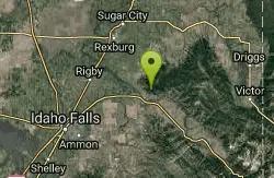
Kelly Mountain Trail
Ririe, Idaho
42.0 miles EKelly Canyon Trail is a moderate, uphill trail that can be used by hikers, mountain bikers, and ATV riders. The trail features views of hills, mountains, trees, wildflowers, and some wildlife. Dogs...
Cross-country Ski, Hike, Mountain Bike, Snowshoe
Poison Flats
Ririe, Idaho
42.7 miles EHike near Ririe, Idaho
Hike 1.7 mi
Buckskin Morgan Ridge
Ririe, Idaho
42.8 miles ECLOSED. This land is owned and managed by the US Forest Service and is not designated for use. As of July 2024, being caught mountain biking on this trail could recieve up to a $5000 fine and a...
Hike, Mountain Bike 1.1 mi
Hidden Vista / Pine Loop
Ririe, Idaho
42.8 miles ECLOSED. This land is owned and managed by the US Forest Service and is not designated for use. As of July 2024, being caught mountain biking on this trail could recieve up to a $5000 fine and a...
Hike, Mountain Bike


