


54 Hiking Trails near Fossil Creek Waterfall
first prev 1 2 3 next lastShowing Hiking Trails within 50 miles Distance miles of Fossil Creek Rd, Pine, AZ 85544, USA City, Zip, or Address

Fossil Creek Dam (Toilet Bowl)
Pine, Arizona
2.6 miles EHidden within the vast Arizona desert is an oasis of a river that brings the surrounding banks to life around it. This is Fossil Creek--one of Arizona's two designated "Wild and...
Dive, Hike, Swim 0.1-3.8 mi
Fossil Springs Trail No. 18
Pine, Arizona
2.6 miles ELocated within the Fossil Springs Wilderness, this trail leads down a canyon to the springs for which it is named. At the trailhead, there are several hikes, some of which are available for...
Hike, Horseback, Swim
Verde Hot Springs
Camp Verde, Arizona
6.2 miles SWVerde Hot Springs are a few natural hot spring pools located along the Verde River, near Sedona, Arizona. Once a resort, now all that remains are the foundations and the hot pools...
Camp, Hike, Hot Springs
Bearfoot Trail
Strawberry, Arizona
7.4 miles EHike and Mountain Bike near Strawberry, Arizona
Hike, Mountain Bike 3.0 miBlodgett Basin Trail No. 31
Camp Verde, Arizona
10.6 miles NWBlodgett Basin Trail is one of a select few trails that shows off the riparian desert beauty unique to West Clear Creek Wilderness. The trail stretches from Bull Pen Trailhead through the canyon and...
Backpack, Hike, Swim 16.9 mi
West Clear Creek Trail No. 17
Camp Verde, Arizona
10.8 miles NWWest Clear Creek Trail No. 17 is a great way to reach the running waters of West Clear Creek. By far the most accessible and popular, it starts from the Bull Pen Ranch parking lot and winds down the...
Backpack, Hike, Swim
Bullpen Day Use Area
Camp Verde, Arizona
10.8 miles NWBullpen has something for everyone. Whether you park here and use the trail head to start on one of several hikes that lead down West Clear Creek, or stay nearby to use the picnic areas and...
Backpack, Dive, Hike, Swim 0.4 mi
Clear Creek Campground
Camp Verde, Arizona
11.6 miles NWWest Clear Creek flows along the boundary of this desert canyon country camp and is a popular place for hiking, swimming, wading and fishing. Cool water species such as smallmouth bass and green...
Camp, Hike, Swim 0.6-2.9 mi
Tramway Trail No. 32
Happy Jack, Arizona
15.2 miles NETramway Trail is a very short but very steep hike down the ridge of the Colorado Plateau to the nearby West Clear Creek. The trail crosses over the sharp edge of the Mogollan Rim, and descends to the...
Hike, Rock Climb, Swim 1.9 mi
Maxwell Trail No. 37
Happy Jack, Arizona
16.5 miles NEThe Maxwell Trail leads over the Mongollan Rim down the canyon into West Clear Creek. Although still somewhat steep, it is an easier hike than shorter neighboring Tramway trail, which shares its...
Hike, Swim 0.5-0.6 mi
Ellison Creek Falls
Payson, Arizona
19.3 miles EEllison Creek provides 4 beautiful waterfalls in this area, each with their own swimming and diving opportunities. There are even fishing spots where trout can be caught. Since the falls are close to...
Dive, Hike, Swim 7.1 mi
The Crack at Wet Beaver Creek
Rimrock, Arizona
19.4 miles NThe Crack is a popular swimming hole found by hiking the Bell Trail down to Wet Beaver Creek. After following the trail for about 3.5 miles away from the parking lot, take a detour to the left just...
Dive, Hike, Horseback, SwimEast Clear Creek
Happy Jack, Arizona
27.6 miles EEast Clear Creek is a river that stretches through the Mogollon Rim area of Arizona. It provides water to the surrounding desert landscape, fishing opportunities, and various areas to hike,...
Canyoneer, Hike, Swim 1.6-3.6 mi
Kinder Crossing Trail #19
Happy Jack, Arizona
28.8 miles NEKinder Crossing Trail #19 travels down to the beauty of East Clear Creek, and then extends up until reaching FR 137; but many people use the trail to reach the creek waters and play in the water. The...
Hike, Swim 1.1-3.5 mi
Horton Springs
Payson, Arizona
29.9 miles EHorton Springs is a spring on the Mogollon Rim that leads into Horton Creek. There are campsites near the springs, and several hiking trails in the area that lead to the spring itself. Between the...
Backpack, Camp, Hike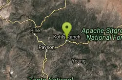
Upper Tonto Creek Campground
Payson, Arizona
30.0 miles EUpper Tonto Creek Campground is a beautiful place to camp at the intersection of Tonto and Horton Creeks. In addition to camping, this is a popular destination to both fish and hike. The campground...
Camp, Hike
Red Rock State Park
Sedona, Arizona
31.1 miles NRed Rock in Sedona, Arizona details the beauty in the layers of sedimentary rock that has been constructed over millions of years. It is at Red Rock that you can see "Schnebly Hill...
Hike, Swim 0.8 mi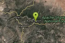
Promontory Butte
Payson, Arizona
31.6 miles EThis destination is on the edge of Promontory Butte, providing spectacularly scenic views as part of the Mogollon Rim. There are several old forest roads on the mountain that can serve as trails to...
Hike
Chavez Crossing
Sedona, Arizona
31.7 miles NChavez Crossing is a campground in Sedona, Arizona. It sits perfectly nestled in Arizona's most beautiful red rock attractions along with the grand summer sunsets. If that didn't sound...
Camp, Hike, Swim
Hell's Gate
Payson, Arizona
32.0 miles SEThis Wilderness was established in 1984, and contains approximately 37,440 rough acres with a major canyon and perennial stream extending its entire length. Deep pools of water may be separated by...
Backpack, Camp, Hike, Swim


