


137 Hiking Trails near Camelback Mountain
first prev 1 2 3 4 5 6 7 next lastShowing Hiking Trails within 50 miles Distance miles of 5700 N Echo Canyon Dr, Phoenix, AZ 85018, USA City, Zip, or Address
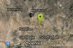
Western Vista Trail
Phoenix, Arizona
16.8 miles NWFairly difficult short Trail to one of the summits on the Dixie Mountain Loop. Great views from the top as well as a birds eye view of the gravel pit below.
Hike 2.8 mi
Desert Tortoise
Phoenix, Arizona
16.8 miles NWAt just over a mile long, Desert Tortoise is a doubletrack connector to the Valle Verde Trail. Very good hiking area with a good range of difficulty levels. Starts with a short climb from the...
Hike, Mountain Bike
Dixie Summit Trail
Phoenix, Arizona
16.8 miles NWA steep and difficult short trail using many switchbacks to get to the summit. You will be rewarded with spectacular views of the surrounding area.
Hike
Dixie Mountain Loop Trail
Phoenix, Arizona
16.8 miles NWThe main loop trail at Phoenix's Sonoran Preserve provides plenty of options for either a short walk or a longer hike. The elevation gain is accumulated through small ups-and-downs along the...
Hike, Horseback, Mountain Bike
Union Peak Loop
Phoenix, Arizona
16.8 miles NWHike near Phoenix, Arizona
Hike
Thunderbird H-1 H-2 H-3 Loop Trail
Glendale, Arizona
16.9 miles NWHike and Mountain Bike near Glendale, Arizona
Hike, Mountain Bike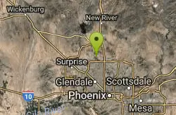
Thunderbird H-2 Trail
Glendale, Arizona
16.9 miles NWThe trail is great for hiking and normally takes 1-3 hours. This is a nice, steady, non-strenuous, climb to the summit for anyone who is somewhat active. The type of incline where you...
Hike
Arrowhead Point Trail
Glendale, Arizona
16.9 miles NWArrowhead Trail is a 2.4 mile hiking and mountain biking trail within Thunderbird Conservation Park. This trail is manageable enough for beginners, but offers enough challenge for more experienced...
Hike, Mountain Bike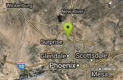
H-1 to H-4 Trails Loop
Glendale, Arizona
17.0 miles NWThunderbird Park in Glendale, AZ consists of 5 H-Trails, named so because of the Hedgpeth Hills through which they wind. H-1: One-Way - 5.0 miles H-1a: Loop trail - 2.5 miles - 400...
Hike, Mountain Bike
Apache Wash Trail
Phoenix, Arizona
17.3 miles NStart west on Ocitillo to Ridgeback north till you get to the crossing of Sidewinder then head west. Keep on Sidewinder toil you come to the crossing of Octillio and head east back to...
Hike
Sidewinder, Apache Vista, Ocotillo Loop Trail
Phoenix, Arizona
17.5 miles NThis is an excellent loop that is very well maintained, well sign posted and if you include the vista summit trail, a moderate work out. Massive Car Park, good restrooms, and plenty of...
Hike, Horseback, Mountain Bike
Riparian Preserve at Water Ranch Trail
Gilbert, Arizona
17.5 miles SEThe Riparian Preserve is an urban park with a series of loop trails surrounding seven ponds stocked with fish and birds. It is located at 2757 E. Guadalupe Road, Gilbert AZ. Several...
Canoe, Hike
Ocotillo/Ridgeback/Sidewinder Loop Trail
Phoenix, Arizona
17.5 miles NGreat moderate loop which includes a summit, great views and Classic Sonoran Desert scenery. Multiple access points and other connecting trails allows for the loop to be changed if...
Hike, Horseback, Mountain Bike
Deem Hills East Trail
Phoenix, Arizona
17.6 miles NWDeem Hills is one of the newer parks in Phoenix to open (2010) and as such a lot of people still don't know it's there. This means that it has much more of a secluded feel then some of...
Hike
Palisade to Basalt to Circumference Trail Loop
Phoenix, Arizona
17.6 miles NWHike near Phoenix, Arizona
Hike
Deem Hills Inner Loop
Phoenix, Arizona
17.6 miles NWHike and Mountain Bike near Phoenix, Arizona
Hike, Mountain Bike
Deem Hills Circumference Trail with Summit
Phoenix, Arizona
18.0 miles NWDeem Hills is one of the newer parks in Phoenix to open (2010) and as such a lot of people still don't know it's there. This means that it has much more of a secluded feel then some of...
Hike
Deem Hills Circumference Trail
Phoenix, Arizona
18.1 miles NWDeem Hills s a 10.5 mile loop trail located near Phoenix, Arizona. The trail is rated as moderate and primarily used for mountain biking.
Hike, Horseback, Mountain Bike 2.1 mi
Lower Salt River Nature Trail
Fort McDowell, Arizona
18.1 miles EThe Lower Salt River Nature Trail is a scenic walk to take at the Tonto National Forest. This trail provides stunning views as you walk alongside the Salt River. This rustic trail is older and less...
Camp, Hike
Pima and Dynamite Trail
Scottsdale, Arizona
18.2 miles NEPima and Dynamite is an area with a network of trails for hiking, but more popularly for mountain biking, in North Scottsdale, Arizona. The area feautures a variety of trails for...
Hike, Mountain Bike


