


Herkenham Trail
Sedona, Arizona
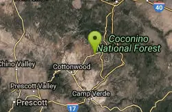
| Address: | ~Herkenham Trail, Sedona, AZ 86336, USA |
| GPS: |
34°50'49.3"N 111°49'42.5"W Maps | Directions |
| State: | Arizona |
| Trail Length: | 1.00 miles |
| MTB Difficulty: | Advanced |
| Trail Type: | Out & Back |
| MTB Trail Type: | Singletrack |
Mountain Bike
This singletrack flows down through a canyon underneath a small power line. It is full of tight corners, small drops, loose gravel here and there, rocks, sand, cactus, great views- all the ingredients of that classic Sedona riding. Although its not real steep it is a steady grade and can be a little challenging of a climb coming back up. Normally I wouldn't write up a description for a trail so short, however this trail grants you access to several other trails in the valleys and ridges within this area of Sedona. This 1 mile trail ends at the Old Post tr, turning left will take you to the Carroll Canyon tr & the Ridge tr which make for several different options. There are also a few unnamed, social trails running through the area, most of the major intersections are signed, just a lot of great riding. Turning right at the Old Post tr will take you to the Red Rock Crossing rd. Following this too the river (Oak Creek) and crossing it will have you at the base of the Baldwin Loop tr and other points beyond. You may have guessed by now a trail map (readily available in town) is very handy for riding in the Sedona area, there seems to be new trails here all the time. Courtesy of Singletracks.com
More Information
Add ResourceNever modify trail features. Ride trails when they're dry enough that you won't leave ruts. Speak up when you see others on the trail and always yield to hikers, horses, and others coming uphill. Always ride on the established trail.
Read More- Plan Ahead and Prepare
- Travel & camp on durable surfaces
- Dispose of waste properly
- Leave what you find
- Minimize campfire impacts
- Respect wildlife
- Be considerate of other visitors
Directions
From Sedona, Arizona
- Head south on N State Rte 89A toward Forest Rd (0.3 mi)
- At the traffic circle, take the 2nd exit onto AZ-89A (417 ft)
- At the traffic circle, continue straight to stay on AZ-89A (4.1 mi)
- Turn left onto Upper Red Rock Loop Rd (0.2 mi)

Other Mountain Bike Trails Nearby
Special Ed
Sedona, Arizona
0.3 miles WTechy fast flowing undulating trail. You can form a loop with other trails in teh area but this trails isn not on any map
Mountain Bike
Girdner Trail
Sedona, Arizona
0.4 miles NWThis trail runs in a North/South direction into yet another area of Sedona filled with short trails. This area is known as 'Seven Canyons' and is north of Hwy 89A, West of Dry Creek rd...
Mountain Bike
Chuck Wagon
Sedona, Arizona
1.2 miles NEChuck Wagon was adopted for mountain biking in the spring of 2012. It incorporates the original Chuck Wagon trail with what was once known locally as "Gunslinger." It is laid out in...
Mountain Bike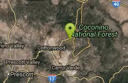
Ram's Head Trail
Sedona, Arizona
1.4 miles SESometimes you are traveling with kids or neophyte mountain bikers and are wondering where to take them. (I hesitate to say “beginners. They belong in the middle of a grassy...
Mountain Bike
Airport Mesa Trail Network
Sedona, Arizona
1.6 miles EThere are networks of trails on all sides of Sedona. This network of trails is in the area south of Hwy 89A and north of Oak Creek. There are several possible routes and trail...
Mountain Bike
Ridge Trail
Sedona, Arizona
1.7 miles EWith all of the trails available to ride around Sedona, it is easy to overlook some nice but lower profile trails south of AZ-89A in Sedona West. One benefit of riding these trails is...
Mountain Bike
North Urban Trail System - West
Sedona, Arizona
1.9 miles NEThe North Urban Trail System is an interconnected series of trails along the red rock front country at the north edge of Sedona. The western portion, described here, includes Lower...
Mountain Bike
Chimney Rock Trail
Sedona, Arizona
2.0 miles NEThere is an upper and lower Chimney Rock Trail. Tie them both together and you have a short and painless 3.16 mile figure eight loop. The Upper Chimney Rock Trail is 1.79 miles around...
Mountain Bike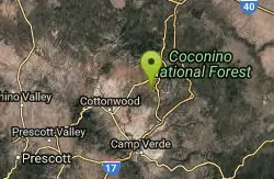
Baldwin Loop
Sedona, Arizona
2.1 miles SEThis is the loop at the end of Templeton Trail that makes a Templeton/Baldwin lollipop ride if you start at the Bell Rock Pathway. This entry describes a direct access to make the...
Mountain Bike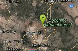
Upper Dry Creek Area Trails
Sedona, Arizona
2.4 miles NThe Upper Dry Creek Area Trails are easily accessible from West Sedona and include a lot of Sedona classics like Chuckwagon, Mescal, and Aerie. While this trail system offers gorgeous...
Mountain Bike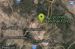
Long Canyon
Sedona, Arizona
2.5 miles WThis is an easy "learner" ride. There are many fairly tricky rides in the Sedona area, so flag this one if you want any easy ride or if you have young or learning mountain bikers with...
Mountain Bike
North Urban Trail System - East
Sedona, Arizona
2.6 miles NEThe North Urban Trail System is an interconnected series of trails north of Sedona along the red rock front country. These trails extend from the Jim Thompson Trailhead on the east end...
Mountain Bike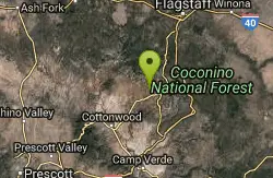
Mescal Trail
Sedona, Arizona
3.0 miles NMany of the newer trails and best riding in the Sedona area are in the Boynton Pass area. The route described with the accompanying TOPO map includes all or part of Chuckwagon, Mescal,...
Mountain Bike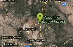
Soldier Wash Trails
Sedona, Arizona
3.2 miles NEWhat locals once called the "Secret Trails" isn't so secret anymore. The USFS has adopted many of them into what is now called "Soldier Wash Trails." You may not see them yet on the...
Mountain Bike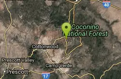
Broken Arrow Trail System
Sedona, Arizona
3.3 miles EThe Broken Arrow Trail system incorporates a number of classic Sedona rides, such as Broken Arrow, Hog Heaven, Hog Wash, Pig Tail, and more. While some of these trails are relatively...
Mountain Bike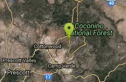
Templeton
Sedona, Arizona
3.4 miles SEThis challenging, fun & exciting singletrack rewards you with some of the most scenic vistas of the Sedona area. Leaving the B.R. Pathway you twist & turn downhill through the forest...
Mountain Bike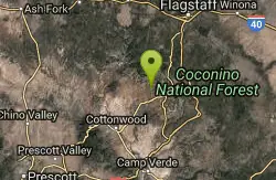
Dawa Loop
Sedona, Arizona
3.4 miles NSometimes you are traveling with kids or neophyte mountain bikers and are wondering where to take them. The following route describes a fun and fairly easy practice trail. Can't...
Mountain Bike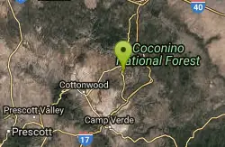
Pig Tail
Sedona, Arizona
3.4 miles EPig Tail is a short one-way downhill-only trail full of jumps, drops, berms, and rocks. A riot of a descent!
Mountain Bike
Broken Arrow Trail / Chicken Point
Sedona, Arizona
3.4 miles EThis trail is definitely not for beginners. It has a lot of technical climbs and descents- drop offs and stairs, etc. A lot of narrow singletrack along cliffs. This trail takes you...
Mountain Bike
Cockscomb Trail
Sedona, Arizona
3.7 miles NWAs with most trails in Sedona, a recreation pass is required to park your car at the trailhead. There is a kiosk at a nearby parking area. From the Cockscomb trailhead, ride to the left...
Mountain BikeNearby Campsites

Chavez Crossing
Sedona, Arizona
2.9 miles EChavez Crossing is a campground in Sedona, Arizona. It sits perfectly nestled in Arizona's most beautiful red rock attractions along with the grand summer sunsets. If that didn't sound...
Camp, Hike, Swim 0.1-0.7 mi
Cave Springs
Sedona, Arizona
11.5 miles NECave Springs Campground is a scenic campground that sits in Oak Creek Canyon. Cave Springs is nestled perfectly in the town of Sedona, giving the campground the notorious Sedona red views. Uniquely,...
Camp, Hike, Swim
Beaver Creek Dispersed Camping
13.2 miles SE
Free dispersed camping on the cliffs above Beaver Creek.
Camp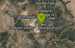
Beaver Creek Campground
Camp Verde, Arizona
13.9 miles SECamp, Canoe, Kayak, and Swim near Camp Verde, Arizona
Camp, Canoe, Kayak, Swim 0.4 mi
Clear Creek Campground
Camp Verde, Arizona
23.2 miles SWest Clear Creek flows along the boundary of this desert canyon country camp and is a popular place for hiking, swimming, wading and fishing. Cool water species such as smallmouth bass and green...
Camp, Hike, Swim
Verde Hot Springs
Camp Verde, Arizona
35.3 miles SVerde Hot Springs are a few natural hot spring pools located along the Verde River, near Sedona, Arizona. Once a resort, now all that remains are the foundations and the hot pools...
Camp, Hike, Hot Springs 0.1-7.8 mi
Wolf Creek Falls
Sedona, Arizona
45.3 miles SWWolf Creek Falls is a wonderful space to explore and be immersed in nature. With it's six miles of trails, beautiful waterfalls and two campgrounds this is the perfect place to spend a...
Camp, Hike, Swim


