Harding Springs Trail
Sedona, Arizona
| Address: | Harding Springs Trail, Arizona 86336, USA |
| GPS: |
35°0'2.0"N 111°44'15.3"W Maps | Directions |
| State: | Arizona |
| Trails/Routes: | 1.0 mi |
Hike
Harding Springs Trail is a beautiful hiking trail in Sedona, Arizona. This trail was originally one of several that provided a way for cattlemen to drive their stock in and out of Oak Creek Canyon. This trail was used as a means of travel because it was wide, and very mild Today, many use this trail to admire the beauty encompassed around it. Because this trail isn't steep at all, it is a great hike for all ages. This trail makes for a gradual hike up to the canyon's rim. The hike takes about an hour to finish, and is also mostly shaded. The Harding Springs Trail also has rest stops along the hike, which is great for the summer months when the temperatures can climb to the triple digits.
As you climb to the top of this canyon, you have the option of going back down to the beginning, or continuing north on Cookstove Trail or south on Thomas Point Trail. Overall, this hike is easy, fun, and a great way to escape from the fast pace world. Take advantage of the beauty around Sedona with the beautiful views of the Harding Springs Trail.
More Information
Be courteous, informed, and prepared. Read trailhead guidelines, stay on the trail, and don't feed the wildlife.
Read MoreDirections
From Sedona, Arizona
- Head east toward N State Rte 89A (118 ft)
- Exit the traffic circle onto AZ-89A N/
N State Rte 89A (11.4 mi) - Turn left at Harding Springs TrailDestination will be on the right(112 ft)

Trails
Distance ?
1.0 milesElevation Gain ?
792 feetReal Ascent ?
1,039 feetReal Descent ?
247 feetAvg Grade (9°)
16%Grade (-41° to 46°)
-88% to 104%Elevation differences are scaled for emphasis. While the numbers are accurate, the cut-away shown here is not to scale.
Other Hiking Trails Nearby
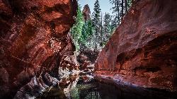
Cave Springs
Sedona, Arizona
0.3 miles SCave Springs Campground is a scenic campground that sits in Oak Creek Canyon. Cave Springs is nestled perfectly in the town of Sedona, giving the campground the notorious Sedona red views. Uniquely,...
Camp, Hike, Swim 0.3 mi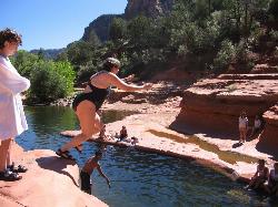
Slide Rock
Sedona, Arizona
4.0 miles SSlide Rock is one of the most popular locations in the Sedona area. Slide Rock is natures most thrilling water slides. Slide Rock is a gargantuan 80 feet long, and 2-4 feet wide. This slippery slope...
Hike, Swim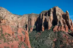
Brins Mesa Trail
Sedona, Arizona
7.0 miles SWBrins Mesa Trail is located in the Coconino National Forest just at the edge of the town of Sedona. This trail will provide picturesque views of the gorgeous, geological landscape. Brins...
Hike 3.4 mi
Grasshopper Point
Sedona, Arizona
7.8 miles SGrasshopper Point is a beautiful swimming hole located in Sedona, Arizona. Grasshopper Point is the perfect place to cool off in the summer after a nice hike, or a hot summer day. This swimming...
Dive, Hike, Swim
Schnebly Hill Vista Overlook
Sedona, Arizona
7.9 miles SThe Schnebly Hill Formation is a beautiful red rock gem in Sedona, Arizona. This rock formation is considerably big, which is why it is divided into four different sections that are called...
Hike
Wilson Mountain Trail
Sedona, Arizona
7.9 miles SHike near Sedona, Arizona
Hike
Midgley Bridge Trail
Sedona, Arizona
7.9 miles SHike near Sedona, Arizona
Hike
Devil's Bridge
Sedona, Arizona
8.0 miles SWWe loved the red rock views on this hike! It's a 3.6 mile round-trip trail, on rocky/sandy ground, and is fairly easy, until the last mile, which is steep. Dozens of jeeps and ATVs passed us -...
Hike 8.5 mi
Munds Wagon Trail
Sedona, Arizona
8.8 miles SMunds Wagon Trail is different from many of the other more “classic†rides around Sedona. If you come from somewhere else and are missing the feel of loose rocks...
Hike, Mountain Bike 6.0 mi
Huckaby Trail
Sedona, Arizona
9.3 miles SOn the hunt for adventure? Established in 1998, Huckaby Trail is just the adventuresome route for both avid hikers and mountain bikers. It offers up forestry of Arizona Sycamores and picturesque...
Canoe, Hike, Mountain Bike
Chavez Crossing
Sedona, Arizona
11.1 miles SChavez Crossing is a campground in Sedona, Arizona. It sits perfectly nestled in Arizona's most beautiful red rock attractions along with the grand summer sunsets. If that didn't sound...
Camp, Hike, Swim
Red Rock State Park
Sedona, Arizona
12.8 miles SRed Rock in Sedona, Arizona details the beauty in the layers of sedimentary rock that has been constructed over millions of years. It is at Red Rock that you can see "Schnebly Hill...
Hike, Swim 7.1 mi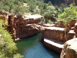
The Crack at Wet Beaver Creek
Rimrock, Arizona
22.6 miles SThe Crack is a popular swimming hole found by hiking the Bell Trail down to Wet Beaver Creek. After following the trail for about 3.5 miles away from the parking lot, take a detour to the left just...
Dive, Hike, Horseback, Swim
Pumpkin Trail to Bulls Basin Trail Loop
Flagstaff, Arizona
30.8 miles NHike

Kendrick Peak Trail
Flagstaff, Arizona
30.8 miles NHike

Bullpen Day Use Area
Camp Verde, Arizona
31.8 miles SBullpen has something for everyone. Whether you park here and use the trail head to start on one of several hikes that lead down West Clear Creek, or stay nearby to use the picnic areas and...
Backpack, Dive, Hike, Swim 16.9 mi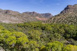
West Clear Creek Trail No. 17
Camp Verde, Arizona
31.9 miles SWest Clear Creek Trail No. 17 is a great way to reach the running waters of West Clear Creek. By far the most accessible and popular, it starts from the Bull Pen Ranch parking lot and winds down the...
Backpack, Hike, Swim 3.0 mi
Blodgett Basin Trail No. 31
Camp Verde, Arizona
31.9 miles SBlodgett Basin Trail is one of a select few trails that shows off the riparian desert beauty unique to West Clear Creek Wilderness. The trail stretches from Bull Pen Trailhead through the canyon and...
Backpack, Hike, Swim 0.4 mi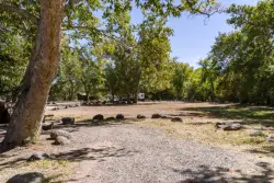
Clear Creek Campground
Camp Verde, Arizona
33.5 miles SWest Clear Creek flows along the boundary of this desert canyon country camp and is a popular place for hiking, swimming, wading and fishing. Cool water species such as smallmouth bass and green...
Camp, Hike, Swim
Slate Mountain Trail
Flagstaff, Arizona
34.0 miles NDirections from Flagstaff: Drive 35 miles north on US 180 to FR 191. Turn west 2 miles to the trailhead on the right side of the road. US 180 is paved. FR 191 is graveled and suitable...
HikeNearby Campsites

Cave Springs
Sedona, Arizona
0.3 miles SCave Springs Campground is a scenic campground that sits in Oak Creek Canyon. Cave Springs is nestled perfectly in the town of Sedona, giving the campground the notorious Sedona red views. Uniquely,...
Camp, Hike, Swim
Chavez Crossing
Sedona, Arizona
11.1 miles SChavez Crossing is a campground in Sedona, Arizona. It sits perfectly nestled in Arizona's most beautiful red rock attractions along with the grand summer sunsets. If that didn't sound...
Camp, Hike, Swim
Beaver Creek Dispersed Camping
22.6 miles S
Free dispersed camping on the cliffs above Beaver Creek.
Camp
Beaver Creek Campground
Camp Verde, Arizona
22.9 miles SCamp, Canoe, Kayak, and Swim near Camp Verde, Arizona
Camp, Canoe, Kayak, Swim 0.4 mi
Clear Creek Campground
Camp Verde, Arizona
33.5 miles SWest Clear Creek flows along the boundary of this desert canyon country camp and is a popular place for hiking, swimming, wading and fishing. Cool water species such as smallmouth bass and green...
Camp, Hike, Swim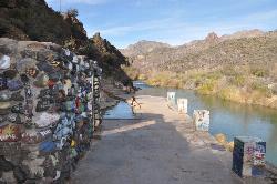
Verde Hot Springs
Camp Verde, Arizona
45.1 miles SVerde Hot Springs are a few natural hot spring pools located along the Verde River, near Sedona, Arizona. Once a resort, now all that remains are the foundations and the hot pools...
Camp, Hike, Hot Springs


