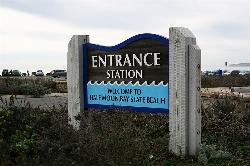
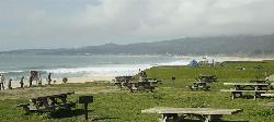
Half Moon Bay State Beach
Half Moon Bay, California
| Address: | 95 Kelly Ave, Half Moon Bay, CA 94019, USA |
| GPS: |
37°28'1.1"N 122°26'49.1"W Maps | Directions |
| State: | California |
| Trail Length: | 4.70 miles |
Restrooms Picnic Tables Pet Friendly State Park
Camp, Hike, Horseback, and Swim
Half Moon Bay State Park's Coastside Trail runs parallel to the Pacific Coast along what used to be the Ocean Shore Railroad. The railroad itself was in operation for just 14 years before it was driven out of business in the early 1920s by the automobile. However, the railroad had a tremendous effect on the Northern California coastline. It opened the area to agriculture, created new communities along the shoreline and made the coastal beaches prime tourist destinations. The Coastside Trail is truly a destination trail. It offers sweeping views of the Pacific Ocean, access to several beaches and excellent nature viewing. Bird watching is quite good and a popular activity here. Red-tailed hawks, blue herons and red-winged blackbirds are spotted frequently, and large hawks can often be seen perched on benches and the trail's split-rail fence. Half Moon Bay State Beach is also home of the world-famous Mavericks, a surfing spot near Pillar Point that's visible from the trail. In winter, surfers can ride waves up to 80 feet high here.Courtesy of traillink.com
More Information
Be courteous, informed, and prepared. Read trailhead guidelines, stay on the trail, and don't feed the wildlife.
Read MoreDirections
From Half Moon Bay, California
- Head west on Kelly St toward Main St (1.0 mi)
- Turn left at 2nd Ave (400 ft)
You can park at the Half Moon Bay State Beach Visitor Center for a fee and pick up the trail here. Heading north you follow the paved trail for about 2 miles in total. On your left is the coastline and on your right, the equestrian trail. Beyond this trail are views of gorgeous beachfront properties. A mile into your walk, you reach another parking lot with access to Venice Beach. The rail-trail continues for about another mile then merges into Mirada Road. If you continue walking on Mirada Road for a few minutes, you will end up at the Miramar Beach Restaurant, a bar and restaurant that overlooks the ocean. This is a great place to watch the sunset; the Miramar even posts a daily sunset schedule on its website. Heading south from the visitor center, the Pacific Ocean is on your right and the equestrian trail on your left. Beyond this horse trail are open, green fields. The trail hugs the bluff's edge here. As you head south, you see a landscape of wind-sculpted trees. It is typically windy along the bluff, so be sure to bring a jacket for this leg of the trail. The rail-trail officially ends about 1 mile in, and the surface changes to dirt. However, you can continue walking south along the cliff's edge on the path. This path, which the Coastside Trail is also a part of, is a segment of the much longer California Coastal Trail. Parking and Trail Access To reach the Half Moon Bay State Beach visitor center, take State Route 1 and turn on Kelly Avenue toward the coast. The visitor center is at the end of Kelly Avenue. Park in the visitor center parking lot. There is no parking at the endpoints. Additional parking is available at Venice Beach, at the end of Venice Boulevard off SR 1, and Dunes Beach, at the end of Young Avenue off SR 1.Courtesy of traillink.com
Other Swimming Holes, Hiking Trails, and Horseback Trails Nearby

Memorial Park
Loma Mar, California
15.9 miles SESwim near Loma Mar, California
Swim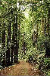
Pescadero Creek Trail Area
Loma Mar, California
15.9 miles SEPerfect for all redwood lovers, the Pescadero Creek Park area is an incredible shady trail for a hike on a hot summer day. This is a great place to escape from city sounds and enjoy...
Hike, Horseback, Mountain Bike, Swim 0.1-0.6 mi
Mt. Sutro Open Space Reserve
San Francisco, California
20.2 miles NMount Sutro Open Space Reserve is a 61-acre ecological oasis in the heart of San Francisco, just south of UCSF's Parnassus Heights campus. UCSF is committed to maintaining the Reserve as a safe...
Hike, Mountain Bike
Aquatic Park
San Francisco, California
23.5 miles NIn the heart of San Francisco, in the Golden Gate National Recreation Area, is Aquatic Park: a small beach on a lagoon in the San Francisco Bay which is a historic swimming place and is still used...
Swim
Auburn Area
San Francisco, California
23.6 miles NAlongside of the North Fork of the American River in the Auburn State Recreation Area, there are several swimming holes. Located at Emigrant Gap in the Tahoe National Forest, the North...
Hike, Horseback, Kayak, Rock Climb, Swim, Whitewater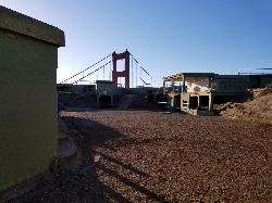
Battery Spencer
Mill Valley, California
25.1 miles NThis is easily one of the best places to view the Golden Gate Bridge. For over half a century, this was one of the most strategically important sites guarding the Golden Gate. Completed in 1897,...
Hike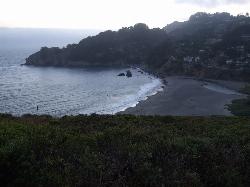
Muir Beach
Muir Beach, California
28.1 miles NMuir Beach is a little gem nestled away in the hills North of San Francisco, not far from the Muir Woods National Monument. There's a great beach and an entire network of trails. To get to the...
Hike, Swim 3.7 mi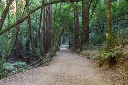
East Ridge Trail
Oakland, California
28.4 miles NEThis trail is deeply tucked away up into the hills of Oakland. East Ridge is the perfect trail to deeply appreciate the beauty of the Redwoods and has many entry points. This trail weaves...
Hike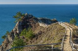
Muir Beach Overlook
Muir Beach, California
28.4 miles NHike near Muir Beach, California
Hike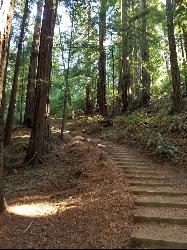
Muir Woods National Monument
Mill Valley, California
30.5 miles NThere are several suggested hikes on the main trail leaving from the visitors center. The longest, a loop, is about 2 miles. It is the only one that leaves the boardwalk. It has some elevation...
Hike 0.5-0.6 mi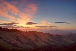
Grizzly Peak Trail
Berkeley, California
31.0 miles NGrizzly Peak Trail is located near La Loma Park in the Berkeley Hills section of the city of Berkeley, California and leads to an incredible lookout of the San Francisco Bay area....
Hike, Mountain Bike 4.0 mi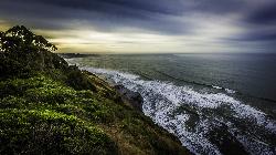
Palomarin Trail
Bolinas, California
36.2 miles NWThis hike is about 5 miles north from Bolinas is the Palomarin Trailhead. As you hike the trail you overlook the ocean and beautiful beaches. The trail takes you up to different lakes and then...
Hike
Garden of Eden
Felton, California
37.4 miles SEA great swimming hole in the Santa Cruz moutains of California, the Garden of Eden lives up to its name. This swimming hole is popular among all ages and offers beaches perfect for sunbathing and...
Hike, Swim 0.1 mi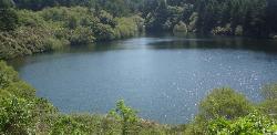
Bass Lake
Bolinas, California
37.7 miles NWHike and Swim near Bolinas, California
Hike, Swim 0.1-0.9 mi
Natural Bridges State Park / Monarch Butterfly Trail
Santa Cruz, California
41.6 miles SEThis trail is perfectly tucked away from the business of Santa Cruz. Monarch butterflies, during the Winter, fly here to stay warm. As you walk through the Monarch Grove, you will see trees...
Hike


