Gilgal Sculpture Garden
Salt Lake City, Utah
| Address: | Gilgal Sculpture Garden, 749 E 500 S, Salt Lake City, UT 84102, USA |
| GPS: |
40°46'45.5"N 111°51'41.7"W Maps | Directions |
| State: | Utah |
National Park State Park
More Information
Directions
From Salt Lake City, Utah
- Head north on Main St toward W 300 S/Broadway (0.1 mi)
- Turn right onto 300 S/Broadway (0.1 mi)
- Turn left onto S State St (0.5 mi)
- Turn right onto S Temple (1.3 mi)
- Turn left onto N St E (0.6 mi)
- Turn right onto 7th Ave (338 ft)
- Turn left onto 930 EDestination will be on the left(0.2 mi)
Other Nearby
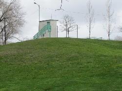
Lindsey Gardens
Salt Lake City, Utah
0.2 miles WSled near Salt Lake City, Utah
Sled
Bobsled Trail
Salt Lake City, Utah
0.6 miles EThe Bobsled Trail is a famous, fast-paced biking trail that will keep your heart racing and send you flying over your handlebars if you're not vigilant. It extends from the Bonneville...
Mountain Bike 4.7 mi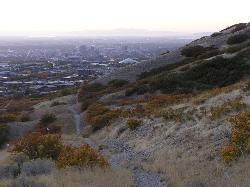
Bonneville Shoreline Trail
Salt Lake City, Utah
1.2 miles NWBonneville Shoreline Trail is a great place for hiking, biking, and trail running. It stretches from North Salt Lake to Parley's Canyon. The trail follows the shoreline of ancient Lake...
Hike, Mountain Bike
University of Utah Disc Golf
Salt Lake City, Utah
1.5 miles SEOn the former University ball golf course. Hill-side layout with spectacular views, mature trees and grass fairways. More info at the web site. Public (No Fee)
Disc Golf
Bonneville Shoreline Trail - Northern Salt Lake City
Salt Lake City, Utah
2.0 miles SEThe Bonneville Shoreline Trail is a series of trails along the slope of the Wasatch Mountains where the old shoreline of Lake Bonneville met the hills. Good aerobic ride. Can be...
Mountain Bike
Mt. Wire
Salt Lake City, Utah
3.3 miles SEThe Mt. Wire Pipeline Trail is a great singletrack away from the crowds. The lower portion is steep with loose rock. The Pipeline itself is loose gravel and has more hills then a...
Mountain Bike
Wild Rose Trailhead Park
North Salt Lake, Utah
3.7 miles NWThe Wild Rose trail park has several trails with varying uphill and downhill portions. There are a few single track routes taht are good for early intermediate riders, and a more technical...
Mountain Bike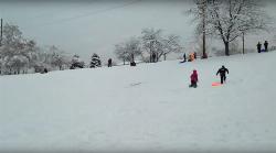
Sugar House Park
Salt Lake City, Utah
3.8 miles SThere are a few shorter slopes around the park which are great for sledding and one big hill in the Southwest corner that will get you some real speed.
Sled
Fairmont Park Disc Golf Course
Salt Lake City, Utah
4.1 miles STight, poorly marked object course in a busy city park with mature trees. Bring the map (old but still useful). Crossing fairways that zigzag through the park. Tees and targets are telephone poles...
Disc Golf
Roots Disc Golf Course
Salt Lake City, Utah
4.2 miles WRebuilt at the location of Utah's 2nd known disc golf polehole course (1981-1986). The area hosted a par 3 ball golf course until a 2014 grant was awarded to the local club for the current...
Disc Golf
Parley's Canyon
Salt Lake City, Utah
6.0 miles SEIt's located at the mouth of Parley's Canyon adjacent to a subdivision. This climb is quick and easy to access if you live in Salt Lake City. Even if you don't, since it's not...
Rock Climb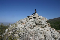
Mueller Park Trail
Bountiful, Utah
6.0 miles NThe Mueller Park Trail is a great year-round trail that's almost right off the road. It's considered moderate difficulty. It's a gradual grade with beautiful views. It's a popular...
Cross-country Ski, Hike, Mountain Bike
East Mueller Park
Bountiful, Utah
6.4 miles NSled near Bountiful, Utah
Sled
The Connection Skatepark
South Salt Lake, Utah
6.5 miles S14,600 sq. ft. indoor park includes: mini ramp, pro shop, street course, pads required and a membership and/or fee is required to skate....
Skateboard
Mills Park
Woods Cross, Utah
7.0 miles NWShort recreational course in multi-use park. Public (No Fee)
Disc Golf
Holbrook Trailhead
Bountiful, Utah
7.1 miles Nairsoft feaild woth bunkers
Airsoft, Backpack, Camp, Paintball, Snowshoe
Grandeur Peak
Salt Lake City, Utah
7.3 miles SEGrandeur Peak is the most easily accessible of the major peaks that form the Salt Lake City skyline. For many valley residents Grandeur Peak was there first major summit. The peak offers great...
Hike
Creekside Park
Millcreek, Utah
7.8 miles SSome open, some tight fairways, with rolling hills and scenic mountain views. A creek alongside comes into play on 4 holes. Russian olive bush hazards, mature oaks, and cottonwoods. Well maintained...
Disc Golf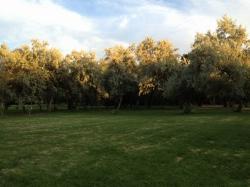
Walter Fredrick Morrison Disc Golf Course
Millcreek, Utah
7.9 miles SThe course at Creekside Park was established in 1982 and is one of the first 50 disc golf courses in existence. The course has been officially renamed the "Walter Fredrick Morrison Disc Golf...
Disc Golf
Bountiful City Park
Bountiful, Utah
8.0 miles NLength: ~100-200ft Slope: ~45°
SledNearby Campsites

Holbrook Trailhead
Bountiful, Utah
7.1 miles Nairsoft feaild woth bunkers
Airsoft, Backpack, Camp, Paintball, Snowshoe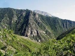
Mill Creek Canyon
Salt Lake City, Utah
9.5 miles SEMill Creek is an out and back with over 1000 ft of elevation gain. The lower section of the ski trail gets a lot of foot traffic, but the upper section (above Elbow Fork) is generally very quiet....
Camp, Cross-country Ski, Snowshoe
Spruces Campground
Salt Lake City, Utah
15.1 miles SECamping isn't free. See USDA.gov for details. If you know the coordinates of the sledding hill here, please comment.
Camp, Sled 5.6 mi
Antelope Island Lakeside Trail
Syracuse, Utah
25.9 miles NWThe Lakeside Trail is a kid-friendly trail with great views and many bugs. This is a gorgeous scenic hike winding around part of the Great Salt Lake. The trail on Antelope Island that runs about...
Camp, Hike, Horseback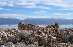
Antelope Island State Park
Syracuse, Utah
26.2 miles NWLocated just 41 miles north of Salt Lake City, Antelope Island State Park encompasses a vast selection of outdoor activities and spectacular scenery providing a peaceful nature experience. Experience...
Backpack, Camp, Hike, Horseback, Mountain Bike 1.6-14.1 mi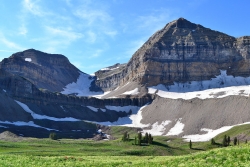
Mount Timpanogas
Provo, Utah
26.7 miles SEMt. Timp, as the locals call it, is the 2nd highest mountain in the Wasatch range (only Mt. Nebo is higher). What sets "Timp" apart is its location. It towers over the Provo, Orem, Pleasant...
Camp, Hike, Horseback, Swim 2.9 mi
Pineview Reservoir
Eden, Utah
35.8 miles NLocated on the backside of the Wasatch Front, Pineview Reservoir in the Ogden River Canyon is home to stunning views of the water, sandy beaches, the Southern Skyline trail, paved ramps, and...
Camp, Canoe, Hike, Kayak, Mountain Bike, Swim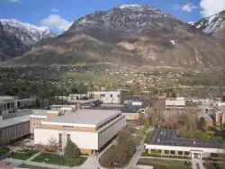
Y-Mountain Summit Trail
Provo, Utah
39.2 miles SY Mountain is located directly east of Brigham Young University (BYU) in Provo, Utah, United States. The Slide Canyon/Y Mountain Trail leads to a large block Y located 1.2 miles (1.9 km) from a...
Camp, Hike


