


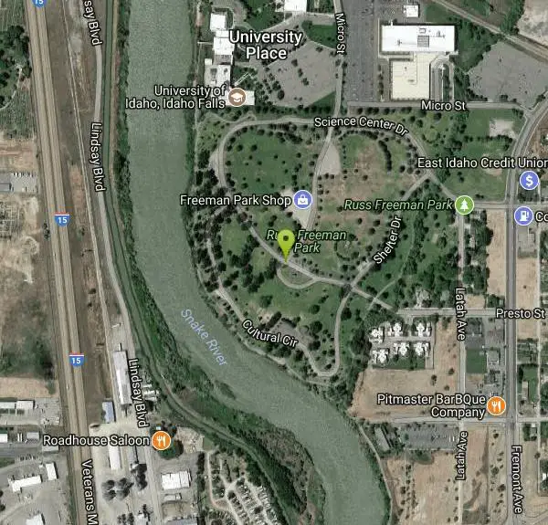
Freeman Park
Idaho Falls, Idaho
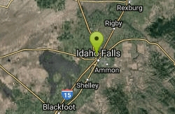
| Address: | 1290 Science Center Dr, Idaho Falls, ID 83402, USA |
| GPS: |
43°30'50.2"N 112°3'8.9"W Maps | Directions |
| State: | Idaho |
| Disc Golf Target Type: | DISCatcher |
| Disc Golf Tee Type: | Concrete |
Disc Golf
A couple of creek crossings add to appeal. Snake river borders most of this beautifully maintained course. Good elevation and variety. Public (No Fee)Courtesy of DiscGolfUnited.com
More Information
Add Resource- Plan Ahead and Prepare
- Travel & camp on durable surfaces
- Dispose of waste properly
- Leave what you find
- Minimize campfire impacts
- Respect wildlife
- Be considerate of other visitors
Directions
From Idaho Falls, Idaho
- Head northwest on A St toward N Capital Ave (0.1 mi)
- Turn right at the 2nd cross street onto Memorial Dr (0.3 mi)
- At the traffic circle, take the 3rd exit onto Riverside Dr (0.6 mi)
- Continue onto Fremont Ave (0.6 mi)
- Turn left onto Presto St (0.3 mi)
I-15 exit 119 (follow signs to Vietnam Memorial). Turn east/north on Hwy 20 to City Center exit. Turn north on Riverside Dr. to a left at 1st light into park. 1st left to memorial and course. Directions at website also.Courtesy of DiscGolfUnited.com
Other Folf Courses Nearby
McCowin Park Disc Golf Course
Ammon, Idaho
4.8 miles SEShort - longest hole 333'. A few trees and fences for obstacles. Good for a quick game. Public (No Fee)
Disc Golf
Eagle Point Park
Ammon, Idaho
5.8 miles SEPractice course with 3 baskets and 3 tees. Play each basket from each tee for 9 holes. Playground nearby. Private (No Fee)
Disc Golf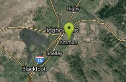
Woodland Hills
Idaho Falls, Idaho
6.3 miles SEGrassy with slight elevation and some young trees that can come into play. Course map near 1st tee and parking lot. An OB irrigation canal comes into play #3 and 4. Fun course layout with some...
Disc Golf
North Bingham County Park
Shelley, Idaho
11.2 miles SWWell kept park. Public (No Fee)
Disc Golf
Beaver Dick Park
Rexburg, Idaho
22.7 miles NBeaver Dick is a park 4.5 miles west of Rexburg, Idaho on Hwy 33. It's a 9.5 acre park that passes next to the west bank of the Henry Fork of the Snake River; it's a popular...
Camp, Canoe, Disc Golf, Swim 0.1-0.3 mi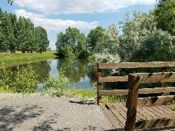
Rexburg Nature Park
Rexburg, Idaho
25.4 miles NERexburg Nature Park: Life can be stressful, annoying, or just not good. Sometimes, it takes a moment to simply get away from the non-sense of this world; to gather yourself and seek peace and...
Disc Golf
Blackfoot Disc Golf Course
Blackfoot, Idaho
26.6 miles SWHalf the trees removed in 2005 due to drought. Sprinklers installed and grass everywhere now. Great for practicing rollers. Public (No Fee)
Disc Golf
Idaho State University
Pocatello, Idaho
45.4 miles SChallenging desert course with lots of elevation changes and large scrubby junipers. Public (No Fee)
Disc Golf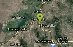
Sister City Disc Golf Course
Pocatello, Idaho
46.6 miles SW7 short holes in the grassy park followed by 11 in surrounding natural terrain. Back 9 fairly long (one at 700'!) and has significant elevation. Multiple pin positions. Posts mark the tees. Best...
Disc Golf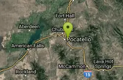
Bengal Ridge at ISU
Pocatello, Idaho
48.1 miles SChallenging desert course with extreme elevation changes and large scrubby junipers. . Public (No Fee)
Disc Golf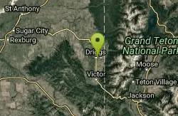
Teton Valley Disc Golf Course
Driggs, Idaho
49.7 miles EEnjoy 360-degree mtn views from this city park that also features a skateboard area. This course is on your way to the Grand Targhee course. Public (No Fee)
Disc Golf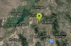
Ross Park
Pocatello, Idaho
49.8 miles SOn grass with elevation and large trees that force a variety of throws. Alt. pins throughout the seasons. Public (No Fee)
Disc Golf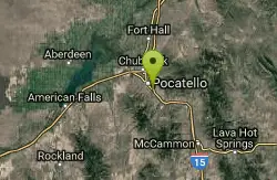
Upper Ross Park
Pocatello, Idaho
49.8 miles SOn grass with elevation and large trees that force a variety of throws. Alt. pins throughout the seasons. Public (No Fee)
Disc GolfNearby Campsites

Sealander Park
Idaho Falls, Idaho
7.7 miles SWThe story of Sealander park begins with Carl Sealander. Leaving Sweden in 1893 at the age of seventeen, Carl worked in mining communities across Colorado and Utah before meeting his wife, Lizzie...
Camp
Jefferson County Lake (AKA Rigby Lake)
Rigby, Idaho
14.9 miles NERigby Lake has long been a favorite swimming hole for those in the area. The county has taken it well under its wing and made it a buzzing spot on any warm summer day. Along with the long standing...
Camp, Canoe, Dive, Kayak, Sled, Swim
Firth River Bottoms
Firth, Idaho
16.0 miles SWWhether you like to ride horses, picnic, camp, fish, learn about the past, or play baseball, this park has something for everyone. The Parks & Recreation Department and the IDaho Education...
Camp, Canoe, Hike
Twin Bridges Park
Rexburg, Idaho
18.1 miles NETwin Bridges is a campground 12 miles South East of Rexburg on S. 600 E. It is maintained by Madison County Parks Department. It is a 27 acre park of pristine land rich with wildlife on the Snake...
Camp, Canoe 0.6-2.0 mi
North Menan Butte ('R' Mountain)
Menan, Idaho
19.0 miles NThe North Menan Butte is more commonly known to the locals and college students as R Mountain. Many kids know it better as Ou'R' Mountain. The butte is a rare and unique geological area and provides...
Camp, Cave, Hike
Kelly Island Campground
Ririe, Idaho
20.9 miles EThis is a BLM campground with 14 campsites for RVs or tents and 1 group campsite. Daily Rates $5-20 Showers No Bathrooms Vault...
Camp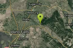
Paramount Wall / Blanche Rock
Ririe, Idaho
21.8 miles NESitting high above the road, the routes at Paramount offer great exposure and relief from the afternoon summer sun. Chuck Oddette, Steve Reiser and Jed Miller established the routes from 1989...
Camp, Horseback, Rock Climb
Beaver Dick Park
Rexburg, Idaho
22.7 miles NBeaver Dick is a park 4.5 miles west of Rexburg, Idaho on Hwy 33. It's a 9.5 acre park that passes next to the west bank of the Henry Fork of the Snake River; it's a popular...
Camp, Canoe, Disc Golf, Swim
Wolf Flats Recreation Area
Ririe, Idaho
22.9 miles EWolf Flats is a completely free, dispersed, undeveloped camping area with 25 locations to camp. Some areas are large enough to accommodate groups of 50 people.
Camp
Table Rock Campground
Ririe, Idaho
24.5 miles ETable Rock / Poison Flat Campground is located at the Caribou-Targhee National Forest which occupies over 3 million acres and stretches across southeastern Idaho, from the Montana, Utah, and Wyoming...
Camp
Big Hole Dispersed Campsites
Ririe, Idaho
24.9 miles NEA dispersed campsite is simply an unestablished and unmaintained area where people camp. Often, this means that there is a campfire or other basic campsite feature to identify the site and that's...
Camp 0.1-0.5 mi
Eagle Park
Rexburg, Idaho
25.6 miles NEEagle Park is a little urban oasis. Once you drive in to this cottonwood forest along the river, you may forget that you're still inside Rexburg city limits. You can camp, picnic, throw rocks in...
Camp, Hike, Mountain Bike, Sled 0.5-3.5 mi
Webster's Dam
Ririe, Idaho
26.0 miles NEAlso known as Manmade Falls or the Woodmansee Dam, Webster Dam is an abandoned dam located deep in Moody Creek canyon, the dam was abandoned when sediment built up behind the dam which then...
Camp, Hike, Mountain Bike 0.8-1.3 mi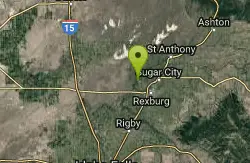
Warm Slough Campground
Rexburg, Idaho
26.4 miles NThis is a pretty popular campsite that fills up pretty quick on busy weekends. Campsites are fairly spread out and there is no official donation box (as of July 2015). A couple of the campsites...
Airsoft, Camp, Canoe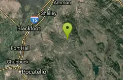
Blackfoot River Crossing at Trail Creek Road
Firth, Idaho
27.3 miles SIn Soda Springs, ID 34 N for ~11 mi; R (E) on Blackfoot River Rd at mp 69.9; zero odometer; travel 10.4 mi; stay to the L as rd turns to gravel at mi 10.9; mi 13.7 pass Mill Canyon Campground; mi...
Camp
Moody Meadows
Driggs, Idaho
31.6 miles EGood place for kids, they can ride bikes in the meadow, play in the stream, and camping is off of the road. Hiking, motorbiking, and horseback riding trails are abundant in the area.
Camp
Fall Creek Falls
Swan Valley, Idaho
34.3 miles EFalls Campground is located next to the Snake River near beautiful Swan Valley, only 45 miles east of Idaho Falls, Idaho. Mixed growth cottonwood trees provide partial shade, and grassy meadows with...
Camp, Cave, Hike, Kayak, Swim
Falls Campground
Victor, Idaho
35.1 miles EFalls Campground is located next to the Snake River near beautiful Swan Valley, only 45 miles east of Idaho Falls, Idaho. Mixed growth cottonwood trees provide partial shade, and grassy meadows...
Camp
Pine Creek Campground
Victor, Idaho
42.6 miles EThe Pine Creek Campground has 10 single units and has restrooms.
Camp 5.6-8.3 mi
Palisades Creek Trail / Lakes and Waterfall Canyon
Irwin, Idaho
42.9 miles EPalisades Creek Trail is located about 50 miles southeast of Idaho Falls and about 60 miles west of Jackson Hole WY in Swan Valley Idaho. The four mile hike up to lower Palisades Lake or the 6.2 mile...
Backpack, Camp, Hike, Horseback, Mountain Bike


