


Flat Laurel Creek
| Address: | Flat Laurel Creek, North Carolina 28716, USA |
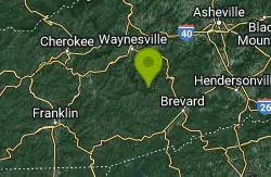
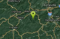
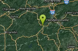
| GPS: |
35°19'39.4"N 82°54'33.5"W Maps | Directions |
| State: | North Carolina |
| Trails/Routes: | 1.7 mi |
Hike, Horseback, Mountain Bike, and Swim
Flat Laurel Creek is a 3.18 mile multi-use trail that is perfect for exploring on foot, horse and bike. This trail can be accessed from a parking lot on either end, making it easy to begin exploring. The trail follows Flat Laurel creek and is easy for hiking and mountain biking. Mountain bikes are allowed on trails, but are not allowed in marked wilderness areas. Horses are allowed throughout the area. This beautiful trail provides distant views of Sam Knob and Black Balsam Knob.
Flat Laurel Creek runs over many beautiful rock formations and rich orange earth. The colors of the water, the earth and the surrounding forest create eye-catching views. The creek also features a small waterfall. In a few spots the creek deepens so that is can be waded and swam in. Those hoping to swim should be careful of their safety in the running water.
Flat Laurel Creek Trail is open year round, making this a great place to explore the colors of every season.
More Information
Add ResourceNever modify trail features. Ride trails when they're dry enough that you won't leave ruts. Speak up when you see others on the trail and always yield to hikers, horses, and others coming uphill. Always ride on the established trail.
Read MoreBe courteous, informed, and prepared. Read trailhead guidelines, stay on the trail, and don't feed the wildlife.
Read More- Plan Ahead and Prepare
- Travel & camp on durable surfaces
- Dispose of waste properly
- Leave what you find
- Minimize campfire impacts
- Respect wildlife
- Be considerate of other visitors
Directions
- Get directions on Google Maps

Trails
Distance ?
1.7 milesElevation Gain ?
1,300 feetReal Ascent ?
1,300 feetReal Descent ?
0 feetAvg Grade (8°)
14%Grade (1° to 19°)
2% to 34%Elevation differences are scaled for emphasis. While the numbers are accurate, the cut-away shown here is not to scale.
Other Mountain Bike Trails, Swimming Holes, Hiking Trails, and Horseback Trails Nearby
Sunburst
Canton, North Carolina
3.4 miles NWSwim near Canton, North Carolina
Swim 0.2-2.8 mi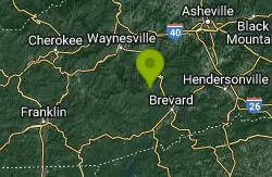
Graveyard Fields
Brevard, North Carolina
3.5 miles EGraveyard Fields is a beautiful hike known for it's forests, wild flowers and two beautiful waterfalls. The Blue Ridge Mountains surround this area creating stunning views throughout the...
Hike, Swim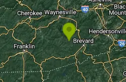
Courthouse Falls
4.0 miles S
Courthouse Falls is a beautiful 45 foot waterfall that is popular to visit. This waterfall is an easy 3/4 mile hike from the parking lot on Courthouse Creek Road (FSR 140) or can be accessed from the...
Hike, Swim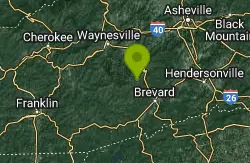
Skinny Dip Falls
Brevard, North Carolina
4.3 miles ESkinny Dip Falls is a beautiful and family friendly waterfall. Despite the misleading name, bathing suits are not optional at Skinny Dip Falls. Skinny Dip Falls is a long, thin cascading waterfall...
Hike, Swim 2.3 mi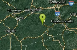
Cove Creek
Canton, North Carolina
5.3 miles EAll the climbing is on gravel forest roads. Then you descend on Cove Creek Trail. There are some cool rock sections up at the top and a few rustic log bridges about mid way down but overall this is a...
Mountain Bike 7.1 mi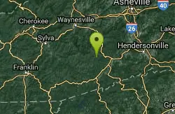
Daniel Ridge Loop
Canton, North Carolina
5.4 miles SEThis is a classic, short Pisgah loop. It's moderately technical most of the way with a couple of trickier sections. Most people prefer to approach it counter-clockwise, but it can be ridden...
Hike, Mountain Bike 3.1-4.3 mi
Farlow Gap
Canton, North Carolina
5.4 miles SEThis is one of the most technical downhills in Pisgah: very steep and rocky! The trail drops about 2000 ft in 3 miles then connects with the Daniel Ridge trail. The climb to the gap is long (9 miles)...
Hike, Mountain Bike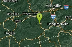
Big East Fork
Canton, North Carolina
5.8 miles NEBig East Fork is a trail along Pigeon River with a variety of activities available. This trail travels through heavy forest along the river with beautiful, clear water. There are several waterfalls...
Backpack, Hike, Kayak, Swim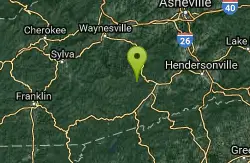
Cove Creek Tubs
Brevard, North Carolina
5.9 miles SEBest tubs in the Pisgah Forest. They’re three magnificent pot holes like you’d expect to find in Vermont or New Hampshire. At the top is a seven foot, almost perfectly round tub. From it...
Swim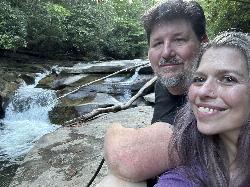
Whaleback Swimming Hole
Asheville, North Carolina
6.1 miles SEMost people in this neck of the woods will head straight to Sliding Rock or Looking Glass Falls, but the locals go to Whaleback on the Davidson River above the fish hatchery. A massive slab of...
Swim 0.8 mi
Daniel Ridge Falls
Brevard, North Carolina
7.2 miles SEThis waterfall in Pisgah National Forest near Brevard has multiple names: Tom's Spring Branch Falls, Daniel Ridge Falls and Jackson Falls. It’s an easy half-mile hike on the Daniel Ridge...
Hike, Mountain Bike, Swim 13.5 mi
Horse Cove Gap Loop / FS 475C
Brevard, North Carolina
7.3 miles SEMaintained fire road. From the hatchery, it's 4 miles of steady elevation gain before easing and connecting to Bracken Mt. Trail. GPS map is 5.8 miles one-way, 12 miles round trip. Otherwise,...
Mountain Bike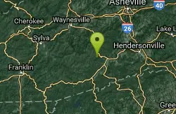
Butter Gap / Trail #123
Brevard, North Carolina
7.3 miles SEThe right (western) fork, which is open to mountain bikes, leads to FS 471D, which some riders use as part of a large loop; otherwise, they must backtrack down Butter Gap Trail. *The portion of the...
Hike, Mountain Bike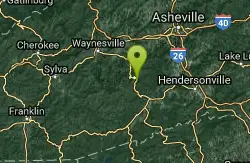
Pilot Cove Loop Trail
Pisgah Forest, North Carolina
7.6 miles EThis short 1.8-mile trail has some steep, very tight singletrack and some very tight turns... but it is well-worth riding because it houses one of the best views in Pisgah National Forest! Definitely...
Hike, Mountain Bike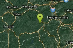
Coontree
Brevard, North Carolina
8.1 miles SEThis trail is 3.7 miles one-way. This trail is a gnarly, steep hike-a-bike in one direction and a steep, technical descent the other. Prepare to get your butt kicked!...
Mountain Bike
Looking Glass Falls
Brevard, North Carolina
8.2 miles ELooking Glass Falls is a gorgeous and easily accessible waterfall in Brevard, North Carolina. This waterfall is a short and beautiful walk from Pigsah Highway (Highway 276). Parking is available just...
Hike, Swim 0.0 mi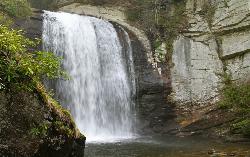
Looking Glass Falls
Brevard, North Carolina
8.2 miles ELooking Glass Falls is one of the most popular and beautiful waterfalls in North Carolina. And it's perhaps the easiest to view (one of the few accessible roadside waterfalls, making it perfect...
Swim
Bear Creek Area
Tuckasegee, North Carolina
8.3 miles SWSeveral swimming holes in lakes along RT 281 southeast of Sylva and Cullowhee. For details... Bathing suits: Optional at most places, very remote
Swim
Big Creek Area
Tuckasegee, North Carolina
8.3 miles SWSeveral swimming holes near the NE border of the Great Smoky Mtns N. P. in the Big Creek Recreation Area on the TN-NC border. NOTE: The National Park Service will not allow you to...
Swim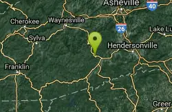
Coontree Recreation Area
Brevard, North Carolina
8.5 miles ECoontree Recreation Area is a beautiful area with many amenities and activities on the Davidson River. This recreation area is best known for its picnic area with a beautiful view of the river. The...
Hike, Mountain Bike, SwimNearby Campsites
Davidson River Campground
Pisgah Forest, North Carolina
11.0 miles EDavidson River Recreation Area offers camping and outdoor activities for the whole family. The campground boasts several loops of shaded campsites, as well as access to hiking trails, fishing spots,...
Camp, Hike, Swim
Mt. LeConte Lodge
Sylva, North Carolina
20.3 miles WHigh atop Mt. LeConte in the Great Smoky Mountains National Park, LeConte Lodge® is the highest guest lodge in the eastern United States. It is situated on an open glade just below the summit of...
Camp, Hike, Horseback, Rock Climb
Cosby Campground
Cosby, Tennessee
34.1 miles NWCamp and Swim near Cosby, Tennessee
Camp, Swim
Rocky Bluff
Hot Springs, North Carolina
37.1 miles NPlay in water in creek, shallow at times.
Camp, Hike, Swim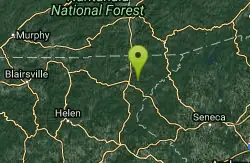
War Woman Dell Wildlife Management Area
Clayton, Georgia
39.7 miles SWWarwoman Dell Nature Trail and Becky Branch Falls Trail is a 0.8 mile out and back trail located near Clayton, Georgia that features a waterfall and is good for all skill levels. The trail is...
Camp, Hike, Horseback


