


Ferguson Canyon
Cottonwood Heights, Utah
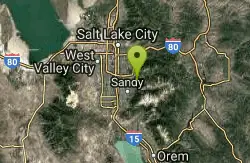
| Address: | 7721 Timberline Dr, Cottonwood Heights, UT 84121, USA |
| GPS: |
40°36'39.1"N 111°47'17.4"W Maps | Directions |
| State: | Utah |
| Trail Length: | 4.00 miles |
| MTB Difficulty: | Intermediate |
| Trail Type: | Out & Back |
| Hike Difficulty: | Intermediate |
Trails Rocks Pet Friendly Bicycles
Hike, Mountain Bike, and Rock Climb
Ferguson canyon is small canyon between Big and Little Cottonwood Canyons. This canyon has gained popularity over the last few year and is a popular destination for rock climbers. This is one hike that the canyon itself is the destination. The hike can be whatever you want to be. You can follow the trail to the end and get to a summit or just make it to the shaded canyon wall and stream.
More Information
Never modify trail features. Ride trails when they're dry enough that you won't leave ruts. Speak up when you see others on the trail and always yield to hikers, horses, and others coming uphill. Always ride on the established trail.Read More
Be courteous, informed, and prepared. Read trailhead guidelines, stay on the trail, and don't feed the wildlife.Read More
- Plan Ahead and Prepare
- Travel & camp on durable surfaces
- Dispose of waste properly
- Leave what you find
- Minimize campfire impacts
- Respect wildlife
- Be considerate of other visitors
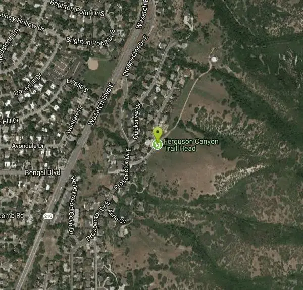
Directions
From Cottonwood Heights, Utah
- Head east on E 7195 S/
Cypress Way toward S 2660 E Continue to follow Cypress Way(476 ft) - Turn right onto E Manor Dr (240 ft)
- Turn left onto S 2700 E (0.3 mi)
- Turn right onto Fort Union Blvd (1.4 mi)
- Turn right onto Wasatch Blvd E (0.3 mi)
- Turn left onto Prospector Dr E (121 ft)
- Turn right onto S 3835 E/
Prospector Dr E (0.3 mi) - Turn left onto Timberline DrDestination will be on the right(0.1 mi)
Head south on Wasatch Blvd. Just past Big Cottonwood Canyon & the 7-11, turn left on Prospector Drive. Turn right immediately. Follow the brown signs for Ferguson Canyon. Park at the trail, or along the road (if it's crowded). Courtesy of girlonahike.com
Other Rock Climbing Walls, Mountain Bike Trails, and Hiking Trails Nearby

Storm Mountain
Salt Lake City, Utah
2.5 miles EStorm Mountain is on of the smaller peaks included in the Wasatch Range. Storm Mountain is located in Cottonwood Canyon. Storm Mountain Day Use Area is just 3 miles up Big Cottonwood Canyon,...
Hike, Mountain Bike, Rock Climb 3.2 mi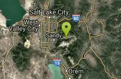
Little Cottonwood Pipeline Trail
Sandy, Utah
2.8 miles SLocated in Sandy, UT, Little Cottonwood Pipeline trail starts at the mouth of Little Cottonwood Canyon and is a single-track trail with some rocky situations on the trail. The first portion of the...
Mountain Bike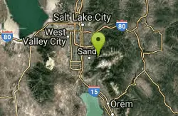
Scruffy Band Little Cottonwood Canyon
Sandy, Utah
2.8 miles SRock Climb near Sandy, Utah
Rock Climb
Pete's Rock
Salt Lake City, Utah
3.0 miles NA large rock next to the Mount Olympus trailhead known locally as Pete's Rock and is a popular place for casual rock climbing. Mount Olympus is a prominent 9,026 feet peak on the east side of the...
Hike, Rock Climb 1.1-4.7 mi
Bells Canyon
Sandy, Utah
3.3 miles SBells Canyon is a moderate, 4.5 mile hike that begins in a residential area and ends at a waterfall in the enter of the canyon's forest. The first 1/2 mile of the hike is relatively...
Backpack, Hike, Mountain Bike, Snowshoe 0.7 mi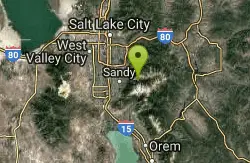
Great White Icicle
Sandy, Utah
3.6 miles SEThe Great White Icicle is located in Little Cottonwood Canyon just outside of Salt Lake City, Utah. It is a climbing area that is a frozen waterfall in the winter and a cascading waterfall...
Hike, Rock Climb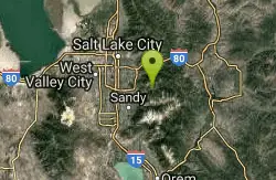
Hidden Falls
Salt Lake City, Utah
3.8 miles NEHidden Falls is a popular road side attraction for anyone cruising Big Cottonwood Canyon on a sunny afternoon. The falls are within strolling distance of the parking lot and only require about 15...
Hike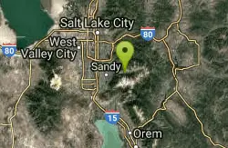
Lisa Falls
Sandy, Utah
4.2 miles SELisa Falls is a great place to climb Spring through Fall, any time of day. The base is well shaded by trees and offers many flat places to belay, or just hang out and relax. The roaring waterfall...
Hike, Rock Climb 0.2 mi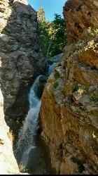
Rocky Mouth Trail/Waterfalls
Sandy, Utah
4.5 miles SThis adventure begins with a very scenic hike to a beautiful waterfall and ends with a magnificent rappel through a short slot canyon and down the waterfall. The hike to the waterfall is a great trip...
Canyoneer, Hike, Rock Climb
Lake Blanche
Salt Lake City, Utah
5.0 miles ELake Blanche is a fun and popular hike. Lake Blanche, Lake Florence and Lake Lillian are all located next to each other in the upper reaches of the South Fork of Mill B. The trail to Lake Blanche...
Hike 0.4 mi
Hidden Valley Park trail
Sandy, Utah
5.0 miles SHidden Valley Trail has different levels and gradual uphill fun and makes for a good adventure trail. It's a wide, shallow valley that is hidden from view; hence the name. The valley’s...
Hike, Mountain Bike 2.6 mi
Salt Lake Valley Scenic Overlook
Salt Lake City, Utah
5.9 miles NThe Salt Lake Valley Scenic overlook starts on the Desolation trail in Millcreek Canyon near Salt Lake City, Utah and offers hikers a wide variety of destinations to stop at along the trail,...
Hike
Pfeiferhorn Peak
Provo, Utah
6.1 miles SEThe Pfeifferhorn is a majestic peak, which is located east of Salt Lake City, Utah in the Wasatch mountain range. It's easy access, proximity to alpine lakes and short trail make it a popular...
Backpack, Hike 0.2 mi
Orson Smith trail
Draper, Utah
6.4 miles SOrson Smith Trail is located north of the Corner Canyon Gate. It leads up to the suspension bridge and has become a popular spot for hiking and bike routes since the suspension...
Hike, Mountain Bike 0.8 mi
Bear Canyon Suspension Bridge
Draper, Utah
6.6 miles SThe Bear Canyon Suspension Bridge is a 185ft bridge that connects the Bear Canyon to the Bonneville Shoreline Trail. The bridge was built and completed in 2015 thanks to donations from residents and...
Hike, Mountain Bike
Grandeur Peak
Salt Lake City, Utah
6.8 miles NGrandeur Peak is the most easily accessible of the major peaks that form the Salt Lake City skyline. For many valley residents Grandeur Peak was there first major summit. The peak offers great...
Hike
Parley's Canyon
Salt Lake City, Utah
6.9 miles NIt's located at the mouth of Parley's Canyon adjacent to a subdivision. This climb is quick and easy to access if you live in Salt Lake City. Even if you don't, since it's not...
Rock Climb 0.5 mi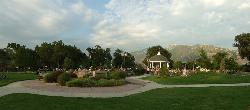
Draper City Park
Draper, Utah
6.9 miles SWDraper City Park is located in the center of the Draper Town Center and the park is near the Porter Rockwell Trail and Willow Creek Trail so visitors can walk or jog around. There are trail heads for...
Hike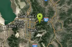
Mill Creek Pipeline
Salt Lake City, Utah
7.3 miles NEthere are quite a few hiking trails that connect into this trail coming up the mountain from your left you will go about 6.5 miles and then a sign post will mark the Rattlesnake down...
Mountain Bike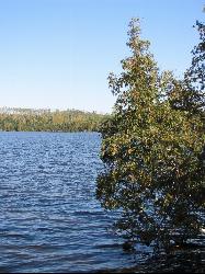
White Pine Lake
Sandy, Utah
7.5 miles SEWhite Pine Canyon has long been the subject of intense controversy between advocates of wilderness and ski resort owners. The original boundaries of Lone Peak Wilderness Area, created in 1977, were...
Hike, Mountain BikeNearby Campsites

Mill Creek Canyon
Salt Lake City, Utah
7.3 miles NEMill Creek is an out and back with over 1000 ft of elevation gain. The lower section of the ski trail gets a lot of foot traffic, but the upper section (above Elbow Fork) is generally very quiet....
Camp, Cross-country Ski, Snowshoe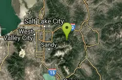
Spruces Campground
Salt Lake City, Utah
8.1 miles ECamping isn't free. See USDA.gov for details. If you know the coordinates of the sledding hill here, please comment.
Camp, Sled 1.6-14.1 mi
Mount Timpanogas
Provo, Utah
14.7 miles SEMt. Timp, as the locals call it, is the 2nd highest mountain in the Wasatch range (only Mt. Nebo is higher). What sets "Timp" apart is its location. It towers over the Provo, Orem, Pleasant...
Camp, Hike, Horseback, Swim
Holbrook Trailhead
Bountiful, Utah
18.9 miles Nairsoft feaild woth bunkers
Airsoft, Backpack, Camp, Paintball, Snowshoe
Y-Mountain Summit Trail
Provo, Utah
27.0 miles SY Mountain is located directly east of Brigham Young University (BYU) in Provo, Utah, United States. The Slide Canyon/Y Mountain Trail leads to a large block Y located 1.2 miles (1.9 km) from a...
Camp, Hike 5.6 mi
Antelope Island Lakeside Trail
Syracuse, Utah
37.1 miles NWThe Lakeside Trail is a kid-friendly trail with great views and many bugs. This is a gorgeous scenic hike winding around part of the Great Salt Lake. The trail on Antelope Island that runs about...
Camp, Hike, Horseback
Antelope Island State Park
Syracuse, Utah
37.2 miles NWLocated just 41 miles north of Salt Lake City, Antelope Island State Park encompasses a vast selection of outdoor activities and spectacular scenery providing a peaceful nature experience. Experience...
Backpack, Camp, Hike, Horseback, Mountain Bike 4.7 mi
Fifth Water Hot Springs
Provo, Utah
43.0 miles SEAKA Diamond Fork Hot Springs A beautiful drive and a 2.5 mile hike along the river will end you at an amazing set of hot springs that's well worth the trip. There's a variety of...
Backpack, Camp, Hike, Hot Springs, Mountain Bike, Swim 2.9 mi
Pineview Reservoir
Eden, Utah
47.4 miles NLocated on the backside of the Wasatch Front, Pineview Reservoir in the Ogden River Canyon is home to stunning views of the water, sandy beaches, the Southern Skyline trail, paved ramps, and...
Camp, Canoe, Hike, Kayak, Mountain Bike, Swim


