


Escalante River
Escalante, Utah
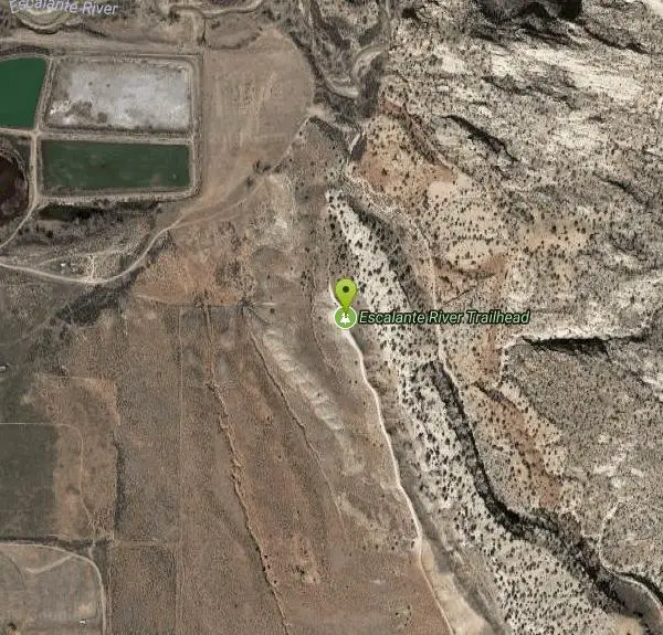
| Address: | Escalante River Trailhead, Escalante, UT 84726, USA |
| GPS: |
37°46'16.9"N 111°34'45.6"W Maps | Directions |
| State: | Utah |
| Trails/Routes: | 12.1 mi |
Rivers Streams Trails Rocks Wildflowers Restrooms Picnic Tables Lakes Waterfalls Glaciers Ponds
Hike and Horseback
More Information
Add ResourceBe courteous, informed, and prepared. Read trailhead guidelines, stay on the trail, and don't feed the wildlife.
Read More- Plan Ahead and Prepare
- Travel & camp on durable surfaces
- Dispose of waste properly
- Leave what you find
- Minimize campfire impacts
- Respect wildlife
- Be considerate of other visitors
Directions
From Escalante, Utah
- Head east on W Main St toward S Center St (0.4 mi)
- Turn left onto E Main St (358 ft)
- Turn left onto N 300 E (0.2 mi)
- Turn right onto 190 N St (0.4 mi)
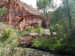
 Natural Bridge courtesy of katiemia↗

 Walking In The River courtesy of katiemia↗
 Along The Cliffs courtesy of katiemia↗
 Amphitheater courtesy of katiemia↗
 Amphitheater Petroglyphs courtesy of katiemia↗
 Beautiful Foliage courtesy of katiemia↗
 Down The Canyon courtesy of katiemia↗
 In The River courtesy of katiemia↗

Added by katiemia
Trails
Distance ?
12.1 milesElevation Gain ?
-555 feetReal Ascent ?
684 feetReal Descent ?
1,239 feetAvg Grade (0°)
-1%Grade (-26° to 26°)
-49% to 48%Elevation differences are scaled for emphasis. While the numbers are accurate, the cut-away shown here is not to scale.
Other Hiking Trails and Horseback Trails Nearby
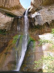
Lower Calf Creek Falls
Boulder, Utah
9.1 miles ELower Calf Creek Falls is a beautiful and popular destination located in the Grand Staircase-Escalante National Monument in southern Utah. The falls are a series of cascading waterfalls that flow...
Hike, Swim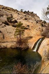
Upper Calf Creek Falls
Boulder, Utah
9.8 miles NEHike and Swim near Boulder, Utah
Hike, Swim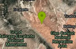
Neon Canyon and Golden Cathedral
Escalante, Utah
23.3 miles SEThe Golden Cathedral is a unique hiking destination within lower Neon Canyon in the Grand Staircase-Escalante area. The Cathedral is locates just over 3/4 of a mile up Neon Canyon from its confluence...
Backpack, Canyoneer, Hike 3.7 mi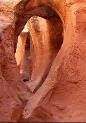
Peek-a-boo Gulch
Escalante, Utah
28.3 miles SEPeek-a-boo Gulch is located in the scenic Grand Staircase National Monument near Escalante, Utah and adjacent to Spooky Gulch. It is not to be confused with Red Slot Canyon AKA Peekaboo....
Hike 4.9 mi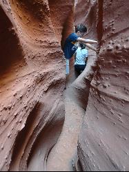
Spooky Gulch
Escalante, Utah
28.3 miles SESpooky Gulch, located near Escalante, Utah, is a short slot canyon hike near the Grand Staircase National Monument. There are parts of the slot canyon that are so narrow, you may wonder if you...
Hike 0.1-0.3 mi
Mossy Cave
Tropic, Utah
30.2 miles WMossy Cave Trail is perfect for Bryce Canyon Visitors who want to experience the wonderful rock formations, like the Hoodoos, without steep and strenuous climbing. This trail is just over a mile and...
Hike 7.6 mi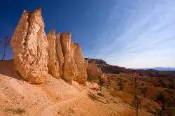
Fairyland Loop Trail
Bryce, Utah
32.2 miles WFairyland Loop Trail is one of the most scenic hikes available in Bryce Canyon. Hiking this loop allows you to see many of Bryce Canyon’s well-known sights from several...
Hike 0.5-5.4 mi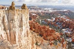
Rim Trail
Bryce, Utah
33.4 miles WRim Trail is a wonderful way for hikers to explore the breathtaking views of Bryce Canyon from above the canyon. The trail curves around the park allowing hikers to view the spectacular, red rock...
Hike 2.3 mi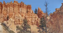
Queens Garden Trail
Bryce, Utah
33.5 miles WThe Queen's Garden Trail is the hike to see the wonders of Bryce Canyon's main amphitheater from all angles. Starting at Sunrise Point, you'll have a great view from the rim before...
Hike 1.6 mi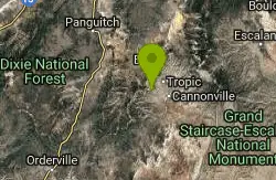
Hat Shop
Bryce, Utah
33.6 miles WHat Shop Trail is a moderately difficult hike with the view of some delicately balanced rock formations. These rock formations are where the Hat Shop Trail got its name. Huge gray boulders can be...
Hike 3.1 mi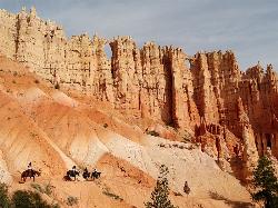
Peek-a-boo Loop
Bryce, Utah
33.7 miles WPeek-a-boo Loop Trail is one of the more strenuous hikes available in Bryce Canyon. The unique challenge this loop provides has beautiful views that are well worth the hike. This three-mile loop can...
Hike 1.8 mi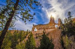
Tower Bridge
Bryce, Utah
33.7 miles WTower Bridge is a unique and uncrowded trail in Bryce Canyon. Tower Bridge gets its name from the prominent rock formation the trail leads to. The rock formation resembles London Bridge and is a...
Hike 1.2 mi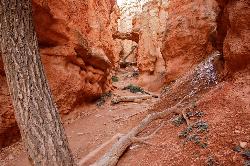
Navajo Trail
Bryce, Utah
33.7 miles WNavajo Trail explores the main amphitheater of Bryce Canyon National park in a short but winding hike. The hike begins at Sunset Point and splits off into a loop. The loop can be taken in either...
Hike 4.1 mi
Swamp Canyon Overlook and Trail
Bryce, Utah
37.0 miles WSwamp Canyon Trail is a wonderful, lesser-explored trail of moderate difficulty. Hikers in this area can expect to see some of Bryce Canyon’s famous rock formations, while also experiencing the...
Hike 20.4 mi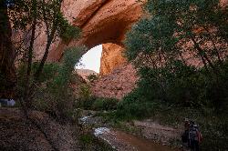
Coyote Gulch
Escalante, Utah
39.2 miles SECoyote Gulch is a natural slot canyon near Escalante, Utah, Bryce Canyon National Park, and Lake Powell State Park. Coyote Gulch is any backpacker's paradise with a flowing river, many places to...
Backpack, Canyoneer, Hike 1.0 mi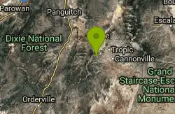
Bristlecone Loop
Kanab, Utah
41.6 miles SWBristlecone Loop is a one-mile trail from Rainbow Point. Rainbow Point is located at the southern end of Bryce Canyon National Park and is the highest point in the park. The spectacular views...
Hike 8.1 mi
Riggs Spring Loop Trail
Kanab, Utah
41.7 miles SWRiggs Spring Loop Trail is the perfect trail for hikers wishing to escape to the wilderness. This is one of the least trafficked trails in Bryce Canyon and one of the most forested. The ponderosa...
HikeNearby Campsites
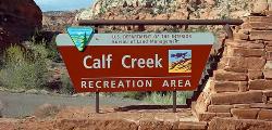
Calf Creek Campground
Boulder, Utah
9.1 miles ECamp, Dive, and Swim near Boulder, Utah
Camp, Dive, Swim
North Campground
Bryce, Utah
33.5 miles WNorth Campground is one of the two main campgrounds in Bryce Canyon National Park. The campground is open to RV and tent campers. Thirteen RV sites available for reservation and 86 RV and tent sites...
Camp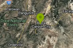
Sunset Campground
Bryce, Utah
34.1 miles WSunset Campground is one of Bryce Canyon's two main campgrounds. It consists of 101 campsites linked together with three loops, loops A B and C. There are 20 tent-only campsites, 80 tent and RV...
Camp


