East Ridge Trail
Oakland, California
| Address: | Redwood Regional Park, 7867 Redwood Rd, Oakland, CA 94619, USA |
| GPS: |
37°48'7.4"N 122°8'40.0"W Maps | Directions |
| State: | California |
| Trail Length: | 5.40 miles |
| Trail Type: | Out & Back |
| Hike Difficulty: | Beginner |
| Trails/Routes: | 3.7 mi |
Waterfalls Trails Wildflowers Pet Friendly
Hike
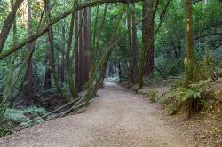
This trail is deeply tucked away up into the hills of Oakland. East Ridge is the perfect trail to deeply appreciate the beauty of the Redwoods and has many entry points. This trail weaves through grassy meadows and over ridges and steep slopes. This trail has shady parts and will lead you to the falls.
This trail on this hike is wide, even and gentle. This hike is accessible to all hikers that want to enjoy it. This trail winds steeply down to the valley floor and after rain, can be very slippery. Hikers that hike at a normal, relaxed pace, can complete this loop in about 2-3 hours. If speed is your thing, trails are equally ideal for trail running.
This hike is accessible all year round. This trail is exposed and can be pretty hot and dusty in the summer. During the rainy seasons, trails can be slippery and muddy after rain. During the winter season, keep your eye out for the massive clusters of ladybugs that migrate to the park’s trees each winter along the park’s coast redwoods.
Dogs must be leashed if you take them on this hike. The main entrance, Redwood Gate, charges a $5 parking fee during peak season. The park is opens at 5am and closes at 10pm. So if you like hiking or running at the crack-of-dawn or would prefer going after work, you can enjoy the trail and facilities.
More Information
Be courteous, informed, and prepared. Read trailhead guidelines, stay on the trail, and don't feed the wildlife.
Read MoreDirections
From Oakland, California
- Head southwest on Broadway toward 14th St (20 ft)
- Turn right onto 14th St (0.4 mi)
- Turn right onto Castro St (0.2 mi)
- Slight left onto the CA-24 ramp to Walnut Creek/San Francisco/Hayward (0.1 mi)
- Merge onto I-980 E (0.5 mi)
- Keep left to continue on CA-24 E (3.5 mi)
- Take the exit onto CA-13 S toward Hayward (4.3 mi)
- Take the Redwood Road exit toward Carson Street (0.1 mi)
- Sharp left onto Redwood Rd (3.5 mi)
- Turn leftDestination will be on the right(0.1 mi)
Take I-80 W and I-680 S to CA-24 W. Take exit 13 from CA-24 W, then continue onto Moraga Road and Canyon Road until you reach Pinehurst Road in Alameda County.
Trails
Distance ?
3.7 milesElevation Gain ?
-452 feetReal Ascent ?
352 feetReal Descent ?
804 feetAvg Grade (-1°)
-2%Grade (-11° to 9°)
-19% to 16%Elevation differences are scaled for emphasis. While the numbers are accurate, the cut-away shown here is not to scale.
Other Hiking Trails Nearby
Grizzly Peak Trail
Berkeley, California
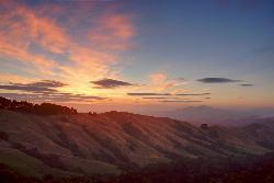
7.6 miles NWGrizzly Peak Trail is located near La Loma Park in the Berkeley Hills section of the city of Berkeley, California and leads to an incredible lookout of the San Francisco Bay area....
Hike, Mountain Bike
Auburn Area
San Francisco, California
15.2 miles WAlongside of the North Fork of the American River in the Auburn State Recreation Area, there are several swimming holes. Located at Emigrant Gap in the Tahoe National Forest, the North...
Hike, Horseback, Kayak, Rock Climb, Swim, Whitewater 0.1-0.6 mi
Mt. Sutro Open Space Reserve
San Francisco, California
17.3 miles WMount Sutro Open Space Reserve is a 61-acre ecological oasis in the heart of San Francisco, just south of UCSF's Parnassus Heights campus. UCSF is committed to maintaining the Reserve as a safe...
Hike, Mountain Bike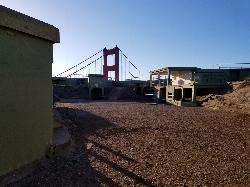
Battery Spencer
Mill Valley, California
18.6 miles WThis is easily one of the best places to view the Golden Gate Bridge. For over half a century, this was one of the most strategically important sites guarding the Golden Gate. Completed in 1897,...
Hike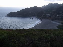
Muir Beach
Muir Beach, California
23.9 miles WMuir Beach is a little gem nestled away in the hills North of San Francisco, not far from the Muir Woods National Monument. There's a great beach and an entire network of trails. To get to the...
Hike, Swim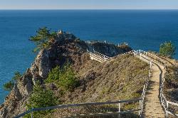
Muir Beach Overlook
Muir Beach, California
24.5 miles WHike near Muir Beach, California
Hike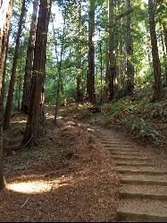
Muir Woods National Monument
Mill Valley, California
24.5 miles WThere are several suggested hikes on the main trail leaving from the visitors center. The longest, a loop, is about 2 miles. It is the only one that leaves the boardwalk. It has some elevation...
Hike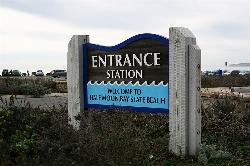
Half Moon Bay State Beach
Half Moon Bay, California
28.5 miles SWHalf Moon Bay State Park's Coastside Trail runs parallel to the Pacific Coast along what used to be the Ocean Shore Railroad. The railroad itself was in operation for just 14 years before it was...
Camp, Hike, Horseback, Swim 4.0 mi
Palomarin Trail
Bolinas, California
34.1 miles WThis hike is about 5 miles north from Bolinas is the Palomarin Trailhead. As you hike the trail you overlook the ocean and beautiful beaches. The trail takes you up to different lakes and then...
Hike 0.1 mi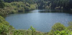
Bass Lake
Bolinas, California
35.4 miles WHike and Swim near Bolinas, California
Hike, Swim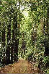
Pescadero Creek Trail Area
Loma Mar, California
37.3 miles SPerfect for all redwood lovers, the Pescadero Creek Park area is an incredible shady trail for a hike on a hot summer day. This is a great place to escape from city sounds and enjoy...
Hike, Horseback, Mountain Bike, Swim
Cosumnes River Preserve
Galt, California
49.9 miles NEThe Cosumnes River Preserve consists of approximately 45,859 acres of wildlife habitat and agricultural lands owned by seven land-owning Partners. The Partners include The Nature Conservancy,...
Canoe, Hike


