


Coxcomb Mountain Bike Trail
Williams, Arizona
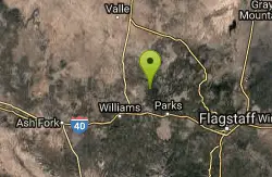
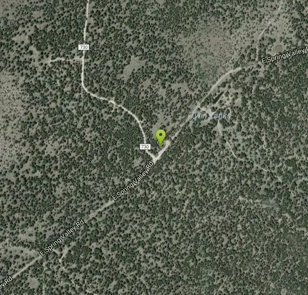
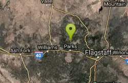
| Address: | ~E Spring Valley Rd, Williams, AZ 86046, USA |
| GPS: |
35°21'56.1"N 112°2'31.1"W Maps | Directions |
| State: | Arizona |
| Trail Length: | 8.00 miles |
| Trail Type: | Loop |
| MTB Trail Type: | Fire Road |
Mountain Bike
The Coxcombs Loop follows a sparsely traveled road that climbs and dips over rolling terrain. The hills are all of moderate length and gradient, and the road surface is fairly smooth. FR 136 bisects the loop and can provide a "shortcut" if you only want to ride part of the trail. A loop from the trailhead via the shortcut is 5.9 miles for the southern route and 7.7 miles for the northern one. source: fs.usda.gov Courtesy of Singletracks.com
More Information
Never modify trail features. Ride trails when they're dry enough that you won't leave ruts. Speak up when you see others on the trail and always yield to hikers, horses, and others coming uphill. Always ride on the established trail.Read More
- Plan Ahead and Prepare
- Travel & camp on durable surfaces
- Dispose of waste properly
- Leave what you find
- Minimize campfire impacts
- Respect wildlife
- Be considerate of other visitors
Directions
From Williams, Arizona
- Head east on Grand Canyon Ave/Historic Rte 66/W Railroad Ave toward S 4th StContinue to follow Historic Rte 66(2.5 mi)
- Continue onto AZ-64 N (5.5 mi)
- Turn right onto E Spring Valley Rd (3.6 mi)
- Turn left to stay on E Spring Valley RdDestination will be on the left(4.4 mi)
Other Mountain Bike Trails Nearby
Spring Valley Loop
Williams, Arizona
5.6 miles EThe Spring Valley Loop offers a ride on remote roads and trails with good views and abundant wildlife. Since the route serves as a cross country ski trail in winter, it offers the fat...
Mountain Bike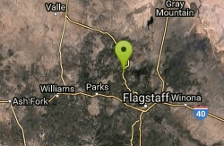
Barn Burner Course
Flagstaff, Arizona
14.2 miles ENice fast smooth trail with some good climbing and a few technical sections.
Mountain Bike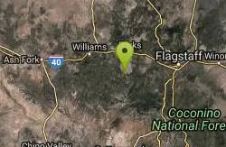
Sycamore Rim Trail
Parks, Arizona
14.9 miles SMost people come to this ride for the view of Sycamore Canyon at the overlook, but the scenery along the way is worth the trip, too. The ride starts out in a ponderosa pine forest where...
Mountain Bike
Sunflower Flat
Williams, Arizona
16.1 miles SThis ride is actually two rides in one. The first follows a secondary road through flat open forest country with a short detour to one of the best views on the forest. The second traces...
Mountain Bike
Devil Dog Loop #117
Williams, Arizona
16.9 miles SWThe Devil Dog Loop starts out on FR 108 and turns almost immediately onto the unpaved 1922 alignment of Route 66 (now FR 45). At 0.7 miles into the ride, FR 45 branches off to the south...
Mountain Bike
Arizona Trail: Flagstaff
Flagstaff, Arizona
19.8 miles ELeaving the back of Buffalo Park, stay right on the MT Elden Trail System. Any combination of this network of trails will get you over to the east side where you pick up the AZT and follow that to...
Mountain Bike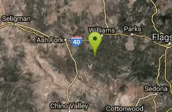
Stage Station Loop
Williams, Arizona
20.7 miles SWThis is a pleasant ride over rolling terrain along a primitive road that winds through ponderosa pine forests, pinyon and juniper stands and open grasslands. The scenery consists of...
Mountain Bike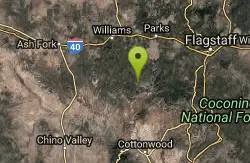
Round Mountain Loop
Williams, Arizona
21.4 miles SThis ride follows a little used forest road that passes through virtually every type of ponderosa pine habitat that one could find on the south Kaibab. The scenery here is diverse....
Mountain Bike
Fort Valley Trail System
Flagstaff, Arizona
21.5 miles ELocated at the base of the San Francisco Peaks, the Fort Valley Trail System was designed primarily for connecting popular mountain biking trails. This system is a multi-use trail to be...
Mountain Bike
Flagstaff Loop Trail
Flagstaff, Arizona
22.8 miles SEThe trail forms a 42 mile loop around the city of Flagstaff. It is nearly completed and consists of various existing trails, forest roads, and newly constructed ST. It is divided into...
Mountain Bike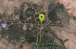
Schultz Creek
Flagstaff, Arizona
23.2 miles EGreat trail, once you get there. I bit of just a bit too much for my self . 25 miles to be exact. It's a network of trails to get there but once you do the actual Shultztrail is about 6-8 miles...
Mountain Bike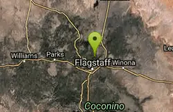
Supermoto
Flagstaff, Arizona
23.6 miles ETech rocky trail thru the pines. One of the best in the area, fun and shady. Return (back) is usually ridden on Schlutz Pass Rd making an 8 mile loop.
Mountain Bike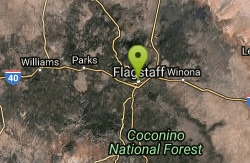
Observatory Mesa
Flagstaff, Arizona
24.4 miles SENovice ridingBeginner skill levelRide between apr-novLots of options. Refer to cosmic rays fat tire guide for more info2-20 miles
Mountain Bike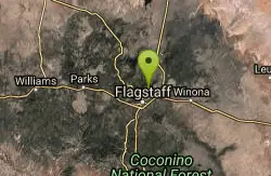
Upper Brookbank Loop
Flagstaff, Arizona
24.7 miles ERide up Schultz trail to the log gate. Turn right up the old double track and follow that until you come to the edge of a large meadow. Single track breaks off left across the meadow....
Mountain Bike
Soldiers Loop / Fairgrounds trails
Flagstaff, Arizona
25.1 miles SESoldiers Loop makes a loop around the park with moderate ups and downs and not really any tech to worry about. Bridge Trail cuts through the center of the loop and has more more tech...
Mountain Bike
Oldham Trail
Flagstaff, Arizona
25.2 miles SEThere is a sigletrack here down though the towering trees. Follow this to a network of trails. Then look for the Oldham tr sign and head up hill. Climb all the way up to the fire road...
Mountain Bike
Fisher Point Trail
Flagstaff, Arizona
26.9 miles SEThe trail run approximately 3 miles from Pine Canyon housing development to Fisher Point. It is mostly downhill to Fisher Point. It is predominately doubletrack with some singletrack...
Mountain Bike
Arizona Trail: Marshall Lake to Fisher Point
Flagstaff, Arizona
27.7 miles EPlentiful wildlife and great views of the San Francisco Peaks provide the major features of interest on this section of the state-spanning Arizona Trail. For the best views, begin at...
Mountain Bike
Arizona Trail: South of Grand Canyon NP
Flagstaff, Arizona
28.7 miles NEThe Arizona Trail runs about 24 miles one-way south of Grand Canyon National Park through Kaibab National Forest.
Mountain Bike
Fisher Point Overlook Trail
Flagstaff, Arizona
29.1 miles SEThis trail is composed of a lot of technical ST and a short stretch of DT. It is a mix of intermediate, advanced and expert levels of difficulties. The trail is very well marked once...
Mountain BikeNearby Campsites

Cave Springs
Sedona, Arizona
30.7 miles SECave Springs Campground is a scenic campground that sits in Oak Creek Canyon. Cave Springs is nestled perfectly in the town of Sedona, giving the campground the notorious Sedona red views. Uniquely,...
Camp, Hike, Swim
Chavez Crossing
Sedona, Arizona
39.1 miles SChavez Crossing is a campground in Sedona, Arizona. It sits perfectly nestled in Arizona's most beautiful red rock attractions along with the grand summer sunsets. If that didn't sound...
Camp, Hike, Swim
Grand Canyon South Rim Area Campgrounds
Grand Canyon Village, Arizona
42.1 miles NCamp
Tonto Trail: New Hance Trail to Grandview Point
Grand Canyon Village, Arizona
43.1 miles NBackpack, Camp, Hike
Tonto Trail from Grandview Point to South Kaibab Trailhead
Grand Canyon Village, Arizona
43.8 miles NA rigorous point-to-point backpack of four to five days; recommended for experienced Grand Canyon backpackers only. Long stretches of this scenic, lonely segment of the Tonto Trail are...
Backpack, Camp, Hike
Grandview Trail Loop
Grand Canyon Village, Arizona
43.8 miles NThis is definitely not a mountain biking trail! I am a resident of Grand Canyon and know for sure. Also use of Mtn bikes on canyon trails is illegal in the Park....
Backpack, Camp, Cross-country Ski, Hike 9.1 mi
New Hance Trail
Grand Canyon Village, Arizona
44.6 miles NNew Hance Trail is a colorful hike through Red Canyon to the Colorado River. This trail is considered one of the more difficult trails in the Grand Canyon and is a challenge only prepared hikers...
Backpack, Camp, Hike
Tanner Trail
Grand Canyon Village, Arizona
47.3 miles NA rigorous rim-to-river backpack of three or more days, following one of the South Rim's more difficult trails. The unmaintained trail, recommended only for seasoned hikers, is...
Backpack, Camp, Hike 0.6 mi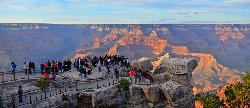
Mather Campground Trail
Grand Canyon Village, Arizona
47.4 miles NLocated on the South Rim of the Grand Canyon, Mather Campground Trail is a brief one mile out and back connector trail which is great for hiking, mountain biking, walking, and trail running. The...
Camp, Hike, Mountain Bike
South Kaibab to North Kaibab to Bright Angel Trail
Grand Canyon Village, Arizona
47.5 miles NGenerally an early morning start and a late finish with an amazing sunrise on the way down the South Kaibab and depending on your speed, a beautiful sunset as you hike back toward (or up) Bright...
Backpack, Camp, Hike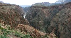
Clear Creek Trail
Grand Canyon Village, Arizona
47.5 miles NAn extended backpack trip of four to six days deep within the Grand Canyon. NOTE: The starting point for Clear Creek Trail, Bright Angel Campground, is in a remote location away from a trailhead. The...
Backpack, Camp, Hike 13.6 mi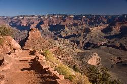
South Kaibab Trails
Grand Canyon Village, Arizona
47.6 miles NSouth Kaibab Trail is a 7 mile point-to-point trail located near Grand Canyon, Arizona that features a river and is rated as difficult. The trail is primarily used for hiking & walking and is...
Camp, Hike, Horseback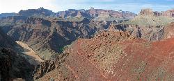
South Kaibab to Phantom Ranch to Bright Angel Trail
Grand Canyon Village, Arizona
47.6 miles NOne of the most popular hikes in Grand Canyon National Park is the South Kaibab to Phantom Ranch to Bright Angel Trail. Marked as difficult, the trail is well maintained and labeled. This Grand...
Backpack, Camp, Hike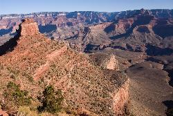
The Grand Canyon: Kaibab to Bright Angel Trail
Grand Canyon Village, Arizona
47.6 miles NExperience the Grand Canyon like few others with this unforgettable 2-3 day trip down into the canyon. If you are looking for the perfect hike in the Grand Canyon, this is it. The 2 (or 3) day hike...
Backpack, Camp, Hike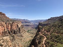
Bright Angel Trail to Three-Mile Rest house
Grand Canyon Village, Arizona
48.1 miles NThe popular out-and-back Bright Angel Trail to Three-Mile Resthouse is 5.4 miles out in distance. The trail includes many steep switchbacks and 360 degrees of absolutely stunning views of the inside...
Backpack, Camp, Hike 4.9 mi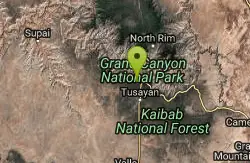
Bright Angel Trail to Tonto Trail
Grand Canyon Village, Arizona
48.1 miles N"[T]he Tonto Trail offers a degree of civility not found elsewhere along the trail, and it is here that most hikers get their first exposure to the unique nature of this singular transcanyon...
Backpack, Camp, Hike 4.5 mi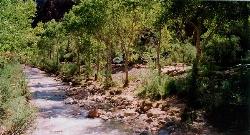
Bright Angel Trail to Bright Angel Campground and River Trail
Grand Canyon Village, Arizona
48.1 miles NBright Angel Trail to Bright Angel Campground and River dirt trail is one of the most famous trails near Grand Canyon, Arizona. The well-maintained trail encompasses incredible views and has an...
Backpack, Camp, Hike, Rock Climb 1.4-9.8 mi
The Bright Angel Trails
Grand Canyon Village, Arizona
48.2 miles NPrepare yourself for switchbacks as part of a tough elevation gain on the Bright Angel trail to Plateau Point trail. This trail features spectacular views as you hike along the edge of...
Backpack, Camp, Hike, Horseback
Boucher Trail to Hermit Trail Loop
Grand Canyon Village, Arizona
49.0 miles NA demanding loop trip of three to four days, tracing one of the most difficult South Rim trails. Even seasoned Grand Canyon backpackers consider the Boucher Trail to be the most difficult, hazardous,...
Backpack, Camp, Hike
Hermit's Rest Viewpoint to Tonto Trail to Bright Angel Trail
Grand Canyon Village, Arizona
49.0 miles NHermit’s Rest Viewpoint to Tonto Trail to Bright Angel Trailhead is perfect for hiking, backpacking, walking, and trail running. The Trail takes you across a well-established portion of the...
Backpack, Camp, Hike


