


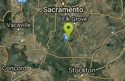
Cosumnes River Preserve
Galt, California
Canoe and Hike
The Cosumnes River Preserve consists of approximately 45,859 acres of wildlife habitat and agricultural lands owned by seven land-owning Partners. The Partners include The Nature Conservancy, Bureau of Land Management, California Department of Fish & Game, Sacramento County, Department of Water Resources, Ducks Unlimited, and the California State Lands Commission. The Preserve is centered along the Cosumnes River, its floodplains and riparian habitat. This habitat is buffered by a variety of agricultural operations. The Preserve provides numerous social, economic, and recreational benefits to local communities and to people residing in the larger Sacramento and San Joaquin areas. The habitat supports wildlife, including birds that migrate throughout the Pacific Flyway.
More Information
Be courteous, informed, and prepared. Read trailhead guidelines, stay on the trail, and don't feed the wildlife.
Read More- Plan Ahead and Prepare
- Travel & camp on durable surfaces
- Dispose of waste properly
- Leave what you find
- Minimize campfire impacts
- Respect wildlife
- Be considerate of other visitors
Directions
From Galt, California
- Head east on A St toward Market St (0.3 mi)
- Continue onto Crystal Way (0.1 mi)
- Turn left onto the Inter State 99 ramp (0.2 mi)
- Merge onto CA-99 N (2.2 mi)
- Take exit 277 toward Twin Cities Rd/Jackson/Lone/CA-104/Sacramento E13 (394 ft)
- Merge onto Stockton Blvd (signs for Ione/Jackson/CA-104/Twin Cities Road/County Road E13) (0.1 mi)
- At the traffic circle, take the 3rd exit onto CA-104 W (0.1 mi)
- At the traffic circle, continue straight onto Twin Cities Rd (7.0 mi)
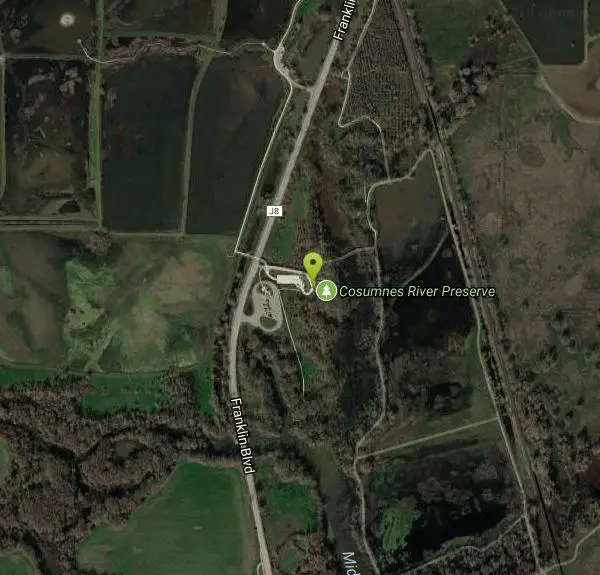
- Turn left onto Franklin Blvd (1.7 mi)
The Cosumnes River Preserve is located off Interstate 5 between Sacramento and Stockton.
From I-5 (Sacramento Area-North):
Take Interstate 5 south to the Twin Cities Road exit (marked with a binoculars sign for wildlife viewing) about midway between Stockton and Sacramento. Take Twin Cities Road exit and go East for exactly one mile, to the first stop sign. Turn right at the first stop sign, onto Franklin Boulevard, for 1.7 miles. The Visitor Center is located on the left side of Franklin Boulevard. Continue down Franklin Boulevard and park in the parking lot just past the Visitor Center.
Other Hiking Trails and Canoeing Areas Nearby
New Hogan Lake
Valley Springs, California
34.6 miles EBackpack, Camp, Hike, and Swim near Valley Springs, California
Backpack, Camp, Hike, Swim 1.2-2.7 mi
Lake Clementine Trail Loop
Auburn, California
49.9 miles NELocated in Auburn, California, Lake Clementine Trail Loop is a hike along the North Fork American River is an easy to moderate trail with an elevation gain of 785 ft. It's wheelchair...
Camp, Canoe, Hike, Kayak, Mountain Bike, SwimNearby Campsites
New Hogan Lake
Valley Springs, California
34.6 miles EBackpack, Camp, Hike, and Swim near Valley Springs, California
Backpack, Camp, Hike, Swim 1.2-2.7 mi
Lake Clementine Trail Loop
Auburn, California
49.9 miles NELocated in Auburn, California, Lake Clementine Trail Loop is a hike along the North Fork American River is an easy to moderate trail with an elevation gain of 785 ft. It's wheelchair...
Camp, Canoe, Hike, Kayak, Mountain Bike, Swim


