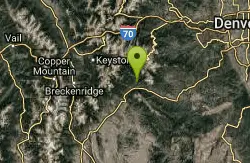
Colorado Trail: Waterton To South Platte
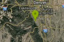
Littleton, Colorado

| Address: | ~11338 Waterton Rd, Littleton, CO 80125, USA |
| GPS: |
39°29'28.9"N 105°5'35.6"W Maps | Directions |
| State: | Colorado |
| Trail Length: | 34.00 miles |
| MTB Difficulty: | Advanced |
| Trail Type: | Out & Back |
| MTB Trail Type: | Singletrack |
Mountain Bike
*Note: Waterton Canyon will be closed for for two extended periods in 2010 and 2011: 8/2/2010 - 12/3/2010 and 2/28/2011 - 12/31/2011. Alternate access to the first section of the Colorado Trail will be from the west leg of the Indian Creek loop. (from comba.org)This section of the CT is undoubtedly the most travelled section both for hikers and mountain bikers. It is about 17 miles from the Waterton parking lot to the parking lot at South Platte. The first 6 miles up Waterton Canyon is especially crowded, and is likely to be filled with children and weaving pedestrians. Once you get to the Strontia dam, the trail begins it's upward journey for the next couple of miles up to the "sitting bench." If you turn left you will be on the Roxborough Loop, and if you continue on past the bench (downhill) you will be on the Colorado Trail. Only 460 miles to Durango!The singletrack is pretty sweet on this part of the trail, although this first descent is almost the only downhill you will do for about the next 8 miles! You will encounter some pleasant forest covered trail, as well as some very rocky and technical uphill sections that are easier to walk than to ride. On long distance rides you are better off walking some places rather than exert too much energy. You have to save something for the trip back! Remember that as you plow into these steep hills...Once over a couple of these rocky sections, you will head into the open-to-motorcycles section of the trail, and the rocks get bigger and the trail gets even harder. You WILL be walking parts of the trail here. Again, this is mostly uphill...although it does eventually level out somewhat. Overall, the grades are pretty easy on this trail and it is mostly ridable once you pass the motorcycle area. Then begins a long steady climb with rolling hills and great views as you head west towards South Platte.At about mile 13 you will find yourself on the top of a rocky outcropping looking down on the river to the west. This is the beginning of the last descent. This one is MAJOR. If you want an easy day, turn around here and head back to Waterton. No one will think any less of you. However, if you are up for a challenge, you can complete this section of the CO Trail by heading down what is nearly a 4 mile descent straight down. Great fun as the trail is well maintained, and the switchbacks are all pretty ridable. Your hands will burn from using the breaks and holding on for dear life as you blaze down this trail and finally emerge at the river. As you turn around, you will be shocked at how far you dropped! Congratulations, you have just completed section 1 of the Colorado Trail!It is best to carry a water filter, as you might find yourself on the edge of your water allowance on the return trip. This is important as now you are looking at a 4 mile climb to get out of the valley and get back to Waterton! After a rest, you can begin the ascent and hopefully survive the climb without too much walking (some of the switchbacks are a bit tricky when going uphill). Note the joy on the faces of those downhillers speeding by you, and remember a happier time when that was you! Honestly, the grade is not terrible and although long, most of this ascent is not that bad. If you do OK on Mt. Falcon or Deer Creek, you will probably have no trouble here. Now, once you knock out that climb, you are looking at a great ride back towards Waterton. For the first several miles you have rolling singletrack that is a pure joy to coast down. I would estimate that for about 5 miles the trail is rolling singletrack, until it eventually goes back into the motorcycle area. Going down is much easier, despite the large rocks in the trail. You will also be able to go down the steeper hills at the end of this stretch if you don't mind loose, steep, rocky trail. At the very end, you will have one last ascent that can be a bit of a burner after all you've been through to this point (about 25 miles of trail behind you). When done, you will be back up to the resting bench...at which point it is all downhill and dirt road back to Waterton parking lot. Total mileage should be around 34 miles to do the out and back. Courtesy of Singletracks.com
More Information
Never modify trail features. Ride trails when they're dry enough that you won't leave ruts. Speak up when you see others on the trail and always yield to hikers, horses, and others coming uphill. Always ride on the established trail.Read More
- Plan Ahead and Prepare
- Travel & camp on durable surfaces
- Dispose of waste properly
- Leave what you find
- Minimize campfire impacts
- Respect wildlife
- Be considerate of other visitors
Directions
From Littleton, Colorado
- Head south (33 ft)
- Turn left toward S Prince St (115 ft)
- Turn right at the 1st cross street onto S Prince St (0.2 mi)
- Turn right onto Church Ave (0.3 mi)
- Turn left onto S Santa Fe Dr (3.2 mi)
- Slight right to merge onto CO-470 W (2.7 mi)
- Take the CO-121 S exit (0.3 mi)
- Turn left onto CO-121 S/S Wadsworth Blvd (4.4 mi)
- Turn left onto Waterton Rd (0.3 mi)
- Turn leftDestination will be on the right(259 ft)

Other Mountain Bike Trails Nearby
Indian Creek Loop
Littleton, Colorado
0.0 miles WThe first and last 6 miles of this trail are on the gravel road that goes through Waterton Canyon, meaning your total off-road trail distance will be about 17 miles (29 miles total)....
Mountain Bike
Colorado Trail
Littleton, Colorado
0.2 miles SWAmazing singletrack, killer views, and lung busting elevation - what more could you ask for? Portions of the Colorado Trail are off limits to bikes so you'll need to detour around each...
Mountain Bike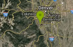
Dirt Jumps
Littleton, Colorado
5.1 miles Nthese jumps are under the first set of tress you'll see. There are some good jumps in there i wouldn't make the trip if you live farther then 5 miles.
Mountain Bike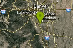
Plum Creek Park
Littleton, Colorado
5.5 miles NEThis is the shortest single track ever but it is a good trail for beginners and practice for the big stuff. It is a little sandy and slightly downhill. There ar5e a few small turns but...
Mountain Bike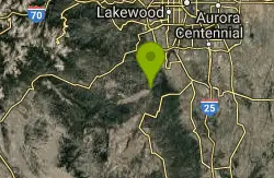
North Fork
Littleton, Colorado
7.1 miles SWThis is a new machine-made singletrack, that largely runs on the side of mtn's. Can be done either as out/back, with folks usually starting at the bottom next to the South Platte...
Mountain Bike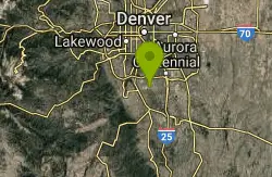
Highlands Point
Highlands Ranch, Colorado
7.2 miles EThe section of trails at Highlands Point can be accessed from Mountain Vista High School or via the East-West Regional trail parking lot on Griggs rd. Note that all but two of these...
Mountain Bike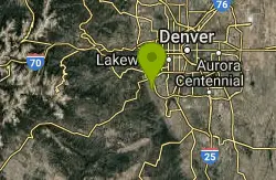
Ken Caryl Valley
Littleton, Colorado
7.9 miles NWSingle Track linked togather with a couple short road segments
Mountain Bike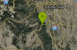
Devil's Head Stretch
Sedalia, Colorado
8.0 miles SDevil's Head Stretch is a multi-use trail that is full of moto-carved rollers, berms, dips, chutes, and off-shoots. It is densely populated with dirt-bikes on the weekends.This trail...
Mountain Bike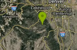
Colorado Trail: South Platte To Buffalo Creek
Conifer, Colorado
8.0 miles WThe initial climb out of the parking lot is by far the hardest part of this section of the Colorado Trail. Within the past several years, a re-routed portion of trail was created and...
Mountain Bike
East-West Regional Trail
Littleton, Colorado
9.8 miles E-- "This is the first leg of the East-West Regional Trail that will connect Chatfield State Park with the Town of Parker. The trail winds through grasslands and oak bluffs including...
Mountain Bike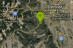
Meyer Ranch Park
Morrison, Colorado
10.3 miles WThere's nothing special about this ride, but a good little spot to ride a couple of miles if you're coming back from the mountains and have had quite enough for the day. This is a...
Mountain Bike
Bluffs Regional Park Trail
Lone Tree, Colorado
11.3 miles EThis is a multi-use trail made of crushed gravel. There are no technical features at all, but it is good for a lunchtime lap or for a couple of laps after work. It's also good for...
Mountain Bike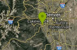
Bear Creek Lake Park
Lakewood, Colorado
11.9 miles NThis is a good trail system to ride when the foothills and mountains are covered in snow. Located just to the south of Green Mountain, it provides a close-in alternative for riders to...
Mountain Bike
Glendale Open Space Trail
Castle Rock, Colorado
11.9 miles EAdjacent to I-25, the 160-acre property has native chokecherry and wild plum shrubs along an intermittent stream. The trail winds up into Gambel oak shrubland and onto a grassland plain...
Mountain Bike
5-Parks
Morrison, Colorado
12.2 miles NWLink up of several parks above Morrison.
Mountain Bike
Mount Falcon Park
Morrison, Colorado
12.6 miles NWThe ride is actually a 'lollipop' configuration with an out and back attached to a loop at the top. Ride up the Castle trail where you'll climb about 1800 feet in 3.5 miles. Once you...
Mountain Bike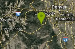
Flying J Ranch
Conifer, Colorado
12.8 miles WSuper easy singletrack with a couple of very short challenging sections. Very possibly the best beginner's trail on the Front Range and just a lovely little park. Going clockwise on...
Mountain Bike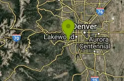
Green Mountain
Lakewood, Colorado
13.1 miles NThis park has three parking areas. The loop is the same from all. From any trailhead, begin a clockwise loop in the park. On the south-east sides of the park, this loop maintains fairly...
Mountain Bike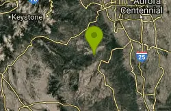
Colorado Trail: Green Mountain
Pine, Colorado
13.4 miles SWThis is the trail Leah and I have been looking for since we moved to Colorado. Sweet, smooth singletrack, beautiful scenery, and a good mix of climbs and descents. This is easily my...
Mountain Bike
Chair Rocks
Pine, Colorado
13.4 miles SWThe first five and a half miles of this route follow the Colorado Trail. Find the signs that show you to the trail and head north for about a mile where the trail crosses the road...
Mountain Bike