


Climbworks El Regis
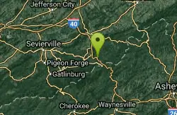
Gatlinburg, Tennessee
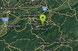
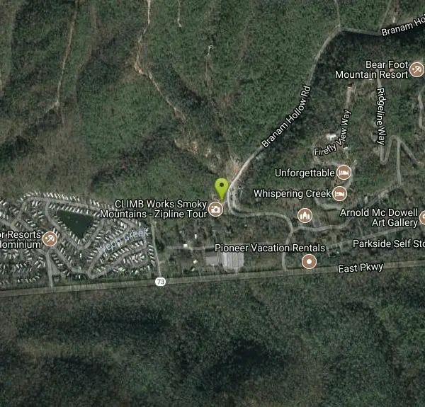
| Address: | ~155 Branam Hollow Rd, Gatlinburg, TN 37738, USA |
| GPS: |
35°45'48.5"N 83°19'34.6"W Maps | Directions |
| State: | Tennessee |
| Trail Length: | 2.00 miles |
| Trail Type: | Loop |
| MTB Trail Type: | Singletrack |
Mountain Bike
Private flow trail with large signature wood feature. Bike rentals available, cost is $25 for a three hour ride (bike rental not included.) Courtesy of Singletracks.com
More Information
Add ResourceNever modify trail features. Ride trails when they're dry enough that you won't leave ruts. Speak up when you see others on the trail and always yield to hikers, horses, and others coming uphill. Always ride on the established trail.
Read More- Plan Ahead and Prepare
- Travel & camp on durable surfaces
- Dispose of waste properly
- Leave what you find
- Minimize campfire impacts
- Respect wildlife
- Be considerate of other visitors
Directions
From Gatlinburg, Tennessee
- Head northeast toward East Pkwy (135 ft)
- Slight left onto US-321 N/East Pkwy (12.2 mi)
- Turn left onto Branam Hollow RdDestination will be on the left(0.2 mi)
Other Mountain Bike Trails Nearby
Firetower/haws Top
Hartford, Tennessee
11.0 miles EIt is up and down hill. The trail can be combined with rides on Hall's Top road, or one can single track off the mountain by going by the firetower, the path back to the cemetery....
Mountain Bike
Deep Creek Trail
Bryson City, North Carolina
21.5 miles SThe trail appears to be an old forest service road or an old logging road. There are two out and back trails. Deep Creek and Indian Creek Falls. Deep Creek is about 2 miles one way....
Mountain Bike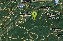
Cades Cove
Townsend, Tennessee
26.1 miles WTake some of the gravel roads on the right for adventures but turn around or you'll end up sssomewhere else besids the parking lot. If you wimp out take either of the two gravel roads...
Mountain Bike
Tsali Right Loop
Almond, North Carolina
28.6 miles SWThe Right Loop is by far my favorite Tsali trail. Start at the trailhed parking lot and follow the signs for the LEFT LOOP (that's right). After about 0.3 miles, turn right onto the...
Mountain Bike
Tsali Recreation Area
Almond, North Carolina
28.6 miles SWTsali features four singletrack loops that hug the banks of Fontana Lake. The trails are super fast and flowy singletrack with mostly moderate climbs and amazing scenery.Daily usage...
Mountain Bike
Tsali Thompson Loop
Almond, North Carolina
28.7 miles SWThompson Loop, like Mouse Branch Loop, is more technical than the Right and Left loops at Tsali. Thompson has a lot of tight twisting singletrack and like all the trails at Tsali is...
Mountain Bike
Tsali Mouse Branch Loop
Almond, North Carolina
28.7 miles SWFrom the main parking area, Mouse starts with doubletrack. Head out the main road and continue in a clockwise direction. Many riders consider Mouse the most technical of the Tsali trails, but...
Mountain Bike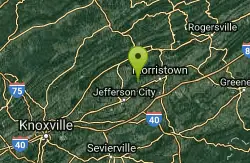
Panther Creek State Park
Morristown, Tennessee
30.8 miles NWe have some friends from Virginia that moved here. They were looking for some Singletrack riding. We read that PantherCreek had some trails. We took off on our 45 min. ride not...
Mountain Bike
AC/DC/MCR
Knoxville, Tennessee
31.7 miles WI would say to use a gps enabled phone, bring a map, or ride with someone who is familiar, or just do it!! AC/DC starts from W side of Chain Ring, at a huge berm, can't miss it.(two...
Mountain Bike
Groundhog
Knoxville, Tennessee
31.9 miles WThis is one of the entrance/exits from Forks of the River Wildlife Management Area. Alternate entry/exit from park to the S. From rd it's a very steep first 1/4 mile rocky climb in and...
Mountain Bike
Chain Ring/Creek
Knoxville, Tennessee
31.9 miles WLoop around area. Everything from easy double track to, steep rocky climbs. In South East corner, there's a nice gravel stream crossing to a small loop (Creek side) with a nice hill....
Mountain Bike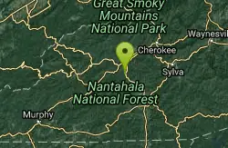
Swinging Bridge
Bryson City, North Carolina
32.0 miles SThis is a relatively flat ride with one huge hill near the end. From Brush Creek Church, ride Lower Needmore to the swinging bridge on the right (about one mile from the church)....
Mountain Bike
Lost Chromosome
Knoxville, Tennessee
32.3 miles WLost Chromosome is the S leg of the South Loop, and the entry to Helix area, at about the half way point. Starting from school it's an easy trail, well marked, and finishes with a few...
Mountain Bike
Anderson School/Helix
Knoxville, Tennessee
32.4 miles WHeading down Lost Chromosome (part of the Urban wilderness S Loop) you get to signs for Chain Ring. L.C. continues down hill to the Fork of the river area. Chain ring is the perimeter...
Mountain Bike
WCU Trails
Cullowhee, North Carolina
32.4 miles STrail is intermediate in difficulty with steep mountainside terrain. Although the elevation change from the trail's highest to lowest point is only a few hundred feet, there are lots of...
Mountain Bike
Forks Of The River
Knoxville, Tennessee
32.5 miles NWThe 350 acre Forks of the River (formerly, Eastern State) Wildlife Management Area is nestled on the south shore of the Tennessee River. The area is only a few hundred acres and...
Mountain Bike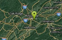
William Hastie Natural Area
Knoxville, Tennessee
32.9 miles WThe William Hastie Natural Area is a small park featuring a little bit of everything. The Sink Hole trail offers some more "techy" stuff with bridges, rocks, and mud. The View Park...
Mountain Bike
Ijams Nature Centre
Knoxville, Tennessee
32.9 miles NWIjams Nature Center was an old rock quarry in Knoxvvile converted to a nature conservatory with some pretty awesome hiking and biking tails. Here you'll find singletracks on Hickory and...
Mountain Bike
Victor Ashe/Marie Myers park
Knoxville, Tennessee
33.2 miles WPart of the Urban Wilderness South loop, trail connects from Quarries to William Hastie. Good single track with significant elevation changes.
Mountain Bike
Urban Wilderness South Loop
Knoxville, Tennessee
33.2 miles WSouth loop is a cobbled together circuit connected to and by all the area riding venues. Start at any point you wish and go either way, and you'll wind up where you started as long as...
Mountain BikeNearby Campsites
Cosby Campground
Cosby, Tennessee
6.6 miles ECamp and Swim near Cosby, Tennessee
Camp, Swim
Mt. LeConte Lodge
Sylva, North Carolina
26.0 miles SHigh atop Mt. LeConte in the Great Smoky Mountains National Park, LeConte Lodge® is the highest guest lodge in the eastern United States. It is situated on an open glade just below the summit of...
Camp, Hike, Horseback, Rock Climb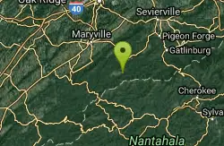
Cades Cove Campground
Townsend, Tennessee
27.7 miles SWOver 2 million visitors annually come to enjoy the scenic beauty of Cades Cove and its many historic structures. Popular activities here include hiking, biking, touring the 11-mile Cades Cove loop...
Camp
Rocky Bluff
Hot Springs, North Carolina
27.7 miles EPlay in water in creek, shallow at times.
Camp, Hike, Swim
Old Forge Campground
Bethany, Tennessee
42.5 miles NEOld Forge Campground and Recreation Area is a small campsite perfect for campers looking for a primitive experience. Old Forge is located on the beautiful Jennings Creek in the Cherokee National...
Camp, Hike, Swim
Horse Creek Campground
Chuckey, Tennessee
44.3 miles NEHorse Creek Campground is a popular day use and camping location in the Horse Creek Recreation Area. This beautiful spot in the Cherokee National Forest is a great location to connect with nature...
Camp, Swim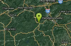
Davidson River Campground
Pisgah Forest, North Carolina
47.6 miles SEDavidson River Recreation Area offers camping and outdoor activities for the whole family. The campground boasts several loops of shaded campsites, as well as access to hiking trails, fishing spots,...
Camp, Hike, Swim


