


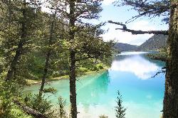
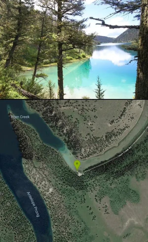
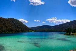
Cliff Lake
Cameron, Montana
| Address: | 592 Cliff Lake Rd, Cameron, MT 59720, USA |
| GPS: |
44°45'47.7"N 111°32'14.1"W Maps | Directions |
| State: | Montana |
Canoe and Kayak
More Information
- Plan Ahead and Prepare
- Travel & camp on durable surfaces
- Dispose of waste properly
- Leave what you find
- Minimize campfire impacts
- Respect wildlife
- Be considerate of other visitors
Directions
From Cameron, Montana
- Head south on US-287 S toward Lonesome Dove (28.2 mi)
- Turn right onto US Frst Service Rd 8381 (3.4 mi)
- Continue straight to stay on US Frst Service Rd 8381 (2.3 mi)
- Turn right at USFS Rd 8381 (72 ft)
- Turn right onto Horn Creek Rd (1.1 mi)

Other Canoeing Areas and Kayaking Areas Nearby
Wade Lake
Cameron, Montana
3.4 miles NWCamp, Canoe, Kayak, and Swim near Cameron, Montana
Camp, Canoe, Kayak, Swim
Upper Coffee Pot Campground
Island Park, Idaho
20.6 miles SEUpper Coffeepot Campground stretches along a floatable section of Henry's Fork of the Snake River. A mixed growth lodgepole pine forest provides partial shade and summer wildflowers are...
Camp, Canoe 0.9 mi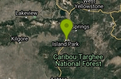
Buffalo River Campground
Island Park, Idaho
24.7 miles SThe float here is nice and easy. It's a great early season float. Later in the season the shallow spots will force you to walk a good chunk of the float. The water is super clear and often pretty...
Camp, Canoe, Kayak, Swim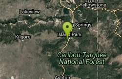
Box Canyon Island Park
Island Park, Idaho
25.0 miles SThe Box Canyon Campground is situated on the canyon rim above the Henry's Fork of the Snake River. There are 16 single and 2 double units, each having tent and camper pads, fire rings, grills...
Canoe
Mesa Falls
Ashton, Idaho
41.1 miles SUpper Mesa Falls, aka Big Falls, is an absolutely awesome waterfall on the Henrys Fork of the Snake River. The falls drop 114 ft. and measure 300 ft. across. To get to the falls from the parking lot...
Cross-country Ski, Hike, Kayak 17.5 mi
Tear Drop Lake
Ashton, Idaho
42.4 miles SENestled in the Targhee National Forest just off of Ashton's Fish Creek Road, this tear drop shaped lake is a family adventure waiting to happen. The lake isn't very big but it is teeming with...
Camp, Canoe, Hike, Kayak, Mountain Bike, Swim 1.5-3.8 mi
Little Gibbon Falls
Norris, Yellowstone National Park
44.8 miles EIce Lake and Little Gibbon Falls Loop is a 4.5 mile loop trail located near Yellowstone National Park, Wyoming. The trail is good for all skill levels and primarily used for hiking, but there are...
Camp, Canoe, Hike
Horseshoe Lake
Ashton, Idaho
46.8 miles SEHorseshoe Lake is hidden back in the Targhee National Forest. It's a beautiful lake with plenty of lily pads. The road to get there is well maintained and there are many options for pull-outs...
Camp, Canoe, Dive, SwimNearby Campsites
Wade Lake
Cameron, Montana
3.4 miles NWCamp, Canoe, Kayak, and Swim near Cameron, Montana
Camp, Canoe, Kayak, Swim
Upper Coffee Pot Campground
Island Park, Idaho
20.6 miles SEUpper Coffeepot Campground stretches along a floatable section of Henry's Fork of the Snake River. A mixed growth lodgepole pine forest provides partial shade and summer wildflowers are...
Camp, Canoe
Big Springs
Island Park, Idaho
23.0 miles SEThere's also a great little walking trail along the river with placards that tell about the ecosystem and history of the area. There's about a 1/2 mile that's paved and then a 1/2 mile...
Camp, Hike 4.8 mi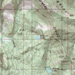
Aldous Lake and Hancock Lake
Kilgore, Idaho
23.2 miles SWA pair of alpine lakes near Kilgore, Idaho. Good road all the way to the trailhead. Easy to moderate 1.5mi hike to the first lake (Aldous) and another mile of moderate hiking to Hancock. Beautiful...
Backpack, Camp, Hike, Horseback, Swim 0.9 mi
Buffalo River Campground
Island Park, Idaho
24.7 miles SThe float here is nice and easy. It's a great early season float. Later in the season the shallow spots will force you to walk a good chunk of the float. The water is super clear and often pretty...
Camp, Canoe, Kayak, Swim
Madison Campground
Madison, Yellowstone National Park
34.0 miles EMadison Campground is named for its proximity to the Madison River, which runs through the area in a lush mountain setting rich in wildlife. Madison Campground is at an elevation of 6,800’ and...
Camp 14.8 mi
Biscuit Basin to Fairy Falls and Firehole Meadows
Old Faithful, Yellowstone National Park
35.6 miles SEFreight Road trail is a almost 15 mile hike that leaves from Biscuit Basin or Fountain Flats Drive. This hike is a beautiful remote hike that passes several unique landmarks, breaking up this hike...
Backpack, Camp, Hike
Pine Butte / The Caldera
St. Anthony, Idaho
37.3 miles SThis is about as close to an oasis as you can get in the deserts of Idaho. It's an old volcano in the middle of the sagebrush desert. As soon as you start down the path, you can feel the air...
Camp, Hike, Horseback
Indian Creek Campground Yellowstone
Mammoth Hot Springs, Yellowstone National Park
40.2 miles EIndian Creek Campground is a quiet and secluded wooded campground within Yellowstone National Park, ideal for tent campers. It’s close to lots of hiking and fishing, and only a few miles to...
Camp
Stoddard Creek
Spencer, Idaho
41.2 miles SWStoddard Creek Campground is located just 1 mile off I-15 and 17 miles north of the town of Dubois, Idaho. Visitors come to the area to enjoy the abundance of trails, wildlife viewing opportunities...
Camp
Norris Campground
Norris, Yellowstone National Park
41.3 miles ENorris campground is centrally located in Yellowstone National Park and offers a good spot for those planning to visit many of the most famous features in Yellowstone. Norris is a relatively short...
Camp 17.5 mi
Tear Drop Lake
Ashton, Idaho
42.4 miles SENestled in the Targhee National Forest just off of Ashton's Fish Creek Road, this tear drop shaped lake is a family adventure waiting to happen. The lake isn't very big but it is teeming with...
Camp, Canoe, Hike, Kayak, Mountain Bike, Swim 0.1-5.2 mi
Mammoth Hot Springs
Mammoth, Yellowstone National Park
43.3 miles EMammoth Hot Springs is a unique sight in Yellowstone National Park. The soft limestone in this area allowed the water to form colorful terraces. The extremely hot running water is clear and smooth,...
Camp, Hike
Mammoth Hot Springs Campground
Mammoth Hot Springs, Yellowstone National Park
43.8 miles EMammoth Hot Springs Campground is the only campground in Yellowstone that is open to campers year-round. Campsites cannot be reserved and are available on a first come first served basis. It is...
Camp 0.3-0.6 mi
Bear Gulch
Ashton, Idaho
44.1 miles SBear Gulch is an abandoned ski hill out of operation since 1969. While the vegetation is beginning to take over, there's still some great sledding to be had. It's just far enough into the...
Camp, Cross-country Ski, Hike, Sled 1.5-3.8 mi
Little Gibbon Falls
Norris, Yellowstone National Park
44.8 miles EIce Lake and Little Gibbon Falls Loop is a 4.5 mile loop trail located near Yellowstone National Park, Wyoming. The trail is good for all skill levels and primarily used for hiking, but there are...
Camp, Canoe, Hike
Warm River Campground
Ashton, Idaho
45.8 miles SWarm River Campground is located nine miles northeast of Ashton, Idaho, along the slow-moving Warm River at an elevation of 5,200 feet. Willows line the riverbanks and pine trees offer partial...
Camp
Horseshoe Lake
Ashton, Idaho
46.8 miles SEHorseshoe Lake is hidden back in the Targhee National Forest. It's a beautiful lake with plenty of lily pads. The road to get there is well maintained and there are many options for pull-outs...
Camp, Canoe, Dive, Swim
Porcupine Creek
Ashton, Idaho
49.3 miles SPorcupine Creek is a hunting, fishing, camping, and swimming spot near Ashton, Idaho in Fremont County within Targhee National Forest. It's surrounded by forests, meadows, and a creek...
Camp, Swim


