McHood Park Clear Creek Reservoir
Winslow, Arizona
| Address: | 8491 AZ-99, Winslow, AZ 86047, USA |
| GPS: |
34°58'5.1"N 110°38'47.5"W Maps | Directions |
| State: | Arizona |
Fishing Motorized Use
Camp, Canoe, Canyoneer, Kayak, Rock Climb, and Swim
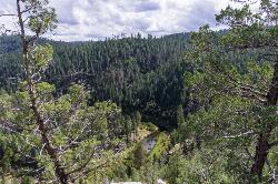
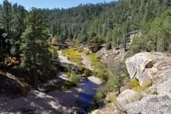
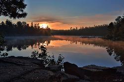
Located just outside of Winslow, Arizona, McHood Park may not initially seem like much. However, with the companion reservoir, it hosts a large variety of potential activities. This area allows for picnicing, camping, canoeing or kayaking, swimming, and even some rock climbing through the canyon for the particularly adventurous.
The nearby campsite offers spots with grills, picnic tables, and nearby restrooms. The site offers 2 paved boat ramps, with a floating dock to allow for boating activities; even fishing though most of the year. Canoers and kayakers can go almost 3 miles into the canyon before the water gets too shallow to navigate.
More Information
Directions
From Winslow, Arizona
- Head northwest on E 3rd St/Old Hwy 66 toward N Kinsley Ave (404 ft)
- Turn left onto N Warren Ave (354 ft)
- Turn left onto W 2nd St/Old Hwy 66 (0.1 mi)
- Turn right onto AZ-87 S/AZ-99 E/N Williamson AveContinue to follow AZ-87 S/AZ-99 E(1.2 mi)
- Turn left onto AZ-99 EDestination will be on the left(4.4 mi)
From Winslow, take RT 87 south a short way then RT 99 east (left turn) about 4 miles to McHood Park. Also, if you go a mile or two upstream, there are great jumping places into deep, clear water.Courtesy of swimmingholes.org

Other Rock Climbing Walls, Swimming Holes, Canoeing Areas, Canyons, and Kayaking Areas Nearby

Kinder Crossing Trail #19
Happy Jack, Arizona
39.7 miles SWKinder Crossing Trail #19 travels down to the beauty of East Clear Creek, and then extends up until reaching FR 137; but many people use the trail to reach the creek waters and play in the water. The...
Hike, Swim
East Clear Creek
Happy Jack, Arizona
41.2 miles SWEast Clear Creek is a river that stretches through the Mogollon Rim area of Arizona. It provides water to the surrounding desert landscape, fishing opportunities, and various areas to hike,...
Canyoneer, Hike, Swim 4.0 mi
Woods Canyon Lake
Payson, Arizona
46.9 miles SWoods Canyon Lake is a fishing lake near Payson, Arizona located near the Mogollon Rim. The lake has a hike that loops around it, and several other hikes nearby to look at the particularly scenic...
Camp, Hike, SwimNearby Campsites

Woods Canyon Lake
Payson, Arizona
46.9 miles SWoods Canyon Lake is a fishing lake near Payson, Arizona located near the Mogollon Rim. The lake has a hike that loops around it, and several other hikes nearby to look at the particularly scenic...
Camp, Hike, Swim
Aspen Campground
Payson, Arizona
47.5 miles SAspen Campground is a large campground near Payson, Arizona. Between the proximity to Woods Canyon Lake and the seclusion of the encompassing Apache-Sitgreaves National Forest, this is a...
Camp
Sinkhole Campground
Payson, Arizona
47.8 miles SSinkhole Campground is a camping area near Willow Springs Lake. There are also hikes, mountain biking trails, and fishing opportunities nearby. There are 26 campsites in total at this...
Camp, Hike, Mountain Bike


