


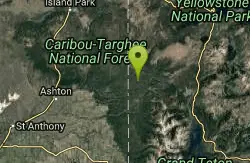
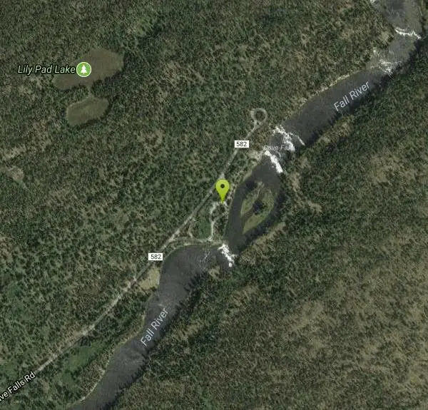
Cave Falls of Yellowstone
Ashton, Idaho
| GPS: |
44°8'34.1"N 110°59'55.9"W Maps | Directions |
| State: | Wyoming |
National Park
Camp and Hike
This campgrond is situated on the banks of Fall River in Wyoming along the south border of Yellowstone National Park. Cave Falls Campground has 23 single site units and a terrific area for fishing. Each campsite has fire rings, grills and picnic tables. Located throughout the campground are vault toilets, water faucets, bear proof storage boxes, and a dumpster.
More Information
Be courteous, informed, and prepared. Read trailhead guidelines, stay on the trail, and don't feed the wildlife.
Read More- Plan Ahead and Prepare
- Travel & camp on durable surfaces
- Dispose of waste properly
- Leave what you find
- Minimize campfire impacts
- Respect wildlife
- Be considerate of other visitors
Directions
From Ashton, Idaho
- Head east on ID-47 N/Main St toward S 6th StContinue to follow ID-47 N(5.7 mi)
- Turn right onto E 1400 N/Cave Falls RdContinue to follow Cave Falls RdEntering Wyoming(19.1 mi)
- Turn right (440 ft)
- Continue straightDestination will be on the right(230 ft)
From Highway 20 at Ashton, ID, go through the town heading east on State Highway 47 for 5.7 miles. Turn right onto E 1400 N/Cave Falls Rd and drive for 17.6 miles. Approximately 12 miles of this road is dirt.
Other Hiking Trails Nearby

Mr. Bubbles Hot Spring
Old Faithful, Yellowstone National Park
2.4 miles WMr. Bubbles is one of the few places you can actually soak in the thermal waters of Yellowstone National Park. The Bechler area of Yellowstone is one of the best kept secrets of the otherwise densely...
Hike, Hot Springs 15.9-16.6 mi
Union Falls & Ouzel Pool
Grant Village, Yellowstone National Park
3.0 miles SEBackpack, Hike, Hot Springs, and Swim near Grant Village, Yellowstone National Park
Backpack, Hike, Hot Springs, Swim 1.1 mi
Fish Lake
Ashton, Idaho
3.0 miles SEHike near Ashton, Idaho
Hike 1.9 mi
Terraced Falls
Grant Village, Yellowstone National Park
7.6 miles E3.6 mile easy out and back trail. 430 ft Elevation gain. The trailhead is off Ashton-Flagg Ranch Road along Yellowstone's South border. Ashton-Flagg Ranch Road is closed during the winter.
Hike 17.5 mi
Tear Drop Lake
Ashton, Idaho
8.5 miles NWNestled in the Targhee National Forest just off of Ashton's Fish Creek Road, this tear drop shaped lake is a family adventure waiting to happen. The lake isn't very big but it is teeming with...
Camp, Canoe, Hike, Kayak, Mountain Bike, Swim 0.3-0.6 mi
Bear Gulch
Ashton, Idaho
14.3 miles WBear Gulch is an abandoned ski hill out of operation since 1969. While the vegetation is beginning to take over, there's still some great sledding to be had. It's just far enough into the...
Camp, Cross-country Ski, Hike, Sled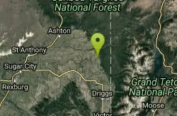
Bitch Creek Trestle
Tetonia, Idaho
15.2 miles SWAs part of the Rails to Trails project, this old railroad bridge has been transformed into a very safe little viewing experience for the whole family. You can drive right up to the bridge where...
Hike 3.2-47.0 mi
Yellowstone Branch Line Trail
Ashton, Idaho
15.6 miles WYellowstone branch line trail runs from Warm River to the Montana border totaling 39 miles. There are a few places to jump on and off the trail as well as a few smaller trails that branch off of this...
Backpack, Cross-country Ski, Hike, Horseback, Mountain Bike
Mesa Falls
Ashton, Idaho
16.6 miles WUpper Mesa Falls, aka Big Falls, is an absolutely awesome waterfall on the Henrys Fork of the Snake River. The falls drop 114 ft. and measure 300 ft. across. To get to the falls from the parking lot...
Cross-country Ski, Hike, Kayak 0.8 mi
Conant Creek Pegram Truss Railroad Bridge
Ashton, Idaho
20.0 miles SWAs part of the Rails to Trails project, this old railroad bridge has been transformed into a very safe little viewing experience for the whole family. You can drive right up to the bridge where there...
Hike
Sheep Falls on Henry's Fork
Island Park, Idaho
20.3 miles WSheep Falls cascades approximately 25' through a narrow basalt chute on the North Fork of the Snake River near Island Park, Idaho. Compared to nearby Lower and Upper Mesa Falls, that height may...
Hike
Badger Creek
Tetonia, Idaho
20.8 miles SBadger Creek is a stream located just 13.6 miles from Ashton, in Teton County, in the state of Idaho, United States, near France, ID. Whether you’re spinning, baitcasting or fly fishing your...
Camp, Cross-country Ski, Hike, Mountain Bike, Rock Climb 2.6 mi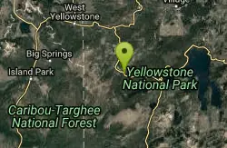
Lone Star Geyser Trail
Old Faithful, Yellowstone National Park
21.3 miles NELone Geyser Star Trail is a hiking and mountain biking trail that leads through the forest to the colorful Lone Star Geyser. The Geyser here has beautiful white, yellow and orange colors in the...
Hike, Mountain Bike 6.2 mi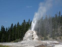
Howard Eaton Trail
Old Faithful, Yellowstone National Park
23.1 miles NThe Howard Eaton Trail in the Old Faithful Area is a hike with incredible geothermic features and other natural views. This hike is a moderately difficult 6.5 mile there and back trail, that...
Hike 6.9 mi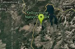
Heart Lake Trail
Grant Village, Yellowstone National Park
23.2 miles NEThe trail is very clear and leads to a moderate eight mile hike to Heart Lake. This hike has many possibilities. Day hikers need to push their time to make sure they are on the trail early to allow...
Backpack, Camp, Hike, Hot Springs 2.1-11.5 mi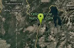
Lewis River Channel / Dogshead Loop
Grant Village, Yellowstone National Park
23.2 miles NEAnyone who doesn't want to backpack through Yellowstone but is looking to experience the real beauty of Yellowstone will truly love this hike. Walking along the Lewis Channel is one of the...
Canoe, Hike, Kayak 1.5 mi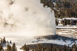
Observation Point Trail
Old Faithful, Yellowstone National Park
23.5 miles NObservation Point Trail is an just over 2 mile loop that passes several geysers along the way to Solitary Geyser. Observation Point Trail provides up close views of several geysers as well as...
Hike 3.1 mi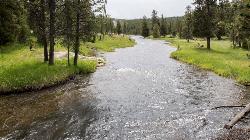
Mallard Lake
Old Faithful, Yellowstone National Park
23.5 miles NThe Mallard Lake trail is majestically lined with trees both old an new. This is a 5 mile leading to the beautiful Mallard lake, making it a 10 mile round trip. The trail is...
Hike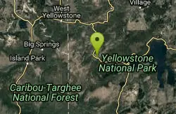
Old Faithful Geyser
Old Faithful, Yellowstone National Park
23.5 miles NOld Faithful is a cone geyser located in Yellowstone National Park in Wyoming, United States. It was named in 1870 during the Washburn-Langford-Doane Expedition and was the first geyser in the park...
Hike 14.8 mi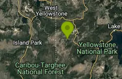
Biscuit Basin to Fairy Falls and Firehole Meadows
Old Faithful, Yellowstone National Park
23.9 miles NFreight Road trail is a almost 15 mile hike that leaves from Biscuit Basin or Fountain Flats Drive. This hike is a beautiful remote hike that passes several unique landmarks, breaking up this hike...
Backpack, Camp, HikeNearby Campsites

Loon Lake
Ashton, Idaho
3.2 miles SECamp, Kayak, and Swim near Ashton, Idaho
Camp, Kayak, Swim
Horseshoe Lake
Ashton, Idaho
5.3 miles WHorseshoe Lake is hidden back in the Targhee National Forest. It's a beautiful lake with plenty of lily pads. The road to get there is well maintained and there are many options for pull-outs...
Camp, Canoe, Dive, Swim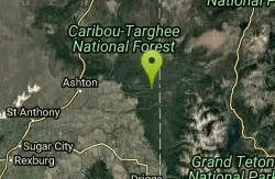
Sheep Falls on Fall River
Ashton, Idaho
6.3 miles SWThe lesser known Sheep Falls on Fall River is a local treasure off of Cave Falls road. There are primitive campsites and beautiful views for a great picnic spot. The water splits and comes down in...
Camp 17.5 mi
Tear Drop Lake
Ashton, Idaho
8.5 miles NWNestled in the Targhee National Forest just off of Ashton's Fish Creek Road, this tear drop shaped lake is a family adventure waiting to happen. The lake isn't very big but it is teeming with...
Camp, Canoe, Hike, Kayak, Mountain Bike, Swim
Porcupine Creek
Ashton, Idaho
11.6 miles WPorcupine Creek is a hunting, fishing, camping, and swimming spot near Ashton, Idaho in Fremont County within Targhee National Forest. It's surrounded by forests, meadows, and a creek...
Camp, Swim 0.3-0.6 mi
Bear Gulch
Ashton, Idaho
14.3 miles WBear Gulch is an abandoned ski hill out of operation since 1969. While the vegetation is beginning to take over, there's still some great sledding to be had. It's just far enough into the...
Camp, Cross-country Ski, Hike, Sled
Warm River Campground
Ashton, Idaho
15.5 miles WWarm River Campground is located nine miles northeast of Ashton, Idaho, along the slow-moving Warm River at an elevation of 5,200 feet. Willows line the riverbanks and pine trees offer partial...
Camp 0.1 mi
Lewis Lake Campground
Grant Village, Yellowstone National Park
20.7 miles NELewis Lake is located in the southern part of Yellowstone National Park. It is 4 miles southeast of Shoshone Lake. Lewis Lake offers a plethora great water activities. This lake offers...
Camp, Canoe, Kayak
Badger Creek
Tetonia, Idaho
20.8 miles SBadger Creek is a stream located just 13.6 miles from Ashton, in Teton County, in the state of Idaho, United States, near France, ID. Whether you’re spinning, baitcasting or fly fishing your...
Camp, Cross-country Ski, Hike, Mountain Bike, Rock Climb 6.9 mi
Heart Lake Trail
Grant Village, Yellowstone National Park
23.2 miles NEThe trail is very clear and leads to a moderate eight mile hike to Heart Lake. This hike has many possibilities. Day hikers need to push their time to make sure they are on the trail early to allow...
Backpack, Camp, Hike, Hot Springs 14.8 mi
Biscuit Basin to Fairy Falls and Firehole Meadows
Old Faithful, Yellowstone National Park
23.9 miles NFreight Road trail is a almost 15 mile hike that leaves from Biscuit Basin or Fountain Flats Drive. This hike is a beautiful remote hike that passes several unique landmarks, breaking up this hike...
Backpack, Camp, Hike 0.9 mi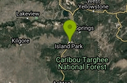
Buffalo River Campground
Island Park, Idaho
26.7 miles NWThe float here is nice and easy. It's a great early season float. Later in the season the shallow spots will force you to walk a good chunk of the float. The water is super clear and often pretty...
Camp, Canoe, Kayak, Swim
Reunion Flat Campground
Alta, Wyoming
26.7 miles SCamp near Alta, Wyoming
Camp 3.8-6.4 mi
Table Rock / Table Mountain
Driggs, Idaho
27.0 miles SAt 11,300 feet, Table Mountain is possibly the most beautiful climb this side of the Tetons and offers what may well be the very best view of the Grand Tetons. It's just far enough away...
Camp, Hike
Teton Canyon Campground
Alta, Wyoming
27.0 miles STeton Canyon is the start of several great adventures, including the Alaska Basin Trail, Table Rock, Devil's Stairs, and the Teton Crest. The campground offers a perfect basecamp to get an...
Camp
Big Springs
Island Park, Idaho
27.6 miles NWThere's also a great little walking trail along the river with placards that tell about the ecosystem and history of the area. There's about a 1/2 mile that's paved and then a 1/2 mile...
Camp, Hike
Grant Village
Grant Village, Yellowstone National Park
27.6 miles NEGrant Village was built in 1984 and named after Ulysses S. Grant, president when Yellowstone became the world’s first national park in 1872. Located near the West Thumb of Yellowstone Lake,...
Camp, Canoe, Kayak
Upper Coffee Pot Campground
Island Park, Idaho
30.1 miles NWUpper Coffeepot Campground stretches along a floatable section of Henry's Fork of the Snake River. A mixed growth lodgepole pine forest provides partial shade and summer wildflowers are...
Camp, Canoe
Jenny Lake Campground
Jackson Hole, WY
30.4 miles SEJenny Lake campground is a scenic beauty in the heart of Grand Teton National Park. It's understandable why it often fills before 8 AM during peak summer periods. It's nestled right at the...
Camp
Darby Canyon Camping
Alta, Wyoming
32.4 miles SThere's no official campgrounds up the canyon but there are several dispersed campsites with existing fire lays. Please adhere to principles of Leave No Trace. Use existing fire lays and leave...
Camp


