


Cave Creek Swimming Hole
Cave Creek, Arizona
| Address: | N Seven Springs Rd, Seven Springs, AZ, USA |
| GPS: |
33°58'20.9"N 111°51'59.4"W Maps | Directions |
| State: | Arizona |
| Trails/Routes: | 3.9 mi |
Rivers
Hike and Swim
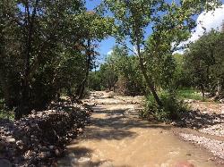
Hidden along Cave Creek Trail #4 is a swimming hole deep enough to refresh from the summer heat. It takes almost four miles of hiking in Arizona desert to reach the swimming hole, but the water is refreshing enough to be worth it. Although much of the hike takes place where only cactus will keep you company, the trail does intersect with shaded areas where you can cool off for a bit.
Water levels in the creek will fluctuate after rain, so take care after a storm. Be careful not to drink the water without treating it first. There may be fish in the pool, so keep an eye out.
More Information
Be courteous, informed, and prepared. Read trailhead guidelines, stay on the trail, and don't feed the wildlife.
Read More- Plan Ahead and Prepare
- Travel & camp on durable surfaces
- Dispose of waste properly
- Leave what you find
- Minimize campfire impacts
- Respect wildlife
- Be considerate of other visitors
Directions
From Cave Creek, Arizona
- Head east on E Cave Creek Rd toward N Hidden Valley Dr (1.9 mi)
- At the traffic circle, continue straight to stay on E Cave Creek Rd (8.8 mi)
- Continue onto Rd 24/7 Springs Rd/N Seven Springs Rd (2.8 mi)
- Slight left onto Rd 24/Cave Creek Rd/N Seven Springs Rd (6.1 mi)
- Turn right onto Rd 24/7 Springs Rd/N Seven Springs RdDestination will be on the left(0.9 mi)
In the Seven Springs Recreation Area of the Tonto National Forest. To get there, take I-17 north from Phoenix to Exit 223. Follow the Carefree Highway east to Cave Creek Rd. north. DO NOT turn off at signs to the "Cave Creek Recreation Area", which is a local park near here. (Make sure you get drinking water as there is none further up.) Stay on Cave Creek Rd. for many miles, through the towns of Cave Creek and Carefree, past numerous subdivisions, to the sign for the Cave Creek Ranger District office. STOP AT THIS RANGER STATION FOR MAPS AND INFORMATION. Continue up Cave Creek Rd. as it changes to FR 24, a dirt road which has some wash boarding but negotiable with a passenger car. About 9 miles past the ranger station you will see the Seven Springs picnic area. Park here and hike.
Hike from the Seven Springs picnic area. A network of five trails originates in this area; the one along Cave Creek to the swimming hole is known prosaically as "Trail Number 4". (SEE THE TRAIL MAP YOU PICKED UP AT THE RANGER STATION) The trailhead for #4 is just a short walk up Cave Creek Road (FR 24) from the campground, on your left after you splash through the creek on a low water bridge.
The trail descends and heads west, closely following Cave Creek. It meanders initially through fragrant juniper stands, then up onto the canyon slope high above the water. Stop and enjoy the view: Saguaro cactus standing sentinel over clumpy prickly pear all the way down the canyon. As you cross through the creek the second time, about 3 miles in, the swimming hole is just downstream behind some rocks. There are said to be other swimming holes along this trail as it continues beyond this point for a total length of 9.9 miles, eventually coming our on another forest road (FR 1533 and FR 48).Courtesy of swimmingholes.org
scott heffner
1/3/22 3:28 pm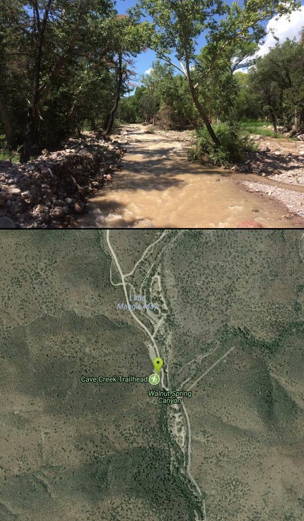

Trails
Distance ?
3.9 milesElevation Gain ?
-347 feetReal Ascent ?
673 feetReal Descent ?
1,020 feetAvg Grade (-1°)
-2%Grade (-30° to 25°)
-57% to 48%Elevation differences are scaled for emphasis. While the numbers are accurate, the cut-away shown here is not to scale.
Other Swimming Holes and Hiking Trails Nearby

Go John Trail
Cave Creek, Arizona
12.4 miles SWThe Go John Trail is a 5.8 mile loop trail outside of Cave Creek, Arizona, that is moderately trafficked, used by both hikers and mountain bikers. It is an excellent opportunity to view the desert...
Hike, Horseback, Mountain Bike
Clay Mine Trail
Cave Creek, Arizona
13.3 miles SWClay Mine Trail is a 1.6 mile out-and-back, beginner friendly trail in Cave Creek Regional Park. This is a trail that is very close to the Visitor Center. It's not too difficult but there...
Hike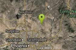
Brown Ranch Trail to Cone Mountain Trail
Scottsdale, Arizona
14.6 miles SHike near Scottsdale, Arizona
Hike
Jane Rau Brown's Canyon Trail
Scottsdale, Arizona
14.7 miles SThe Jane Rau Brown Canyon Trail was named after Jane Rau Brown, one of the pioneers of the McDowell Sonoran Conservancy, for her determination and passion in preserving the desert and the park....
Hike, Horseback, Mountain Bike
Pima and Dynamite Trail
Scottsdale, Arizona
14.7 miles SPima and Dynamite is an area with a network of trails for hiking, but more popularly for mountain biking, in North Scottsdale, Arizona. The area feautures a variety of trails for...
Hike, Mountain Bike
Pinnacle Peak Trail
Scottsdale, Arizona
16.9 miles SPinnacle Peak is a 3.5 mile out-and-back, moderate hiking trail, that includes rock climbing routes (for experienced climbers), within the Sonoran Desert. This trail, and park, in...
Hike, Horseback, Rock Climb
Tower Road - Sonoran Preserve
Phoenix, Arizona
17.3 miles SWShort and steep (.6 mile each way) out and back asphalt road to the radio tower.
Hike
Sidewinder-Ocotillo-West Loop
Phoenix, Arizona
17.3 miles SWThis loop starts at Carefree Hwy and 7th Ave, be aware there is limited parking at the trailhead. The Ocotillo part of the trail is relatively flat and the Sidewinder part has some good...
Hike, Horseback, Mountain Bike
Ocotillo/Ridgeback/Sidewinder Loop Trail
Phoenix, Arizona
17.4 miles SWGreat moderate loop which includes a summit, great views and Classic Sonoran Desert scenery. Multiple access points and other connecting trails allows for the loop to be changed if...
Hike, Horseback, Mountain Bike
Sidewinder, Apache Vista, Ocotillo Loop Trail
Phoenix, Arizona
17.5 miles SWThis is an excellent loop that is very well maintained, well sign posted and if you include the vista summit trail, a moderate work out. Massive Car Park, good restrooms, and plenty of...
Hike, Horseback, Mountain Bike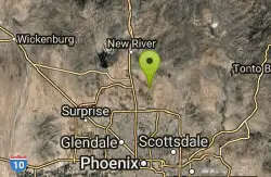
Apache Wash Trail
Phoenix, Arizona
17.8 miles SWStart west on Ocitillo to Ridgeback north till you get to the crossing of Sidewinder then head west. Keep on Sidewinder toil you come to the crossing of Octillio and head east back to...
Hike
Bobcat Trail - Sonoran Preserve
Phoenix, Arizona
19.4 miles SWBobcat Trail is a short, easy trail, often used for connecting to other bigger trails in the Sonoran Desert Preserve. This is a 2 mile out-and back trail. There isn't much of a parking...
Hike 2.2 mi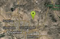
Marcus Landslide Trail
Scottsdale, Arizona
19.5 miles SThe Marcus Landslide Trail is named after ASU professor Melvin Marcus, a renouned geographer, after the discovery and recognition of the interesting geographical area in 2002. More than 500,000...
Hike, Horseback, Mountain Bike, Rock Climb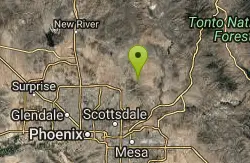
Tom's Thumb Trail
Scottsdale, Arizona
19.6 miles STom's Thumb Trail is a popular trail on the McDowell Sonoran Preserve due to its unique thumb-like granite rock formation. This is a 4.7 out-and-back, intermediate trail because of its 1,200...
Hike, Mountain Bike, Rock Climb
Tom's Thumb, Feldspar, and Marcus Landslide Loop
Scottsdale, Arizona
19.6 miles SHike near Scottsdale, Arizona
Hike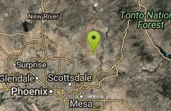
Wagner Trail
Scottsdale, Arizona
20.7 miles SWagner Trail is a 2.2 mile, beginner to intermediate loop trail located in the McDowell Sonoran Preserve. The trail is well-marked and easy to follow; this wide, but rugged...
Hike, Horseback, Mountain Bike
Wagner-Granite-Bluff Trails
Scottsdale, Arizona
20.8 miles SHike and Mountain Bike near Scottsdale, Arizona
Hike, Mountain Bike
Dixie Summit Trail
Phoenix, Arizona
20.8 miles SWA steep and difficult short trail using many switchbacks to get to the summit. You will be rewarded with spectacular views of the surrounding area.
Hike
Dixie Mountain Loop Trail
Phoenix, Arizona
20.8 miles SWThe main loop trail at Phoenix's Sonoran Preserve provides plenty of options for either a short walk or a longer hike. The elevation gain is accumulated through small ups-and-downs along the...
Hike, Horseback, Mountain Bike 2.8 mi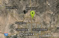
Desert Tortoise
Phoenix, Arizona
20.8 miles SWAt just over a mile long, Desert Tortoise is a doubletrack connector to the Valle Verde Trail. Very good hiking area with a good range of difficulty levels. Starts with a short climb from the...
Hike, Mountain BikeNearby Campsites

Verde Hot Springs
Camp Verde, Arizona
27.7 miles NVerde Hot Springs are a few natural hot spring pools located along the Verde River, near Sedona, Arizona. Once a resort, now all that remains are the foundations and the hot pools...
Camp, Hike, Hot Springs 2.1 mi
Lower Salt River Nature Trail
Fort McDowell, Arizona
31.8 miles SThe Lower Salt River Nature Trail is a scenic walk to take at the Tonto National Forest. This trail provides stunning views as you walk alongside the Salt River. This rustic trail is older and less...
Camp, Hike
Buckhorn Campground Nature Trail
Apache Junction, Arizona
37.3 miles SCamp and Hike near Apache Junction, Arizona
Camp, Hike 0.4 mi
Clear Creek Campground
Camp Verde, Arizona
38.0 miles NWest Clear Creek flows along the boundary of this desert canyon country camp and is a popular place for hiking, swimming, wading and fishing. Cool water species such as smallmouth bass and green...
Camp, Hike, Swim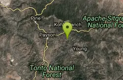
Hell's Gate
Payson, Arizona
47.1 miles EThis Wilderness was established in 1984, and contains approximately 37,440 rough acres with a major canyon and perennial stream extending its entire length. Deep pools of water may be separated by...
Backpack, Camp, Hike, Swim 0.1-7.8 mi
Wolf Creek Falls
Sedona, Arizona
47.9 miles NWWolf Creek Falls is a wonderful space to explore and be immersed in nature. With it's six miles of trails, beautiful waterfalls and two campgrounds this is the perfect place to spend a...
Camp, Hike, Swim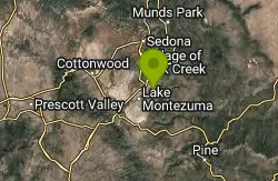
Beaver Creek Campground
Camp Verde, Arizona
49.0 miles NCamp, Canoe, Kayak, and Swim near Camp Verde, Arizona
Camp, Canoe, Kayak, Swim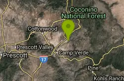
Beaver Creek Dispersed Camping
49.1 miles N
Free dispersed camping on the cliffs above Beaver Creek.
Camp


