Cape Royal Trail
North Rim, Arizona
| Address: | ~Cape Royal Rd, North Rim, AZ 86052, USA |
| GPS: |
36°7'20.2"N 111°57'0.2"W Maps | Directions |
| State: | Arizona |
| Trail Length: | 0.90 miles |
| Trail Type: | Out & Back |
| Hike Difficulty: | Beginner |
| Elevation Gain: | 623 feet |
| Trails/Routes: | 0.5-0.8 mi |
Pet Friendly
Hike
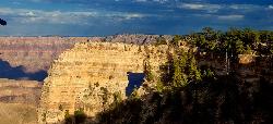
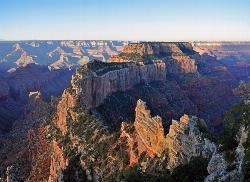
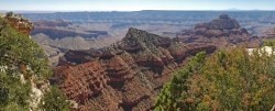
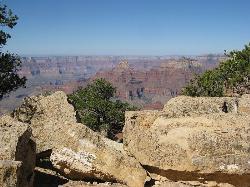
Cape Royal is a long peninsula extending from the North Rim out over the Grand Canyon. It offers a phenomenal view, perhaps the most sweeping view of any Grand Canyon vista. Take the short stroll to the end of the cape and to the promontory on the window. It's an easy walk less than a mile RT on a flat, paved trail providing views of the canyon, Angels Window, and the Colorado River. Markers along the trail interpret the area's natural history. Trail begins at the southeast side of the Cape Royal parking area. With seemingly unlimited vistas to the east and west, it is popular for both sunrise and sunset. The sweeping turn of the Colorado River at the Unkar Delta is framed through the natural arch of Angels Window. Look for the Desert View Watchtower across the canyon on the South Rim. Angels Window can be viewed from Angels Window Overlook at the Cliff Springs Trailhead. The trailhead parking area is at the end of the paved Cape Royal Road, which circles northeast and then south from the main road leading to North Rim VC and lodge. Courtesy of AllTrails.com
Mapped Route/Trail Distances
| Cape Royal Trail to Angel's Window | 0.5 miles |
| Cape Royal Trail | 0.8 miles Round Trip |
More Information
Be courteous, informed, and prepared. Read trailhead guidelines, stay on the trail, and don't feed the wildlife.
Read MoreDirections
From North Rim, Arizona
- Head northwest on AZ-67 N toward Bridle PathMay be closed at certain times or days(1.9 mi)
- Turn rightMay be closed at certain times or days(5.4 mi)
- Turn right toward Cape Royal Rd (171 ft)
- Continue onto Cape Royal RdMay be closed at certain times or days(14.2 mi)
- Continue straight to stay on Cape Royal RdMay be closed at certain times or days(381 ft)
- Turn right (26 ft)
Trails
Distance ?
0.5 milesElevation Gain ?
0 feetReal Ascent ?
22 feetReal Descent ?
22 feetAvg Grade (0°)
0%Grade (-10° to 8°)
-18% to 14%Distance ?
0.8 miles Round TripElevation Gain ?
-50 feetReal Ascent ?
11 feetReal Descent ?
61 feetAvg Grade (-1°)
-2%Grade (-6° to 3°)
-11% to 5%Elevation differences are scaled for emphasis. While the numbers are accurate, the cut-away shown here is not to scale.
Other Hiking Trails Nearby
Cliff Springs
North Rim, Arizona
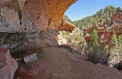
0.2 miles NEStarting just down the hill from the Cape Royal Overlook, the trail immediately heads down into a small valley, passing the granary ruin in a few hundred feet. The valley descends into a side canyon...
Hike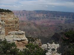
Walhalla Overlook
North Rim, Arizona
0.8 miles NEHistory unfolds as you explore Walhalla Overlook on the North Rim of the Grand Canyon, with views of the Unkar Delta, farmland of the ancient people who once lived here.
Hike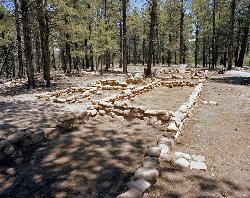
Walhalla Ruins
North Rim, Arizona
0.9 miles NEWalhalla Ruin overview. Nine hundred years ago, people were living on the North Rim at Walhalla Glades. The site was a summer home for families for over 100 years. Walhalla Plateau is...
Hike
Cape Final
North Rim, Arizona
1.8 miles NEThere are plenty of trails on the Grand Canyon's North Rim that have great views, but there may not be a hike more pleasant and more rewarding than the Cape Final Trail. As part of a full...
Camp, Hike
Roosevelt Point Trail
North Rim, Arizona
6.6 miles NRoosevelt Point Trail on Grand Canyon National Park's North Rim is a 0.2 mile short, relatively flat woodland loop trail offering spectacular views. Roosevelt Point Trail on Grand Canyon National...
Hike 0.7 mi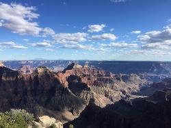
Bright Angel Point Trail
North Rim, Arizona
7.7 miles NWLocated at the North Rim of the Grand Canyon, the Bright Angel Point Trail is a steep, narrow, fully paved path leading to an incredible scenic viewpoint. The trail is conveniently located right next...
Hike
Transept Trail
North Rim, Arizona
7.7 miles NWThe 3.4 mile out and back Transept Trail connects Grand Canyon Lodge to the North Rim Campground, follows the rim of a side canyon called the Transept, and offers a relaxing yet moderate hike with...
Hike 1.9 mi
Bridle Trail
North Rim, Arizona
7.8 miles NWThe Bridle Path located at the Grand Canyon's North Rim connects the Grand Canyon Lodge with the North Kaibab Trailhead and is lined with large rocks. The Bridle Path trail is located in the...
Hike, Horseback
Tanner Trail
Grand Canyon Village, Arizona
8.2 miles SEA rigorous rim-to-river backpack of three or more days, following one of the South Rim's more difficult trails. The unmaintained trail, recommended only for seasoned hikers, is...
Backpack, Camp, Hike
The Escalante Route Trail
Grand Canyon Village, Arizona
8.2 miles SEThe route can be hiked in either direction, but this passage will be described from the perspective of a downcanyon hiker. Follow the Tanner Trail to the shoreline. Rocks placed at the...
Backpack, Hike 9.1 mi
New Hance Trail
Grand Canyon Village, Arizona
8.3 miles SNew Hance Trail is a colorful hike through Red Canyon to the Colorado River. This trail is considered one of the more difficult trails in the Grand Canyon and is a challenge only prepared hikers...
Backpack, Camp, Hike
Grandview Point to Horseshoe Mesa Trail
Grand Canyon Village, Arizona
8.8 miles SA rewarding day hike or backpack to a wooden mesa below the South Rim.
Backpack, Hike
The Grand Canyon: Kaibab to Bright Angel Trail
Grand Canyon Village, Arizona
8.8 miles SWExperience the Grand Canyon like few others with this unforgettable 2-3 day trip down into the canyon. If you are looking for the perfect hike in the Grand Canyon, this is it. The 2 (or 3) day hike...
Backpack, Camp, Hike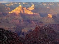
Rim-to-Rim: North Kaibab to Grand Canyon Village
North Rim, Arizona
8.8 miles NWFour days across the Grand Canyon you will never forget! There is a secret to a Grand Canyon rim-to-rim hike: Take four days to do it, even if you can do it in one. I have friends who go South to...
Backpack, Camp, Hike
Grandview Trail Loop
Grand Canyon Village, Arizona
8.8 miles SThis is definitely not a mountain biking trail! I am a resident of Grand Canyon and know for sure. Also use of Mtn bikes on canyon trails is illegal in the Park....
Backpack, Camp, Cross-country Ski, Hike
Rim-to-Rim: North to South Kaibab Trail
North Rim, Arizona
8.8 miles NWArizona Office of Tourism, 2702 N. 3rd St., Suite 4015 , Phoenix, AZ, 85004, Phone: 888-520-3434, Fax: 602-240-5432, mfioritt@pni.com
Camp, Hike, Horseback
Phantom Ranch to Ribbon Falls on North Kaibab Trail
North Rim, Arizona
8.8 miles NWCamp, Hike

North Kaibab Trail to Colorado River
North Rim, Arizona
8.8 miles NWThe North Kaibab Trail to Colorado River Trail is perfect for experienced hikers. The trail contains many elevation changes and is very steep. The trail is well maintained and well marked so you can...
Backpack, Camp, Hike
Uncle Jim Trail
North Rim, Arizona
8.8 miles NWDirections from North Rim Entrance: Drive southward along North Rim Drive to the North Kaibab Trailhead. Turn left into the parking area and locate the trailhead on the eastern side of the lot.
Backpack, Camp, Hike
North Kaibab Trail to Supai Tunnel
North Rim, Arizona
8.8 miles NWThis is a half-day out-and-back hike traverses below the rim on the North Rim’s only maintained Inner Canyon trail. The North Kaibab Trail is the North Rim’s only maintained trail, lying...
Backpack, HikeNearby Campsites

Cape Final
North Rim, Arizona
1.8 miles NEThere are plenty of trails on the Grand Canyon's North Rim that have great views, but there may not be a hike more pleasant and more rewarding than the Cape Final Trail. As part of a full...
Camp, Hike
Tanner Trail
Grand Canyon Village, Arizona
8.2 miles SEA rigorous rim-to-river backpack of three or more days, following one of the South Rim's more difficult trails. The unmaintained trail, recommended only for seasoned hikers, is...
Backpack, Camp, Hike 9.1 mi
New Hance Trail
Grand Canyon Village, Arizona
8.3 miles SNew Hance Trail is a colorful hike through Red Canyon to the Colorado River. This trail is considered one of the more difficult trails in the Grand Canyon and is a challenge only prepared hikers...
Backpack, Camp, Hike
The Grand Canyon: Kaibab to Bright Angel Trail
Grand Canyon Village, Arizona
8.8 miles SWExperience the Grand Canyon like few others with this unforgettable 2-3 day trip down into the canyon. If you are looking for the perfect hike in the Grand Canyon, this is it. The 2 (or 3) day hike...
Backpack, Camp, Hike
Rim-to-Rim: North Kaibab to Grand Canyon Village
North Rim, Arizona
8.8 miles NWFour days across the Grand Canyon you will never forget! There is a secret to a Grand Canyon rim-to-rim hike: Take four days to do it, even if you can do it in one. I have friends who go South to...
Backpack, Camp, Hike
Grandview Trail Loop
Grand Canyon Village, Arizona
8.8 miles SThis is definitely not a mountain biking trail! I am a resident of Grand Canyon and know for sure. Also use of Mtn bikes on canyon trails is illegal in the Park....
Backpack, Camp, Cross-country Ski, Hike
Rim-to-Rim: North to South Kaibab Trail
North Rim, Arizona
8.8 miles NWArizona Office of Tourism, 2702 N. 3rd St., Suite 4015 , Phoenix, AZ, 85004, Phone: 888-520-3434, Fax: 602-240-5432, mfioritt@pni.com
Camp, Hike, Horseback
Phantom Ranch to Ribbon Falls on North Kaibab Trail
North Rim, Arizona
8.8 miles NWCamp, Hike

North Kaibab Trail to Colorado River
North Rim, Arizona
8.8 miles NWThe North Kaibab Trail to Colorado River Trail is perfect for experienced hikers. The trail contains many elevation changes and is very steep. The trail is well maintained and well marked so you can...
Backpack, Camp, Hike
Uncle Jim Trail
North Rim, Arizona
8.8 miles NWDirections from North Rim Entrance: Drive southward along North Rim Drive to the North Kaibab Trailhead. Turn left into the parking area and locate the trailhead on the eastern side of the lot.
Backpack, Camp, Hike
South Kaibab to Phantom Ranch to Bright Angel Trail
Grand Canyon Village, Arizona
8.8 miles SWOne of the most popular hikes in Grand Canyon National Park is the South Kaibab to Phantom Ranch to Bright Angel Trail. Marked as difficult, the trail is well maintained and labeled. This Grand...
Backpack, Camp, Hike
Tonto Trail from Grandview Point to South Kaibab Trailhead
Grand Canyon Village, Arizona
8.9 miles SA rigorous point-to-point backpack of four to five days; recommended for experienced Grand Canyon backpackers only. Long stretches of this scenic, lonely segment of the Tonto Trail are...
Backpack, Camp, Hike
South Kaibab to North Kaibab to Bright Angel Trail
Grand Canyon Village, Arizona
8.9 miles SWGenerally an early morning start and a late finish with an amazing sunrise on the way down the South Kaibab and depending on your speed, a beautiful sunset as you hike back toward (or up) Bright...
Backpack, Camp, Hike 13.6 mi
South Kaibab Trails
Grand Canyon Village, Arizona
8.9 miles SWSouth Kaibab Trail is a 7 mile point-to-point trail located near Grand Canyon, Arizona that features a river and is rated as difficult. The trail is primarily used for hiking & walking and is...
Camp, Hike, Horseback
Clear Creek Trail
Grand Canyon Village, Arizona
8.9 miles SWAn extended backpack trip of four to six days deep within the Grand Canyon. NOTE: The starting point for Clear Creek Trail, Bright Angel Campground, is in a remote location away from a trailhead. The...
Backpack, Camp, Hike 6.3 mi
Tiyo Point Trail
North Rim, Arizona
9.2 miles NWThis former road is becoming increasingly overgrown by the encroaching forest. This being said, it is generally easy to follow with some blown down trees to climb over or around. There are some old...
Backpack, Camp, Hike
Tonto Trail: New Hance Trail to Grandview Point
Grand Canyon Village, Arizona
9.6 miles SBackpack, Camp, Hike 0.6 mi
Mather Campground Trail
Grand Canyon Village, Arizona
10.6 miles SWLocated on the South Rim of the Grand Canyon, Mather Campground Trail is a brief one mile out and back connector trail which is great for hiking, mountain biking, walking, and trail running. The...
Camp, Hike, Mountain Bike
Nankoweap Trail
North Rim, Arizona
11.0 miles NBackpack, Camp, Hike 1.4-9.8 mi
The Bright Angel Trails
Grand Canyon Village, Arizona
11.7 miles WPrepare yourself for switchbacks as part of a tough elevation gain on the Bright Angel trail to Plateau Point trail. This trail features spectacular views as you hike along the edge of...
Backpack, Camp, Hike, Horseback


