Canyon Creek Charcoal Kilns
Melrose, Montana
| Address: | Canyon Creek Rd, Divide, MT 59727, USA |
| GPS: |
45°40'47.0"N 112°52'10.7"W Maps | Directions |
| State: | Montana |
| Trails/Routes: | 0.1 mi |
Hike
In 1875, a 40-ton smelter was built, producing nearly one million ounces of silver and thousands of tons of lead and copper annually. Unfortunately, the district was hit hard when the Sherman Silver Purchase Act was repealed in 1893. Though mining continued, it was on a much smaller scale, and in 1900 the Glendale Smelter was torn down. By 1915, all mining operations in the district had ceased.Courtesy of southwestmt.com
Twenty-three brick-domes charcoal kilns were built on the site to turn trees from the surrounding hillsides into charcoal. The kilns operating from 1884 to 1900 providing charcoal to the smelter in Glendale which extracted silver and lead from ore mined in Helca, MT. In this time, more than $20,000,000 worth of silver and lead were produced.Courtesy of silverbowclub.com
More Information
Be courteous, informed, and prepared. Read trailhead guidelines, stay on the trail, and don't feed the wildlife.
Read MoreDirections
From Melrose, Montana
- Head south on Hwy 91/
I-15 Frontage Rd/ Main St toward 3rd St (0.2 mi) - Turn right onto Frontage Rd (358 ft)
- Continue onto Trapper Creek Rd (5.5 mi)
- Turn right to stay on Trapper Creek Rd (0.1 mi)
- Continue onto Canyon Creek RdDestination will be on the right(5.5 mi)
Take Trapper Creek Road out of Melrose. It starts off paved, but quickly turns to gravel as you pass the Salmonfly Fishing Access. Follow Trapper Creek Road for 5.5 miles then turn right onto Canyon Creek Road. Take that for 5.6 miles and the site is on the right.Courtesy of flyfishingwaters.com

Trails
Distance ?
604 feet Round TripElevation Gain ?
6 feetReal Ascent ?
7 feetReal Descent ?
1 feetAvg Grade (1°)
2%Grade (-3° to 4°)
-6% to 6%Elevation differences are scaled for emphasis. While the numbers are accurate, the cut-away shown here is not to scale.
Other Hiking Trails Nearby

Lake Agnes
Glen, Montana
11.4 miles SAgnes Lake Trail (122) is located in the Pioneer Mountains. The trail begins on the east side of Brownes Lake at the State campground and ends 0.5 mile east of Long Branch Lake on Willow Creek Road....
Camp, Hike, Mountain Bike
Minneopa Lake
Polaris, Montana
20.4 miles SThis is a beautiful short hike that is easily the start of a great trip between several lakes or just a nice easy kid hike. Length: .25 mile (.5 mile roundtrip)
Backpack, Camp, Hike 0.6 mi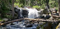
Pintler Falls
Wise River, Montana
30.2 miles NWHike near Wise River, Montana
Hike
Spring Hill Campground and Picnic Area
Anaconda, Montana
36.8 miles NWSpringhill Campground is located in Beaverhead-Deerlodge National Forest in southwestern Montana. Warm Springs Creek runs right next to the campground is popular among anglers who commonly catch...
Camp, Hike, Horseback, Mountain Bike, Swim 1.0 mi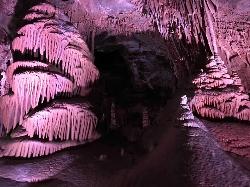
Lewis & Clark Caverns
Whitehall, Montana
49.0 miles EThe Lewis & Clark Caverns State Park encompasses 3,015 acres that you can explore by foot, on a bike, in a canoe or in a tent. The most famous feature of the park is the Lewis & Clark...
Camp, Canoe, Cave, Hike, Mountain Bike 0.4-3.9 mi
Lewis & Clark Caverns Trails
Whitehall, Montana
49.8 miles ELewis & Clark Caverns State Park is a 3,000-acre park with over 10 miles of trails open to hikers and mountain bikers. It is easy to be one with nature as you explore these adventurous trails....
Hike, Mountain BikeNearby Campsites

Lake Agnes
Glen, Montana
11.4 miles SAgnes Lake Trail (122) is located in the Pioneer Mountains. The trail begins on the east side of Brownes Lake at the State campground and ends 0.5 mile east of Long Branch Lake on Willow Creek Road....
Camp, Hike, Mountain Bike
Minneopa Lake
Polaris, Montana
20.4 miles SThis is a beautiful short hike that is easily the start of a great trip between several lakes or just a nice easy kid hike. Length: .25 mile (.5 mile roundtrip)
Backpack, Camp, Hike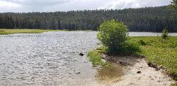
Pintler Lake Campground and Picnic Area
Wise River, Montana
29.5 miles WCamp, Canoe, Kayak, and Swim near Wise River, Montana
Camp, Canoe, Kayak, Swim
Spring Hill Campground and Picnic Area
Anaconda, Montana
36.8 miles NWSpringhill Campground is located in Beaverhead-Deerlodge National Forest in southwestern Montana. Warm Springs Creek runs right next to the campground is popular among anglers who commonly catch...
Camp, Hike, Horseback, Mountain Bike, Swim
Lost Creek State Park
Anaconda, Montana
37.2 miles NCamp near Anaconda, Montana
Camp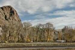
Barretts Station Park
Dillon, Montana
38.6 miles SThis is a great FREE campground right off the highway. There's tent and trailer sites, a water pump for drinking water, handicap accessible bathrooms. The campground continues across the river...
Camp, Rock Climb, Swim
Flint Creek Campground
Philipsburg, Montana
43.5 miles NWFlint Creek campground is a free campground of 3 acres providing 15 camp sites next to the Flint Creek. It is located in the Beaverhead-Deerlodge National Forest. Every spot has a firepit....
Camp 1.0 mi
Lewis & Clark Caverns
Whitehall, Montana
49.0 miles EThe Lewis & Clark Caverns State Park encompasses 3,015 acres that you can explore by foot, on a bike, in a canoe or in a tent. The most famous feature of the park is the Lewis & Clark...
Camp, Canoe, Cave, Hike, Mountain Bike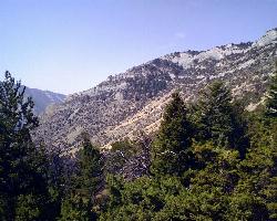
Lewis & Clark Caverns Campground
Whitehall, Montana
49.8 miles EThe Lewis & Clark Caverns Campground is a site that allows for a variety of different camping styles. With 40 campsites open for RV and tent camping, three cabins, and a tipi the Lewis &...
Camp


