Camp on the Boulder
Mc Leod, Montana
| Address: | Main Boulder Rd., Mcleod, MT |
| GPS: |
45°28'23.4"N 110°12'3.6"W Maps | Directions |
| State: | Montana |
| Disc Golf Holes: | 9 |
| Disc Golf Course Length: | 2090 feet |
| Disc Golf Tee Type: | Natural |
| Disc Golf Target Type: | Mach3 |
Disc Golf
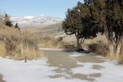
At a not for profit church camp. At 5,900' the mountain vistas are snow covered for 8 months of the year. 14 miles from Natural Bridge State Park and about a 3 hour drive from Yellowstone National Park. Half on mowed open grass near a stream and half in tall pines and boulders on a hillside. Private (No Fee)Courtesy of DiscGolfUnited.com
More Information
Add ResourceDirections
From Mc Leod, Montana
- Head northeast toward McLeod Main St (423 ft)
- Turn right onto McLeod Main St (0.1 mi)
- Turn right onto State Hwy 298 (11.6 mi)
- Continue onto Main Boulder Rd (2.7 mi)
- Continue onto NF-6639 (0.5 mi)
- Continue onto Main Boulder Rd (1.5 mi)
80 miles from Billing. I-90 west to Big Timber exit. Go south on Boulder Rd. to mile marker 3916.Courtesy of DiscGolfUnited.com

Other Folf Courses Nearby

Cooke City Disc Golf Course
Cooke City-Silver Gate, Montana
33.9 miles SChallenging. 16 trees & 2 tones. Not marked well - best to find a guide. The Cooke City Bike Shack has more info. Great scenery, in a great little Montana town. Public (No Fee)
Disc Golf
Mossy Pines at Battle Ridge Campground
Bozeman, Montana
41.4 miles NWGreat natural course in the heart of the Bridger Mountains. Targets are PVC tubes hanging from tree limbs. Navigation issues - bring map and/or guide. Public (No Fee)
Disc Golf
Rose Park
Bozeman, Montana
44.5 miles WPublic (No Fee)
Disc GolfNearby Campsites

East Rosebud Lake
Roscoe, Montana
33.0 miles SEA scenic backpacking trip through some of the most beautiful areas in the Beartooth Mountains of Montana, East Rosebud trail takes hikers into some of the more secluded parts of Montana.
Backpack, Camp, Canoe, Hike
Slough Creek Campground
Tower Junction, Yellowstone National Park
36.6 miles SSlough Creek campground is a small but very popular campground on the Northeast Entrance Road. Most of the campsites are situated right on the banks of Slough Creek where fishing is a favorite...
Camp
Hellroaring Creek Trail
Yellowstone National Park
37.9 miles SIf the name didn't scare you enough, the Hellroaring creek trail begins with an arduous descent down to the the Yellowstone River Suspension Bridge.The suspension bridge is a beautiful...
Camp, Hike, Swim
Pebble Creek Campground
Northeast Entrance, Yellowstone National Park
38.6 miles SPebble Creek is a popular campground for fishermen and those seeking a more quiet and smaller campground in Yellowstone National Park. The campsites can fill very early, so get there before 11 AM...
Camp
Tower Falls
Tower Junction, Yellowstone National Park
41.2 miles STower Fall is a waterfall on Tower Creek in the northeastern region of Yellowstone National Park, in the U.S. state of Wyoming. Approximately 1,000 yards (910 m) upstream from the creek's...
Camp, Hike
Mammoth Hot Springs Campground
Mammoth Hot Springs, Yellowstone National Park
41.9 miles SWMammoth Hot Springs Campground is the only campground in Yellowstone that is open to campers year-round. Campsites cannot be reserved and are available on a first come first served basis. It is...
Camp 0.1-5.2 mi
Mammoth Hot Springs
Mammoth, Yellowstone National Park
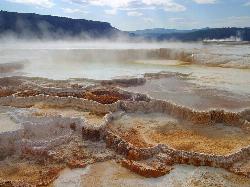
42.4 miles SWMammoth Hot Springs is a unique sight in Yellowstone National Park. The soft limestone in this area allowed the water to form colorful terraces. The extremely hot running water is clear and smooth,...
Camp, Hike
Indian Creek Campground Yellowstone
Mammoth Hot Springs, Yellowstone National Park
48.5 miles SWIndian Creek Campground is a quiet and secluded wooded campground within Yellowstone National Park, ideal for tent campers. It’s close to lots of hiking and fishing, and only a few miles to...
Camp


