C trail
Cedar City, Utah
| Address: | ~400-530 W Greens Lake Dr, Cedar City, UT 84720, USA |
| GPS: |
37°39'1.4"N 113°4'12.1"W Maps | Directions |
| State: | Utah |
| Trail Length: | 9.00 miles |
| MTB Difficulty: | Intermediate |
| Trail Type: | Loop |
| MTB Trail Type: | Singletrack |
Mountain Bike
The C Trail is a great trail for any rider to boost their confidence on switchbacks. This trail is not an easy trail but includes some good climbs up and should be done by those who are in good physical condition. C Trail has several starting points, depending on when and how the rider wants to make it to the top. The real fun of the ride starts at the top as riders will make their way down through many twists and turns. All of the turns on the trail do not require any special technique, but good balance and good braking. Most of the turns will have burms on them, which makes it easier to go down. On the upper portion of the trail, there will be less trail maintence done by volunteers, making it more rocky and difficult.
This trail takes people up to the top of the C letter in Cedar Monuntain. This trail is very popular for hikers, so riders need to be aware when they are heading downhill for any hikers.
More Information
Never modify trail features. Ride trails when they're dry enough that you won't leave ruts. Speak up when you see others on the trail and always yield to hikers, horses, and others coming uphill. Always ride on the established trail.
Read MoreDirections
From Cedar City, Utah
- Head south on N Main St toward E Center St (1.3 mi)
- Sharp left onto S Main St (318 ft)
- Turn right onto Fir St (0.5 mi)
- Fir St turns right and becomes W 1325 S (210 ft)
- Turn left onto S 550 W (0.2 mi)
- Turn left onto W Greens Lake DrDestination will be on the right(279 ft)

Other Mountain Bike Trails Nearby
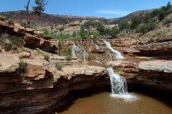
Toquerville Falls
La Verkin, Utah
26.2 miles SNothing says desert oasis quite like driving for 5.5 miles through winding sandy roads to find a favorite swimming hole with ledges, falls, and even a ladder to climb up to the best jumping spots....
Dive, Hike, Mountain Bike, Swim 3.3 mi
Guacamole Mesa
Virgin, Utah
29.3 miles SGuacamole Mesa, also known by locals as the Whole Guacamole, is an advanced level biking trail in Virgin, Utah (just outside of Hurricane). The trail starts in a climb up the mesa that features tight...
Hike, Mountain Bike
Zion National Park
Hurricane, Utah
31.1 miles SThis is a unique place in the world. Sandstone,carved from wind, water and ice have created icons to visitors. The buttes, landings, bends, mounts and mountains have all been given names over the...
Camp, Hike, Mountain Bike, Swim
Springdale Town Loop
Hurricane, Utah
32.0 miles SThis trail has tight twisty turns and is fun at all times of the year.
Mountain Bike
Crypto-Goosebumps
La Verkin, Utah
32.1 miles SProceed west on the trail about 1 mile to Junction of JEM and Hurricane Rim. This is the return point on the trail. Turn right onto the Rim trail and follow it to the outhouse and...
Mountain Bike 6.9 mi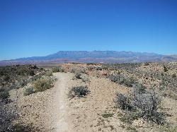
J.E.M. Trail
La Verkin, Utah
32.2 miles SThe J.E.M. trail is one of the many exciting trails located just outside of Hurricane, Utah. It is connected with the More Cowbell and Dead Ringer trails and is the longest of all three trails...
Hike, Mountain Bike 8.4 mi
Grafton Mesa
Springdale, Utah
33.7 miles SGrafton Mesa located just outside of Springdale, Utah and Zion National Park is one of the more difficult and jarring trails in southern Utah. This trail is recommended for experienced mountain...
Mountain Bike
Gooseberry Mesa
Hurricane, Utah
35.6 miles SThe Gooseberry Mesa trail, located near Hurricane, Utah, is one of the most scenic mountain biking trails in southern Utah. Located near the Little Creek Mesa trail, it features beautiful mesas,...
Mountain Bike 7.2 mi
Wire Mesa
Hurricane, Utah
35.8 miles SWire Mesa, located outside of Hurricane, Utah, is a beautiful single track trail near trails like Gooseberry Mesa and Little Creek Mesa. Known for being an introductory trail to the more difficult...
Mountain Bike 5.1 mi
Dead Ringer
Virgin, Utah
36.6 miles SThe Dead Ringer trail is one of three biking trails located just outside of Hurricane, Utah. Starting at the JEM trailhead, bikers start on a winding, up and down trail that runs parallel to the JEM...
Hike, Mountain Bike 3.4 mi
More Cowbell
Virgin, Utah
36.6 miles SThe More Cowbell loop, located outside of Hurricane, Utah, is a beginner level bike trail that gives riders a good feel for what mountain biking is like. It is a great practice run for bigger, more...
Hike, Mountain Bike
Gould's Rim trail
Hurricane, Utah
36.9 miles SRide the long steady double track climb for about two miles. After you reach the top of the hill, watch for the singletrack branching off to the right about 0.5 miles further...
Mountain Bike
Hurricane Rim trail
Hurricane, Utah
37.3 miles SThis is fun but rocky trail along the rim above the Virgin river. There are some sections of slab rock that are awkward, and there are several areas of exposure of several hundred feet...
Mountain Bike
Prospector - Church Rocks Loop
Hurricane, Utah
37.7 miles SWThe trail leaving the parking area is a wide track for about the first quarter mile until a signed intersection where you will turn left (south) onto singletrack and start your ride...
Mountain Bike
Broken Mesa Rim
St. George, Utah
40.3 miles SWThe trail starts at the northern end of the Red Cliffs Desert Reserve. You'll make an initial singletrack climb up some fairly buff switchbacks. At 0.5 mile, the trail reaches a...
Mountain Bike
Thunder Mountain Trail
Panguitch, Utah
41.0 miles ENice dry creek run with nice big berms. Courtesy of Singletracks.com
Mountain Bike 11.3 mi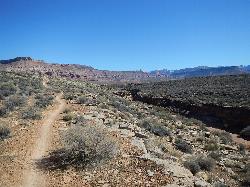
Grapevine Trail
Washington, Utah
41.6 miles SWThe Grapevine trail located near Washington, UT is a unique trail that connects to several other trails in the area such as the Prospector trail and the Church Rocks trail. What makes the Grapevine...
Hike, Mountain Bike 13.0 mi
Little Creek Mesa
Hurricane, Utah
41.7 miles SThe Little Creek Mesa trail, located just outside of Hurricane, Utah, is a single track trail in the red rock mesas around the city of Hurricane. It is intermediate level but not so difficult that it...
Mountain Bike 18.8 mi
Church Rocks
Washington, Utah
41.7 miles SWThe Church Rocks hike near Hurricane, Utah, about a half hour outside of St. George, is another hidden gem outside of Zion National Park. Similar to the Slick Rock Trail in Moab, there are lots...
Hike, Mountain Bike
Ice House Loop
St. George, Utah
42.7 miles SWThe Ice House loop is a great trail in the St George area to try and ride. This portion of the trail is actually part of the Broken Mesa Loop, and is about 6.8 miles of the 15 mile loop. What...
Mountain BikeNearby Campsites
Dixie National Forest
Cedar City, Utah
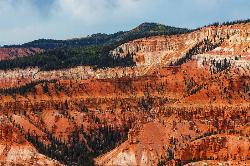
21.7 miles EDixie National Forest is an often forgotten/hidden gem in Cedar City. It is over 2 million acres of beautiful red rock canyons and trees. Dixie Forest isn't only limited to rocks and...
Backpack, Camp, Hike
Zion National Park
Hurricane, Utah
31.1 miles SThis is a unique place in the world. Sandstone,carved from wind, water and ice have created icons to visitors. The buttes, landings, bends, mounts and mountains have all been given names over the...
Camp, Hike, Mountain Bike, Swim
Sand Hollow State Park
Hurricane, Utah
40.5 miles SWSand Hollow is the closest thing to a tropical paradise in the middle of the Utah desert, near Hurricane, Utah. It features a beach area, places to cliff jump, swim, and off-road with your ATV. There...
Camp, Canoe, Dive, Kayak, Swim
Sunset Campground
Bryce, Utah
49.1 miles ESunset Campground is one of Bryce Canyon's two main campgrounds. It consists of 101 campsites linked together with three loops, loops A B and C. There are 20 tent-only campsites, 80 tent and RV...
Camp
North Campground
Bryce, Utah
49.4 miles ENorth Campground is one of the two main campgrounds in Bryce Canyon National Park. The campground is open to RV and tent campers. Thirteen RV sites available for reservation and 86 RV and tent sites...
Camp


