


Bonneville Shoreline Ogden North Of 12th
Ogden, Utah
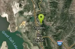
| Address: | ~Sunrise Trail, Ogden, UT 84414, USA |
| GPS: |
41°18'35.6"N 111°56'5.9"W Maps | Directions |
| State: | Utah |
| Trail Length: | 8.00 miles |
| MTB Difficulty: | Advanced |
| Trail Type: | Out & Back |
| MTB Trail Type: | Singletrack |
Mountain Bike
The north side of 12th street on the shoreline is much more exposed and technical than the south side. It also has less traffic, mostly experienced mountain bikers and trail runners. This trail is rideable much of the winter as it's southern exposure helps the trail stay snow free. Great for pre and post season but too hot during the summer unless you ride early. They have been working a lot of new trails and improvements since 2010! Courtesy of Singletracks.com
More Information
Never modify trail features. Ride trails when they're dry enough that you won't leave ruts. Speak up when you see others on the trail and always yield to hikers, horses, and others coming uphill. Always ride on the established trail.Read More
- Plan Ahead and Prepare
- Travel & camp on durable surfaces
- Dispose of waste properly
- Leave what you find
- Minimize campfire impacts
- Respect wildlife
- Be considerate of other visitors
Directions
From Ogden, Utah
- Head east on 24th St toward Grant Ave (1.3 mi)
- Turn left onto S 1200 E St/Harrison Blvd (2.6 mi)
- Continue straight to stay on S 1200 E St/Harrison Blvd (1.1 mi)
- Continue onto N Mountain Rd (2.7 mi)
- Turn right onto 2750 N St (161 ft)

Other Mountain Bike Trails Nearby
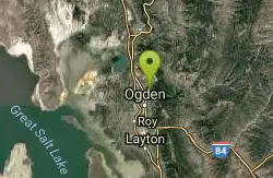
Bonneville Shoreline Trail - Ogden Section
North Ogden, Utah
1.9 miles SWThere's lots of good climbing on this great after-work ride. Go as far as you like and then turn around. If you want a great downhill, make a loop by following the trail all the way...
Mountain Bike
Bonneville Shoreline
North Ogden, Utah
1.9 miles SWOut and back, you will cross a creek 3 times, only one time will you have to ride through it, there is a mixture of short climbs and very short technical sections, great training ride...
Mountain Bike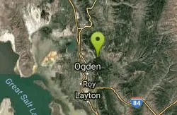
Southern Skyline Trail - Pineview Reservoir
Ogden, Utah
2.0 miles EThe trail starts with a gradual, smooth climb for the first half mile. For the next mile or so, the trail is a strenuous and technical climb. Once you reach the top of the mountain, follow the ridge...
Mountain Bike
Northern Skyline
Ogden, Utah
2.0 miles EHead North on the trail and climb, climb, climb. Smoothly at first, bumpier later on. Much of this trail climbs in excess of a 10% grade so be fit. Turn around whenever you've had...
Mountain Bike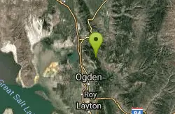
Cutler Flat
Eden, Utah
5.1 miles NThere's a number of trails in this area, none marked and not that easy to follow. Go with a local or get ready for some exploration. The main Cutler Flat route starts up the road...
Mountain Bike 2.9 mi
Pineview Reservoir
Eden, Utah
5.7 miles ELocated on the backside of the Wasatch Front, Pineview Reservoir in the Ogden River Canyon is home to stunning views of the water, sandy beaches, the Southern Skyline trail, paved ramps, and...
Camp, Canoe, Hike, Kayak, Mountain Bike, Swim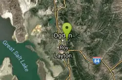
Bonneville Shoreline Ogden South Of 12th
Ogden, Utah
5.8 miles SThe most popular trail in Ogden with lots of runners, hikers, bikers, etc. Great for pre and post season but too hot during the summer unless you ride early morning. Most of it is...
Mountain Bike
Wheeler Creek
Ogden, Utah
6.1 miles SEThe first couple miles of this ride are rather uninteresting. Although the old dort road is closed to bikes, it still feels like a road. Fortunately, it's nicely wooded. When you...
Mountain Bike
Southern Skyline
Eden, Utah
6.5 miles SEThis trail is much like the Northern Skyline--you will climb, climb and then climb--over 3,000 vertical if you go all the way up. While the vertical is a little higher than the...
Mountain Bike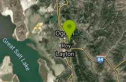
Bonneville Shoreline Trail, Ogden, UT, USA
Ogden, Utah
7.4 miles SBackpack, Hike, and Mountain Bike near Ogden, Utah
Backpack, Hike, Mountain Bike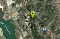
Coldwater Canyon Overlook
Ogden, Utah
7.5 miles SEVery scenic and fairly easy out and back. The view at the top overlooking Ogden canyon is spectacular! Bombing the downhill on the return trip can be a blast, but only if you're not...
Mountain Bike
Sardine Peak Loop
Ogden, Utah
7.6 miles SEThis is a real great loop. This climbs up about 2.5 miles on Coldwater Overlook Trail where the trail cuts back to the left or out to the right climbing toward Sardine Peak. Heading...
Mountain Bike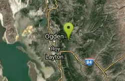
Green Pond Loop
Huntsville, Utah
7.9 miles SEGreenpond is the busiest trail in the snow basin network so check your speed or you'll be running over families hiking with kids and giving us bikers a bad rep. I like doing this trail...
Mountain Bike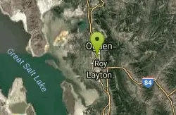
Riverdale Parkway
Ogden, Utah
8.1 miles STake the paved trail to the south, and after the Frisbee Golf course there is a lot of single track network trails to ride. You'll feel close to nature while still being close...
Mountain Bike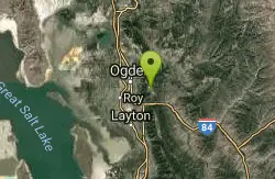
Needles
Ogden, Utah
8.6 miles S2004 is Snowbasin's official "kick off" year for summer activities, and they have done an outstanding job building, marking and maintaining their network of trails! The trails are all...
Mountain Bike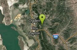
Snowbasin Resort
Ogden, Utah
8.8 miles SESnowbasin Resort's singletrack biking trails provide 26 miles of riding that connect to additional Forest Service Trails creating up to 50 miles of mountain biking enjoyment! Snowbasin Resort...
Mountain Bike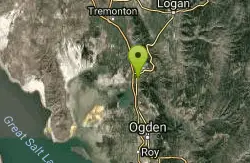
White Rock Loop
Perry, Utah
11.2 miles NWStiff climb. There are a ton of switchbacks on this trail. After the first mile you will come to an intersection where you can head left up the Perry Canyon trail (this is the trail...
Mountain Bike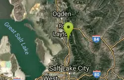
Bonneville Shoreline Trail - Layton Section
Kaysville, Utah
18.2 miles SThis trail has some great singletrack and pretty good variety for being so close to town. There are open, exposed areas, narrow and twisty through the trees, and even a couple spooky...
Mountain Bike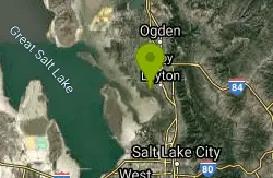
Great Salt Lake Shorelands Preserve
Layton, Utah
18.9 miles SBeautiful scenery with great trails that are close to the shoreline of the Great Salt Lake. Great for any skill level or just a leasurly walk on a beautiful day.
Hike, Mountain Bike 1.8 mi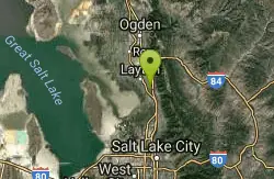
Gailey Trail At Nicholls Park (Nicholls Hollow)
Kaysville, Utah
19.9 miles SThe shady Gailey Trail at Nicholls Park (also known as Bair Creek or Nicholls Hollow) is perfect for walking, running, and enjoying the fresh air of nature all four seasons of the...
Hike, Mountain BikeNearby Campsites
Pineview Reservoir
Eden, Utah
5.7 miles ELocated on the backside of the Wasatch Front, Pineview Reservoir in the Ogden River Canyon is home to stunning views of the water, sandy beaches, the Southern Skyline trail, paved ramps, and...
Camp, Canoe, Hike, Kayak, Mountain Bike, Swim 5.6 mi
Antelope Island Lakeside Trail
Syracuse, Utah
24.5 miles SWThe Lakeside Trail is a kid-friendly trail with great views and many bugs. This is a gorgeous scenic hike winding around part of the Great Salt Lake. The trail on Antelope Island that runs about...
Camp, Hike, Horseback
Antelope Island State Park
Syracuse, Utah
25.1 miles SWLocated just 41 miles north of Salt Lake City, Antelope Island State Park encompasses a vast selection of outdoor activities and spectacular scenery providing a peaceful nature experience. Experience...
Backpack, Camp, Hike, Horseback, Mountain Bike 3.9 mi
Providence Canyon
Logan, Utah
28.1 miles NNice wooded canyon full of trails and campgrounds. The trails offer several different options that you can turn into a loop or an out-and-back. Beautiful scenery all along the way! You can do the...
Camp, Hike, Mountain Bike
Holbrook Trailhead
Bountiful, Utah
30.0 miles Sairsoft feaild woth bunkers
Airsoft, Backpack, Camp, Paintball, Snowshoe
Mill Creek Canyon
Salt Lake City, Utah
43.7 miles SMill Creek is an out and back with over 1000 ft of elevation gain. The lower section of the ski trail gets a lot of foot traffic, but the upper section (above Elbow Fork) is generally very quiet....
Camp, Cross-country Ski, Snowshoe
Spruces Campground
Salt Lake City, Utah
48.7 miles SCamping isn't free. See USDA.gov for details. If you know the coordinates of the sledding hill here, please comment.
Camp, Sled


