Blackfoot, ID 83221, United States
Blackfoot, Idaho
| Address: | Blackfoot, ID 83221, USA |
| GPS: |
43°11'25.7"N 112°20'41.9"W Maps | Directions |
| State: | Idaho |
Hike and Mountain Bike
More Information
Add ResourceNever modify trail features. Ride trails when they're dry enough that you won't leave ruts. Speak up when you see others on the trail and always yield to hikers, horses, and others coming uphill. Always ride on the established trail.
Read MoreBe courteous, informed, and prepared. Read trailhead guidelines, stay on the trail, and don't feed the wildlife.
Read MoreDirections
From Blackfoot, Idaho
- Head on N Broadway St (1 ft)
Other Mountain Bike Trails and Hiking Trails Nearby
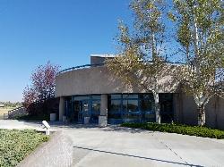
Hell's Half Acre Northbound Rest Stop
Blackfoot, Idaho
8.7 miles NEThis is a well maintained rest area with facilities to keep you happy as you travel through Idaho. This rest stop on Interstate 15 about 9 miles north of Blackfoot Idaho has nice picnic tables and...
Hike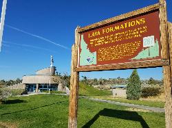
Hell's Half Acre Southbound Rest Stop
Blackfoot, Idaho
8.8 miles NEThis is a well maintained rest area with facilities to keep you happy as you travel through Idaho. This rest stop on Interstate 15 about 15 miles South of Idaho Falls has nice picnic tables and...
Hike
Firth River Bottoms
Firth, Idaho
11.0 miles NEWhether you like to ride horses, picnic, camp, fish, learn about the past, or play baseball, this park has something for everyone. The Parks & Recreation Department and the IDaho Education...
Camp, Canoe, Hike 0.1 mi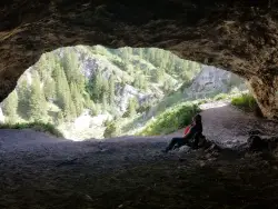
40 Horse Cave
Firth, Idaho
20.9 miles EThe naming of the cave comes from a story of two men who were caught in a bad storm. Upon hiking, these two guys were able to find the cave. One of them commented to the other, "This cave could...
Cave, Hike
Gem Lake Bike Park
Idaho Falls, Idaho
22.2 miles NEBuilt on an old quarry, Gem Lake Bike Park offers a variety of riding. There's no shortages of berms here and there's plenty of space to get some speed, drop in or climb out. The trails here...
Mountain Bike
Cave Trail
Pocatello, Idaho
22.3 miles SMountain Bike near Pocatello, Idaho
Mountain Bike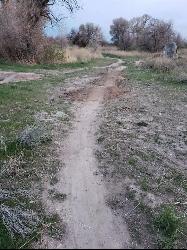
Ryder Park
Idaho Falls, Idaho
23.5 miles NEAdjacent to the pond at Ryder Park is a great little jump park. There are a few different lines of varying difficulty, all of them rather short, and a nice bike path to climb back to the top and do...
Mountain Bike 0.2-9.7 mi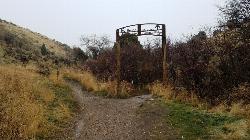
City Creek
Pocatello, Idaho
23.9 miles SThe City Creek Management Area (CCMA) Trail System is a vast network of trails maintained by the City of Pocatello. There are trails to go up and others to come down. Most trails come back to the...
Hike, Horseback, Mountain Bike
17 Mile Cave
Idaho Falls, Idaho
24.3 miles NSeventeen Mile Cave is a lava tube, a cave created by the pocket in which lava used to flow and was left empty when the volcano became inactive. The cave gets its name from its location, just 17...
Cave, Hike 0.9 mi
Hell's Half Acre Lava Walk
Blackfoot, Idaho
25.6 miles NThe Lava Trails traverse the desert of the Snake River Plain through contorted landscapes created from multiple lava flows. These Hawaiian-type lava flows are associated with the stretching of the...
Hike 1.0-7.5 mi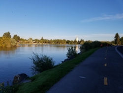
Idaho Falls Greenbelt
Idaho Falls, Idaho
26.0 miles NEThe Idaho Falls Greenbelt is one of Idaho Falls charms located in the heart of Idaho Falls, next to the historic Idaho Falls downtown. The paved foot-trail is approximately 6 miles around,...
Hike
Sportsman's Park American Falls Reservoir
Aberdeen, Idaho
27.5 miles SWThis beautiful 30-acre park is a multi-use area with facilities and activities for a variety of recreational uses. Situated adjacent to the American Falls Reservoir, it provides primary access to...
Camp, Canoe, Hike
Slate Mountain/Gibson Jack Trail
Pocatello, Idaho
27.8 miles SThe Gibson Jack trail offers great views of Southeastern Idaho and a favorite trail among moutain bikers. This trail is a continuation of the West Fork Mink Creek trail and takes travelers further...
Hike, Horseback, Mountain Bike
Gibson Jack/west Fork
Pocatello, Idaho
28.6 miles SThe West Fork is a mix of single/doubletrack with some fun rock spots and good scenery throughout. After climbing about 1500' in elevation, it's all downhill on singletrack on the...
Mountain Bike 3.2 mi
Kinney Creek Trail
Pocatello, Idaho
29.8 miles SKinney Creek Trail is in the Caribou-Targhee National Forest near Pocatello. This is a 6.4 out-and-back trail that takes you to the Indian Mountain Summit. It gives you views of Idaho...
Hike
Driveway Canyon Trail
Inkom, Idaho
30.1 miles SMotorcycle traili. source: fs.usda.gov
Mountain Bike
Cherry Springs
Pocatello, Idaho
30.4 miles SJust a short distance from Pocatello, the Cherry Springs Nature Area has thick green vegetation, an abundance of birds and viewing other wildlife. Take a picnic and a camera and head out on the...
Hike
Slate Mountain Trail
Pocatello, Idaho
31.7 miles STrail is open to cross-country skiing, snowshoeing, mountain biking, horse riding, hiking. source: fs.usda.gov
Mountain Bike
Valve House Draw
Pocatello, Idaho
32.5 miles SThis trail is a motorized, doubletrack trail, as well as a great place to go hiking. For the most part, the trail is all uphill through a forest. There are some technical sections of the route as...
Cross-country Ski, Hike, Horseback, Mountain Bike
West Fork Mink Creek Trail
Pocatello, Idaho
32.6 miles SA popular trail in the Eastern Idaho area for horseback riding, hiking, and mountain biking. The trail is a little over three and a half miles of single track riding. For the majority of the trail...
Hike, Horseback, Mountain BikeNearby Campsites

Firth River Bottoms
Firth, Idaho
11.0 miles NEWhether you like to ride horses, picnic, camp, fish, learn about the past, or play baseball, this park has something for everyone. The Parks & Recreation Department and the IDaho Education...
Camp, Canoe, Hike
Sealander Park
Idaho Falls, Idaho
19.4 miles NEThe story of Sealander park begins with Carl Sealander. Leaving Sweden in 1893 at the age of seventeen, Carl worked in mining communities across Colorado and Utah before meeting his wife, Lizzie...
Camp
Blackfoot River Crossing at Trail Creek Road
Firth, Idaho
22.2 miles EIn Soda Springs, ID 34 N for ~11 mi; R (E) on Blackfoot River Rd at mp 69.9; zero odometer; travel 10.4 mi; stay to the L as rd turns to gravel at mi 10.9; mi 13.7 pass Mill Canyon Campground; mi...
Camp
Sportsman's Park American Falls Reservoir
Aberdeen, Idaho
27.5 miles SWThis beautiful 30-acre park is a multi-use area with facilities and activities for a variety of recreational uses. Situated adjacent to the American Falls Reservoir, it provides primary access to...
Camp, Canoe, Hike
Scout Mountain Campground
Pocatello, Idaho
34.4 miles SScout Mountain Campground is located on beautiful Scout Mountain at an elevation of 6,900 feet, just 13 miles south of Pocatello, Idaho. Scout Mountain is part of the Mink Creek area, a popular...
Camp, Hike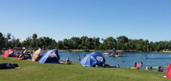
Jefferson County Lake (AKA Rigby Lake)
Rigby, Idaho
41.6 miles NERigby Lake has long been a favorite swimming hole for those in the area. The county has taken it well under its wing and made it a buzzing spot on any warm summer day. Along with the long standing...
Camp, Canoe, Dive, Kayak, Sled, Swim
Pipeline Campground
American Falls, Idaho
42.0 miles SW5 campsites on the Snake River near American Falls Reservoir. Fishing for trophy brown and rainbow trout. More than 30 species of migratory shorebirds rest at the reservoir. From the campground, you...
Camp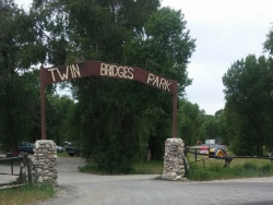
Twin Bridges Park
Rexburg, Idaho
44.2 miles NETwin Bridges is a campground 12 miles South East of Rexburg on S. 600 E. It is maintained by Madison County Parks Department. It is a 27 acre park of pristine land rich with wildlife on the Snake...
Camp, Canoe 0.6-2.0 mi
North Menan Butte ('R' Mountain)
Menan, Idaho
44.8 miles NEThe North Menan Butte is more commonly known to the locals and college students as R Mountain. Many kids know it better as Ou'R' Mountain. The butte is a rare and unique geological area and provides...
Camp, Cave, Hike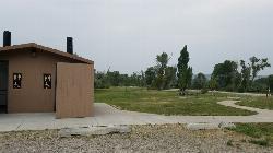
Kelly Island Campground
Ririe, Idaho
45.4 miles NEThis is a BLM campground with 14 campsites for RVs or tents and 1 group campsite. Daily Rates $5-20 Showers No Bathrooms Vault...
Camp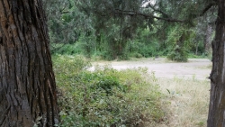
Wolf Flats Recreation Area
Ririe, Idaho
46.3 miles NEWolf Flats is a completely free, dispersed, undeveloped camping area with 25 locations to camp. Some areas are large enough to accommodate groups of 50 people.
Camp
Paramount Wall / Blanche Rock
Ririe, Idaho
46.5 miles NESitting high above the road, the routes at Paramount offer great exposure and relief from the afternoon summer sun. Chuck Oddette, Steve Reiser and Jed Miller established the routes from 1989...
Camp, Horseback, Rock Climb
Hawkins Reservoir Campground
Arimo, Idaho
46.9 miles S14 campsites on a small impoundment, which despite its size, attracts a great deal of wildlife. Spring through fall, plovers, sandpipers and geese frolic in the mudflats and swim in the waters....
Camp, Canoe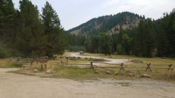
Table Rock Campground
Ririe, Idaho
48.5 miles NETable Rock / Poison Flat Campground is located at the Caribou-Targhee National Forest which occupies over 3 million acres and stretches across southeastern Idaho, from the Montana, Utah, and Wyoming...
Camp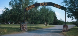
Beaver Dick Park
Rexburg, Idaho
49.0 miles NEBeaver Dick is a park 4.5 miles west of Rexburg, Idaho on Hwy 33. It's a 9.5 acre park that passes next to the west bank of the Henry Fork of the Snake River; it's a popular...
Camp, Canoe, Disc Golf, Swim
Big Hole Dispersed Campsites
Ririe, Idaho
49.7 miles NEA dispersed campsite is simply an unestablished and unmaintained area where people camp. Often, this means that there is a campfire or other basic campsite feature to identify the site and that's...
Camp


