Black Canyon Trail - Little Pan Loop
Black Canyon City, Arizona
| Address: | ~34580 Old Black Canyon Hwy, Black Canyon City, AZ 85324, USA |
| GPS: |
34°3'9.8"N 112°9'7.3"W Maps | Directions |
| State: | Arizona |
| Trail Length: | 24.00 miles |
| MTB Difficulty: | Intermediate |
| Trail Type: | Lariat |
| MTB Trail Type: | Singletrack |
Mountain Bike
The Black Canyon National Recreation Trail will be a 79-mile hiking, mountain biking and equestrian trail stretching from the Sonoran Desert lowlands in Phoenix to the high grasslands of Prescott Valley. Although the trail is not yet complete, the care given to engineering the trail for a great mountain bike singletrack experience is already obvious.This 24-mile “Little Pan Loop†has emerged as one of the favorite segments of the portion of the trail that has been completed. It may take you longer than you think: bring lots of water!The Ride: Leave from the Black Canyon City TH following the singletrack southwest.At mile .85 the trail forks. The right fork is the trail heading towards Prescott. If you follow it for 1.4 miles to the edge of the Agua Fria River you’ll get some great views of the river bottom and will get to try your skills on some tight switchbacks. However, take the left fork for this “Little Pan Loop†lollipop ride.Keep your speed down until you are familiar with the trail. There are a couple tight corners you don’t want to overshoot or you will launch out into space. Before you know it you will make the first of four crossings of the Agua Fri River and will start realizing it’s great to be on a trail designed for mountain bikes. There are no steep or technical ascents or descents. It’s basically a middle-chain-ring kind of ride.At mile 8.7 you begin the loop portion of the lollipop. These directions assume a clockwise approach to this loop. Turn left out to the gravel road and be alert and follow the signs for the “Black Canyon Trail.†Keep your sense of humor when you get close to the river. The trail winds around old motorized trails through the sandy river bottom and you’ll feel like you are on a treasure hunt for awhile. The trail eventually climbs out of the river bottom and is, once again, a great singletrack that’s easy to follow.At mile 11.93 you intersect (“tee†junction) the main Black Canyon Trail singletrack. Turning left will take you in the direction of Phoenix. You will want to turn right and head for your third river crossing. If you leave the river following signs with an American flag on them, backtrack. You’re following the wrong trail. Keep looking for signs indicating you are on the “Black Canyon Trail.â€At mile 15.25 you will complete the lollipop loop and begin retracing your route back to the TH.At mile 23.95 you arrive back at the TH – tired and happy. Courtesy of Singletracks.com
More Information
Never modify trail features. Ride trails when they're dry enough that you won't leave ruts. Speak up when you see others on the trail and always yield to hikers, horses, and others coming uphill. Always ride on the established trail.
Read MoreDirections
From Black Canyon City, Arizona
- Head west on Palm Ln Dr toward Old Black Canyon Hwy (0.1 mi)
- Turn left onto Old Black Canyon Hwy (1.3 mi)
- Turn right onto Warner Rd (0.2 mi)
- Turn right (246 ft)

Other Mountain Bike Trails Nearby

Black Canyon Trail
Black Canyon City, Arizona
0.2 miles SEThis discription is for the Table Mesa trail head which has 1.5 miles (N) out on the Black Canyon Trail to the Little Pan Loop. The Little pan loop will take you down to the Agua Fria...
Mountain Bike
Emery Henderson
Phoenix, Arizona
12.0 miles SBct(Black Canyon Trail) trail head features paved parking and restrooms. From here you can head south on relatively flat ground, or North, working into the desert hills, on multiuse...
Mountain Bike 5.8 mi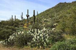
Go John Trail
Cave Creek, Arizona
17.5 miles SEThe Go John Trail is a 5.8 mile loop trail outside of Cave Creek, Arizona, that is moderately trafficked, used by both hikers and mountain bikers. It is an excellent opportunity to view the desert...
Hike, Horseback, Mountain Bike
Sidewinder-Ocotillo-West Loop
Phoenix, Arizona
18.0 miles SThis loop starts at Carefree Hwy and 7th Ave, be aware there is limited parking at the trailhead. The Ocotillo part of the trail is relatively flat and the Sidewinder part has some good...
Hike, Horseback, Mountain Bike
Cave Creek Park
Cave Creek, Arizona
19.1 miles SEMultiple singletrack loops, just explore and find what works best for you. Watch out for hikers and horses.
Mountain Bike 21.4 mi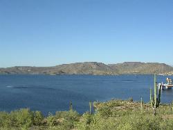
Spur Cross to Lake Pleasant
Cave Creek, Arizona
19.1 miles SEStart at the Flat Tire Bike Shop and head north on Spur Cross Road. You will arrive at the Spur Cross Conservation Ranch in 3.2mi. From there enter the Maricopa Trail system and follow the signs...
Mountain Bike
Ocotillo/Ridgeback/Sidewinder Loop Trail
Phoenix, Arizona
20.6 miles SGreat moderate loop which includes a summit, great views and Classic Sonoran Desert scenery. Multiple access points and other connecting trails allows for the loop to be changed if...
Hike, Horseback, Mountain Bike
Sidewinder, Apache Vista, Ocotillo Loop Trail
Phoenix, Arizona
20.7 miles SThis is an excellent loop that is very well maintained, well sign posted and if you include the vista summit trail, a moderate work out. Massive Car Park, good restrooms, and plenty of...
Hike, Horseback, Mountain Bike
Apache Wash Sidewinder Loop Trail
Phoenix, Arizona
20.8 miles SHorseback and Mountain Bike near Phoenix, Arizona
Horseback, Mountain Bike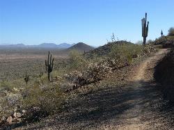
Dixie Mountain Loop Trail
Phoenix, Arizona
21.8 miles SThe main loop trail at Phoenix's Sonoran Preserve provides plenty of options for either a short walk or a longer hike. The elevation gain is accumulated through small ups-and-downs along the...
Hike, Horseback, Mountain Bike 2.8 mi
Desert Tortoise
Phoenix, Arizona
21.8 miles SAt just over a mile long, Desert Tortoise is a doubletrack connector to the Valle Verde Trail. Very good hiking area with a good range of difficulty levels. Starts with a short climb from the...
Hike, Mountain Bike
Dixie Mountain Loop with Two Summits
Phoenix, Arizona
21.8 miles SHike, Horseback, and Mountain Bike near Phoenix, Arizona
Hike, Horseback, Mountain Bike
Hawk's Nest/Desert Tortoise/Dixie Mountain Loop
Phoenix, Arizona
21.8 miles SA nice moderate trail through great desert scenery crossing creeks and twisting and turning around the hills. Provides a loop opportunity between Hawk's Nest Trail, Valle Verde Trail,...
Hike, Horseback, Mountain Bike
Hawk's Nest Trail and Dixie Mountain Loop
Phoenix, Arizona
21.8 miles SModerate Trail providing access from the Car Park to all other trails. Directly links to Desert Tortoise Trail and Dixie Mountain Loop. Good hiking shoes/boots recommended....
Hike, Horseback, Mountain Bike
Sonoran Trail
Phoenix, Arizona
21.8 miles SThe Sonora Trail is smooth, but hilly, and has a 10-12 mile loop course that is well marked at intersections. This ride is suitable for many levels, but beginners should have good...
Mountain Bike
Deem Hills Inner Loop
Phoenix, Arizona
22.1 miles SHike and Mountain Bike near Phoenix, Arizona
Hike, Mountain Bike
Deem Hill
Phoenix, Arizona
22.1 miles SThe trail starts out going north around the mountain then heads uphill and gives you some good inclines with switch backs. Total incline is approximately 650'. The trail is rocky and...
Mountain Bike
Deem Hills Circumference Trail
Phoenix, Arizona
22.5 miles SDeem Hills s a 10.5 mile loop trail located near Phoenix, Arizona. The trail is rated as moderate and primarily used for mountain biking.
Hike, Horseback, Mountain Bike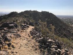
Sunrise Mountain Trail
Peoria, Arizona
23.1 miles SThe Sunrise Mountain Trail can be found within the suburban area of Peoria, Arizona; it is made of up 3 sequential loops; each loop harder than the last. The trail is easy to find, as...
Hike, Mountain Bike
Sonoran Preserve North
Phoenix, Arizona
23.4 miles SNice rolling single track with many steep sustained climbs and fun flawy downhills. No technical features but good fitness is needed. If you do all the climbs and loops can get in over...
Mountain BikeNearby Campsites
Verde Hot Springs
Camp Verde, Arizona
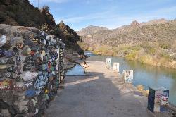
33.0 miles NEVerde Hot Springs are a few natural hot spring pools located along the Verde River, near Sedona, Arizona. Once a resort, now all that remains are the foundations and the hot pools...
Camp, Hike, Hot Springs 0.1-7.8 mi
Wolf Creek Falls
Sedona, Arizona
33.2 miles NWWolf Creek Falls is a wonderful space to explore and be immersed in nature. With it's six miles of trails, beautiful waterfalls and two campgrounds this is the perfect place to spend a...
Camp, Hike, Swim 0.4 mi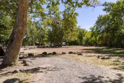
Clear Creek Campground
Camp Verde, Arizona
38.8 miles NEWest Clear Creek flows along the boundary of this desert canyon country camp and is a popular place for hiking, swimming, wading and fishing. Cool water species such as smallmouth bass and green...
Camp, Hike, Swim 2.1 mi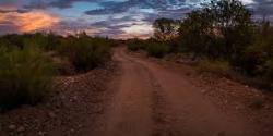
Lower Salt River Nature Trail
Fort McDowell, Arizona
45.0 miles SEThe Lower Salt River Nature Trail is a scenic walk to take at the Tonto National Forest. This trail provides stunning views as you walk alongside the Salt River. This rustic trail is older and less...
Camp, Hike
Beaver Creek Dispersed Camping
49.1 miles NE
Free dispersed camping on the cliffs above Beaver Creek.
Camp
Beaver Creek Campground
Camp Verde, Arizona
49.4 miles NECamp, Canoe, Kayak, and Swim near Camp Verde, Arizona
Camp, Canoe, Kayak, Swim


