


Bent Creek
Asheville, North Carolina
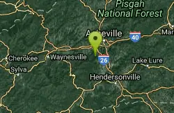
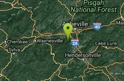
| Address: | ~375 Wesley Branch Rd, Asheville, NC 28806, USA |
| GPS: |
35°29'34.3"N 82°37'5.4"W Maps | Directions |
| State: | North Carolina |
| Trail Length: | 30.00 miles |
| MTB Difficulty: | Intermediate |
| Trail Type: | Network |
| MTB Trail Type: | Singletrack |
Hike and Mountain Bike
Bent Creek is the go-to trail system for the greater Asheville area, and with the deeply-ingrained mountain bike culture in the Asheville/Brevard area, and Western North Carolina in general, Bent Creek sees a ton of traffic. There are several different trailheads and ways to access the trail, and many weekends all of the trailheads are all filled to overflowing. Cars that can't fit into the parking lots line the nearby forest roads, and Lake Powhatan Campground is usually filled as well. This might be the busiest mountain bike trail in North Carolina... and as you'll see if you ride here, there's a good reason for it!The trail system is composed of two very different areas: a flatter area, and a much more mountainous section on the ridge.There are numerous singletack and doubletrack trails in the lower, much flatter areas near Lake Powhatan. These are great beginner trails or warm up/cool down sections. These segments include Deerfield Loop, Explorer Loop, Homestead, Lower Sidehill Trail, Pinetree Loop, and others.If you're looking for a climbing challenge and/or some killer high-speed descending, the place to go is definitely towards the ridge. Green's Lick is the widely-renowned descent, and if you're riding here, you have to ride it! Green's Lick is very fast, flowy, jump-filled, full of massive berms and wallrides to rail (even bigger than those on Ingles Field Gap and Wolf Branch), a few rock gardens, several technical rock features, and offers absolutely no respite until you reach the bottom! Other trails on the ridge that work well as climbs or descents include Ingles Field Gap, Wolf Branch, and others. Courtesy of Singletracks.com
More Information
Never modify trail features. Ride trails when they're dry enough that you won't leave ruts. Speak up when you see others on the trail and always yield to hikers, horses, and others coming uphill. Always ride on the established trail.Read More
Be courteous, informed, and prepared. Read trailhead guidelines, stay on the trail, and don't feed the wildlife.Read More
- Plan Ahead and Prepare
- Travel & camp on durable surfaces
- Dispose of waste properly
- Leave what you find
- Minimize campfire impacts
- Respect wildlife
- Be considerate of other visitors
Directions
From Asheville, North Carolina
- Head east on S Pack Square (154 ft)
- Turn left onto N Pack Square (289 ft)
- Turn right onto Broadway St (0.3 mi)
- Slight right onto the Interstate 240 W/U.S. 70 W ramp to U.S. 74 Alternante (0.2 mi)
- Merge onto I-240 W/US-70 WContinue to follow I-240 W(1.5 mi)
- Keep right at the fork to continue on I-26 E, follow signs for Interstate 240 W/Interstate 26 E/Interstate 40 (5.1 mi)
- Take exit 33 for NC-191 toward Blue Ridge Parkway (0.2 mi)
- Turn left onto NC-191 S/Brevard Rd (2.0 mi)
- Turn right onto Bent Creek Ranch Rd (0.3 mi)
- Slight left onto Wesley Branch RdDestination will be on the right(1.5 mi)

Other Mountain Bike Trails and Hiking Trails Nearby
Little Hickory Top
Asheville, North Carolina
0.7 miles WDogs: Leashed
Hike, Horseback, Mountain Bike
Hardtimes Connector / 661
Asheville, North Carolina
0.7 miles WThis trail connects to the main trail system and the big climbs to the top from the Hardtimes Trailhead. This section of singletrack lies in the flatter terrain but leads to the big climbs up the...
Hike, Horseback, Mountain Bike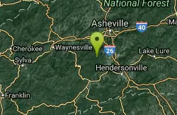
Trace Ridge #354
Horse Shoe, North Carolina
5.0 miles SWForest Road and singletrack. This trail is exhilarating. Climb up the forest road, the single track (rolling and steep), then bust up the technical rock garden and youre home free to fast and furious...
Mountain Bike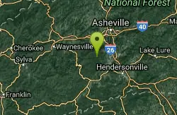
Fletcher Creek
Horse Shoe, North Carolina
5.4 miles SWFrom trailhead parking lot, ride back down gravel road. After concrete bridge, turn left on Wash Creek Road (FS5000). After proceeding up hill on FS5000 for about 2 miles, turn left onto Spencer...
Mountain Bike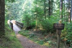
Middle Fork
Horse Shoe, North Carolina
5.5 miles SWThis trail is about 8.8 miles of fire road and 2.6 miles of singletrack. There are 2 gated roads from the trailhead take the one on the right, Fletcher Creek Road (AKA The Never Ending Road). It...
Mountain Bike 3.7 mi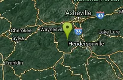
Bradley Creek Road
Horse Shoe, North Carolina
7.5 miles SWThis graded FS road gradually ascends from the Bradley Creek Trail (#351) on its way to Yellow Gap Road. Enjoy the surrounding hardwood forest as you climb - the road itself is not too exciting to...
Mountain Bike 0.2-2.3 mi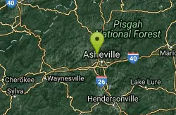
Richmond Hill
Asheville, North Carolina
8.8 miles NHilly, wooded course. Handmade signs and Astro Turf tees. Alt. pins on 14 holes. Long pants smart (poison ivy). Parking lot OB. Public (No Fee) Richmond Hill Park is Asheville's largest wooded...
Disc Golf, Hike, Mountain Bike 2.2 mi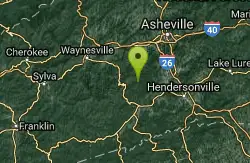
Pilot Cove / Slate Rocks / 102
Canton, North Carolina
9.3 miles SWFun descent with several stream crossings along the way. Nothing too steep but this trail doesn't get a lot of use so there are usually a few trees down along the way. Beautiful scenery and a...
Mountain Bike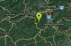
South Mills River Trail
Canton, North Carolina
10.5 miles SWThis is an easy out-and-back trail that follows the South Fork Mills River with several swinging bridge crossings that leads to the site of the old Cantrell Lodge. From the trail head, the left side...
Hike, Mountain Bike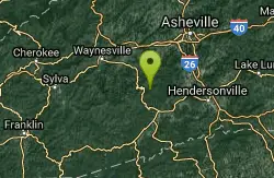
Pink Beds
Pisgah Forest, North Carolina
11.5 miles SWGreat warm up/cool down trails or beginner trails for Pisgah, as they are mostly flat. The bikeable portion of this trail will dump you out on a gravel road near the South Mills River trail after...
Mountain Bike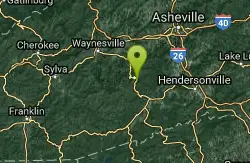
Pilot Cove Loop Trail
Pisgah Forest, North Carolina
13.2 miles SWThis short 1.8-mile trail has some steep, very tight singletrack and some very tight turns... but it is well-worth riding because it houses one of the best views in Pisgah National Forest! Definitely...
Hike, Mountain Bike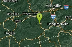
Big East Fork
Canton, North Carolina
14.3 miles SWBig East Fork is a trail along Pigeon River with a variety of activities available. This trail travels through heavy forest along the river with beautiful, clear water. There are several waterfalls...
Backpack, Hike, Kayak, Swim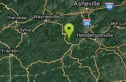
FS 5058
Pisgah Forest, North Carolina
14.6 miles SW5058 is a gated gravel road that many riders use as an easy climb to the tops of some wicked singletrack descents. Park near the horse barns off of FS 477 to access this climb....
Mountain Bike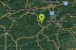
Fs 477
Pisgah Forest, North Carolina
14.7 miles SWParts of this road are gated, so you can't drive all the way through to the other end, which is further up 276. There is camping all along this road, which is great as it can be used...
Mountain Bike
North Slope
Pisgah Forest, North Carolina
15.6 miles SThis trail is only open from October 15 - April 15. This trail is very worn and is more suitable to hiking, but it is an interesting bike trail nonetheless. Start from the parking lot and ride across...
Hike, Mountain Bike 3.4 mi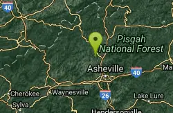
Alexander Mountain Bike Park
Alexander, North Carolina
15.6 miles NNice, challenging singletrack. Not overly technical, with some nice climbs and nice flowing sections, and a nice view of the French Broad river. However, this trail does get overgrown sometimes from...
Hike, Horseback, Mountain Bike
Brevard Bike Path
Brevard, North Carolina
15.7 miles SGovernment at it's best. Great way to get from town to the forest. If you are camping at the Davidson River Campground you can connect to the bike via Eastatoe Trail. The Bike path is great way...
Mountain Bike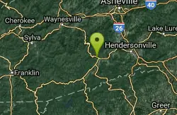
Davidson River Campground
Pisgah Forest, North Carolina
15.8 miles SDavidson River Recreation Area offers camping and outdoor activities for the whole family. The campground boasts several loops of shaded campsites, as well as access to hiking trails, fishing spots,...
Camp, Hike, Swim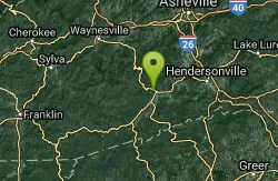
Thrift Cove
Brevard, North Carolina
15.8 miles SStart riding the trail at the back of the parking lot. Go about 0.1 miles and turn right up Thrift Cove trail. Follow the red blazes and turn left at the intersection with Grass Road. On the way back...
Hike, Mountain Bike
Avery Creek / 327
Brevard, North Carolina
15.8 miles SWThe bottom end of Avery Creek can be accessed via FS 477, and the top can be accessed via the Buckwheat Knob trail, the Black Mountain trail, or the Club Gap trail. Avery Creek descends for 3.2 miles...
Hike, Mountain BikeNearby Campsites
Davidson River Campground
Pisgah Forest, North Carolina
15.8 miles SDavidson River Recreation Area offers camping and outdoor activities for the whole family. The campground boasts several loops of shaded campsites, as well as access to hiking trails, fishing spots,...
Camp, Hike, Swim
Rocky Bluff
Hot Springs, North Carolina
28.6 miles NWPlay in water in creek, shallow at times.
Camp, Hike, Swim
Mount Mitchell Area
Trinity, North Carolina
31.6 miles NENice family swimming place right by N. F. campgrounds in the South Toe River (cold) in the Pisgah N. F... Fees: Yes This site is closed seasonally.
Camp, Swim
Mt. LeConte Lodge
Sylva, North Carolina
36.9 miles WHigh atop Mt. LeConte in the Great Smoky Mountains National Park, LeConte Lodge® is the highest guest lodge in the eastern United States. It is situated on an open glade just below the summit of...
Camp, Hike, Horseback, Rock Climb
Cosby Campground
Cosby, Tennessee
37.8 miles NWCamp and Swim near Cosby, Tennessee
Camp, Swim
Old Forge Campground
Bethany, Tennessee
41.6 miles NOld Forge Campground and Recreation Area is a small campsite perfect for campers looking for a primitive experience. Old Forge is located on the beautiful Jennings Creek in the Cherokee National...
Camp, Hike, Swim
Horse Creek Campground
Chuckey, Tennessee
42.6 miles NHorse Creek Campground is a popular day use and camping location in the Horse Creek Recreation Area. This beautiful spot in the Cherokee National Forest is a great location to connect with nature...
Camp, Swim


