


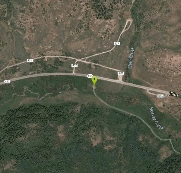
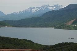
Beaver Creek Trail
Kamas, Utah
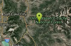
| Address: | ~UT-150, Kamas, UT 84036, USA |
| GPS: |
40°37'51.3"N 111°11'12.5"W Maps | Directions |
| State: | Utah |
| Trail Length: | 8.00 miles |
| MTB Difficulty: | Beginner |
| Trail Type: | Out & Back |
| MTB Trail Type: | Doubletrack |
Mountain Bike
Most of the trail is easy hard-packed dirt, perfect for a first-time alpine bike ride. Except for a not-to-tough hill right at the beginning, the trail is fairly flat. More technical trails, such as the Cedar Loop trail, head uphill at several locations along the Beaver Creek Trail. Courtesy of Singletracks.com
More Information
Add ResourceNever modify trail features. Ride trails when they're dry enough that you won't leave ruts. Speak up when you see others on the trail and always yield to hikers, horses, and others coming uphill. Always ride on the established trail.
Read More- Plan Ahead and Prepare
- Travel & camp on durable surfaces
- Dispose of waste properly
- Leave what you find
- Minimize campfire impacts
- Respect wildlife
- Be considerate of other visitors
Directions
From Kamas, Utah
- Head north on S Main St toward E Center St (56 ft)
- Turn right at the 1st cross street onto UT-150 E/E Center StContinue to follow UT-150 EParts of this road may be closed at certain times or days(7.4 mi)
- Turn rightDestination will be on the right(1.5 mi)
Other Mountain Bike Trails Nearby
Jordanelle Perimeter Trail
Heber City, Utah
8.4 miles WThe Jordanelle Perimeter Trail is an expert trail found along the edges of the Jordanelle Reservoir. Several portions of the trail run along dirt roads as well as mountain bike only trails. The park...
Mountain Bike
Chopped Coyote Loop
Heber City, Utah
13.1 miles SWThe Coyote Canyon Loop lies northeast of Heber. It's a big ride that's best reserved for conditioned riders. Much of the trail is easier-intermediate technical, but there are many tight...
Mountain Bike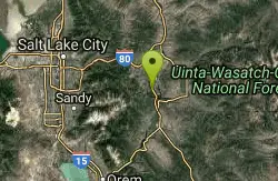
Spin Cycle
Park City, Utah
14.0 miles WFamous Park City trail. Natural half pipe (the actual Spin Cycle portion) that is tons of fun (and makes it pretty much a one-way, downhill only trail). Don't forget to take a picture...
Mountain Bike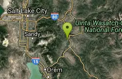
Wasatch Mountain State Park
Park City, Utah
14.7 miles WWasatch Mountain State Park, in beautiful Heber Valley, is Utahs most developed state park. Tucked away in the beautiful Wasatch Mountains, the park is both a summer and winter...
Mountain Bike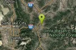
Rockport State Park
Peoa, Utah
15.0 miles NWRockport State Park has several trails for a variety of experience levels. The park is located right next to Rockport Reservoir, near Peoa Utah. One of the easiest and longest trails in the...
Mountain Bike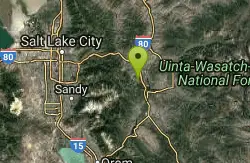
Snow Park Loop
Park City, Utah
15.3 miles WSnow Park loop at Deer Valley is one of those rare, blue ribbon singletrack loops that all mountain bikers are constantly searching for! Deer Valley has world renowned ski runs and...
Mountain Bike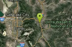
Round Valley
Park City, Utah
15.3 miles WNice network of intermediate singletrack in a open space preserve. Good veiws, some nice curvy sections of trail. Well maintained good training ride. Like most of the trails in Park City,...
Mountain Bike
Solamere
Park City, Utah
15.6 miles WSolamere is a great downhill! Fast and relatively smooth downhill with sweeping switchbacks and a fun rock garden two or three straightaways into the ride. Drops you off on Solamere...
Mountain Bike
SOS
Park City, Utah
15.7 miles WSOS is an advanced .3 mile descent off of the Prospector Trail down to Prospector Park. It's a steep drop, so hang on tight!
Mountain Bike
Corvair
Park City, Utah
15.8 miles WCorvair is another high-alpine Park City trail that starts near the beginning of TG and crosses and intersects with TG several times. It's narrow, steep, and rocky up high....
Mountain Bike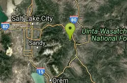
Deer Valley Resort Bike Park
Park City, Utah
15.8 miles WThe Deer Valley area encompasses all of the trails in the Deer Valley ski resort, butting up against PCMR near Empire Lodge, and running all the way North to Jordanelle and Deer Valley...
Mountain Bike
Prospector Area
Park City, Utah
15.9 miles WTrailhead/entrance is off of Mellow Mountain Road. .75 miles of uphill to get to the top of the mountain. Once there, you have a couple of choices for your downhill... either Solamere...
Mountain Bike
Poison Creek
Park City, Utah
16.2 miles WThe Poison Creek trail is a paved greenway that runs through the town of Park City. It connects to several other greenway trails, allowing you to easily get around town by bike without...
Mountain Bike
Gina's Daly Bypass
Park City, Utah
16.3 miles WGina's Daly Bypass is half singletrack, half gravel road. It connects from Gravedigger and Daly Grind down to Sweeney's and town.
Mountain Bike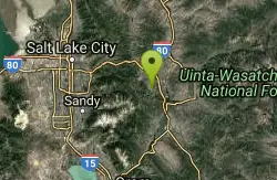
John's Trail
Park City, Utah
16.3 miles WOne of the great Park City Mountain Resort trails. It can be accessed by lift service from PayDay or by riding up King Road or Sweeney's singletrack. Ride this twisting trail through...
Mountain Bike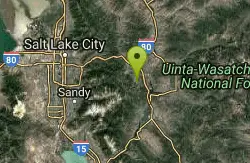
Masonic
Park City, Utah
16.3 miles WMasonic is a twisty, techy oldschool-style descent off the top of the knob down to Lost Prospector. The trees and undergrowth grow in close to the narrow tread, and the challenging...
Mountain Bike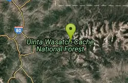
Mirror Lake
Salt Lake City, Utah
16.4 miles EMirror Lake is a beautiful recreation area packed with opportunities to experience nature. Because of the stillness and clarity of the water, Mirror Lake is a beautiful reflection of the surrounding...
Backpack, Hike, Mountain Bike, Swim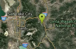
Lost Prospector
Park City, Utah
16.5 miles WLost Prospector is a well-constructed machine-built trail that makes up one big side of the Gambel Oaks trail system. Rocky in places and loamy in others, this trail provides some fantastic views...
Mountain Bike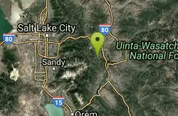
Moosehouse
Park City, Utah
16.5 miles WMoosehouse is a rocking .6-mile advanced descent from John's 99 to Gravedigger. This trail is an oldschool-style freeride trail with drops, sharp berms, and super steep, loamy terrain....
Mountain Bike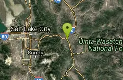
Historic Union Pacific Rail Trail
Park City, Utah
16.5 miles WThe Historic Union Pacific Rail Trail is a 28-mile non-motorized trail. One end of the trail begins in Park City and follows Interstate 80 through Wanship and Coalville to Echo...
Mountain BikeNearby Campsites

Hell Hole Lake
Evanston, Utah
20.9 miles NEThe first 250 feet of this trail are on private property with access provided by Kayenta. The trail is actually the northern portion of Dry Wash. Sand and boulders litter the wash making hiking...
Camp, Hike, Horseback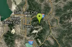
Spruces Campground
Salt Lake City, Utah
23.7 miles WCamping isn't free. See USDA.gov for details. If you know the coordinates of the sledding hill here, please comment.
Camp, Sled 1.6-14.1 mi
Mount Timpanogas
Provo, Utah
27.5 miles SWMt. Timp, as the locals call it, is the 2nd highest mountain in the Wasatch range (only Mt. Nebo is higher). What sets "Timp" apart is its location. It towers over the Provo, Orem, Pleasant...
Camp, Hike, Horseback, Swim
Mill Creek Canyon
Salt Lake City, Utah
28.0 miles WMill Creek is an out and back with over 1000 ft of elevation gain. The lower section of the ski trail gets a lot of foot traffic, but the upper section (above Elbow Fork) is generally very quiet....
Camp, Cross-country Ski, Snowshoe
Y-Mountain Summit Trail
Provo, Utah
34.7 miles SWY Mountain is located directly east of Brigham Young University (BYU) in Provo, Utah, United States. The Slide Canyon/Y Mountain Trail leads to a large block Y located 1.2 miles (1.9 km) from a...
Camp, Hike
Holbrook Trailhead
Bountiful, Utah
38.5 miles NWairsoft feaild woth bunkers
Airsoft, Backpack, Camp, Paintball, Snowshoe 4.7 mi
Fifth Water Hot Springs
Provo, Utah
38.8 miles SAKA Diamond Fork Hot Springs A beautiful drive and a 2.5 mile hike along the river will end you at an amazing set of hot springs that's well worth the trip. There's a variety of...
Backpack, Camp, Hike, Hot Springs, Mountain Bike, Swim


