


Bear Creek Hot Springs
Irwin, Idaho

| Address: | Forest Rd 058, Irwin, ID 83428, USA |
| GPS: |
43°16'33.3"N 111°13'56.6"W Maps | Directions |
| State: | Idaho |
| MTB Trail Type: | Singletrack |
| Trails/Routes: | 13.2-13.5 mi |
Backpack, Camp, Hike, Horseback, Hot Springs, and Mountain Bike
Bear Creek Hot Springs is a 15 mile out and back trail with a hot spring at the end. The trail is not well marked and is only recommended for very experienced outdoorsmen and primarily used for hiking. It is also popular for horses and motorcycles. During archery season, the area near the pool is a popular area for a hunting camp. The pool itself is about 10ft x 10ft. Most of the time, this soak is pretty secluded so it's often a clothing optional soak. Just be courteous of others when they're there.
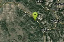
Mapped Route/Trail Distances
| Route #1 | 13.2 miles Round Trip |
| High Trail (fewer creek crossings) | 13.5 miles Round Trip |
More Information
Never modify trail features. Ride trails when they're dry enough that you won't leave ruts. Speak up when you see others on the trail and always yield to hikers, horses, and others coming uphill. Always ride on the established trail.
Read MoreBe courteous, informed, and prepared. Read trailhead guidelines, stay on the trail, and don't feed the wildlife.
Read More
Be careful. Pay attention to posted signs and always test the waters before you get in. Some hot springs can get up to boiling temperatures. Be sure to drink plenty of water to combat the dehydrating effect of the spring.
Be respectful of other soakers and the hot spring. Don't hog the pool. Camp at least 200 yards away and keep fires in designated areas. Keep your pets out of the water and never pee in thermal feature. Glass bottles should never go near a hot spring.
- Plan Ahead and Prepare
- Travel & camp on durable surfaces
- Dispose of waste properly
- Leave what you find
- Minimize campfire impacts
- Respect wildlife
- Be considerate of other visitors
Directions
From Irwin, Idaho
- Head southeast toward Old Irwin Rd (161 ft)
- Turn left onto Old Irwin Rd (0.1 mi)
- Turn right onto US-26 E (6.2 mi)
- Turn right onto Forest Rd 277 (0.4 mi)
- Turn right to stay on Forest Rd 277 (0.1 mi)
- Turn left to stay on Forest Rd 277 (1.7 mi)
- Sharp left onto Forest Rd 076 (2.6 mi)
- Turn right onto Bear Creek Rd (5.6 mi)
- Turn rightDestination will be on the left(0.3 mi)
The trail follows Bear Creek upstream (West) from the trailhead. The main trail crossed the river six times in the first four miles. Before each set, there's a detour to the right (North) that will take you up the hill and around the crossings. That will really save you when the water's higher. The first set has four crossings and the second set has two. At about 4 miles, you'll come to the North Fork of Bear Creek. If you've been detouring, it will look like another up and around detour. Don't do it. Follow the trail to cross over the North Fork and continue. About a mile further, you'll see Warm Springs Creek come in on your left (South). That's the really hard way to get there. Follow Bear Creek another 1/4 mile and watch off to your left(South) for a dirt bike trail up the hill. At this point, the leisurely hike is pretty much over. Follow the trail up South the hill. At one point, you'll cross over a little ravine. After that, there's about a mile or less to go. There's a pretty good campsite near the springs and the trail goes right to it.
wishfulangel
6/2/15 7:51 pm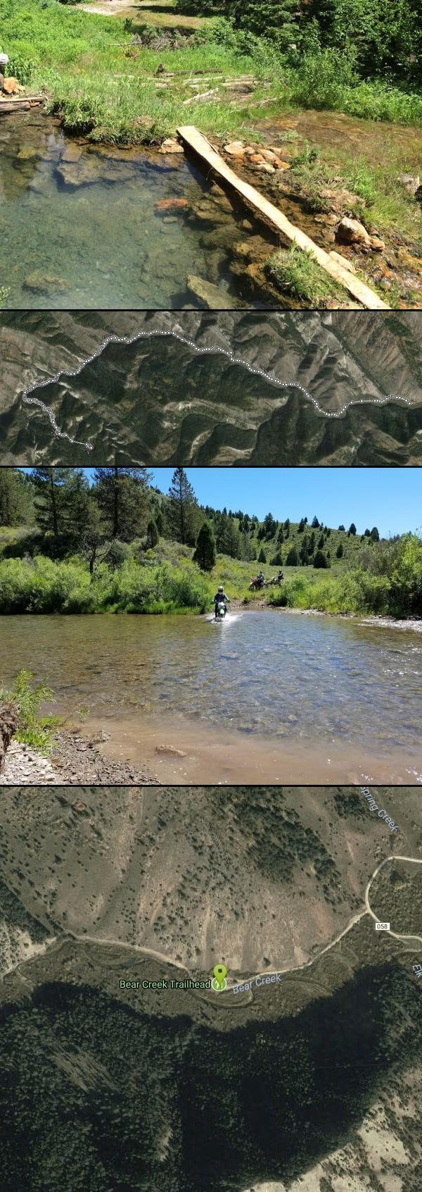 The actual hot springs pool. About 10x20 and a perfect temperature. courtesy of Victor Walker↗

 Dirt Bike Crossing by Lauren Brewer
 Beautiful start to the hike. If only we didn't have to cross that stream so often... courtesy of Victor Walker↗
 Love the steam in the morning air courtesy of Victor Walker↗
 Not a lot of shade on the way down. courtesy of Victor Walker↗
 This is a fresh-water spring where you can get cold clean water. And some pools to soak in when it i courtesy of Victor Walker↗

Trails
Distance ?
13.2 miles Round TripElevation Gain ?
1,183 feetReal Ascent ?
1,779 feetReal Descent ?
596 feetAvg Grade (2°)
3%Grade (-18° to 25°)
-33% to 47%Distance ?
13.5 miles Round TripElevation Gain ?
1,180 feetReal Ascent ?
1,924 feetReal Descent ?
744 feetAvg Grade (2°)
3%Grade (-18° to 25°)
-33% to 47%Elevation differences are scaled for emphasis. While the numbers are accurate, the cut-away shown here is not to scale.
Other Mountain Bike Trails, Hiking Trails, Horseback Trails, Hot Springs, and Backpacking Trails Nearby
Bear Creek Campground at Palisades
Irwin, Idaho
3.7 miles NPalisades Reservoir is ideal for water skiing in the summer and features many picnic spots and boat docks. The area forest service hosts nine campgrounds containing 181 family units. Boat launch...
Camp, Hike, Horseback, Mountain Bike
Calamity Campground
Irwin, Idaho
3.7 miles NCalamity Campground is located just 55 miles east of Idaho Falls, Idaho. This is the perfect area to access the Palisades Reservoir and enjoy the water activities available there. The water here is...
Camp, Canoe, Hike, Kayak, Mountain Bike, Swim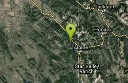
Palisades Hot springs
Swan Valley, Idaho
5.7 miles SELegend has it... The hot water flows right into the lake. Feel free to dig your own little hot tub in the sand.
Hot Springs, Swim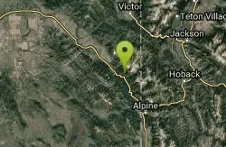
Sheep Creek/little Elk Connection
Irwin, Idaho
6.0 miles NEThe trail headed up hill is extremely rigorous. Some walking will be necessary at first. Follow the climb about 1.5 miles till you reach a plateau. The trail divides and heads south...
Mountain Bike 3.9 mi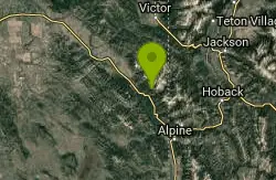
Little Elk Creek Trail
Irwin, Idaho
6.1 miles NEBackpack, Hike, Horseback, and Mountain Bike near Irwin, Idaho
Backpack, Hike, Horseback, Mountain Bike 3.3-10.0 mi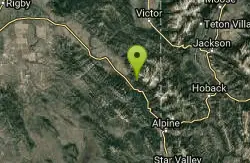
Sheep Creek Trail
Irwin, Idaho
6.6 miles NEHike and Mountain Bike near Irwin, Idaho
Hike, Mountain Bike 13.8 mi
Big Elk Creek
Irwin, Idaho
6.7 miles NEBig Elk Creak Campground is a very versitile campground with plenty of activities to keep busy. Campgrounds are available, with three group sites that include picnic tables and campfire rings. There...
Backpack, Camp, Canoe, Hike, Horseback, Kayak 23.8 mi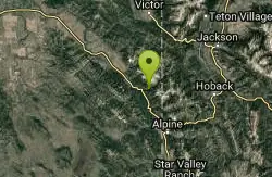
Big Elk Creek Trail
Irwin, Idaho
7.0 miles NENon-motorized trail open to MTB. source: fs.usda.gov
Mountain Bike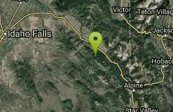
Red Ridge Trail
Swan Valley, Idaho
7.6 miles NWOHV trail. source: fs.usda.gov
Mountain Bike
Long Gulch/Indian Trail
Swan Valley, Idaho
7.6 miles NWOff Highway Vehicles (OHV) less than or equal to 50 inches wide, Mountain Biking, Horse Riding, hiking. source: fs.usda.gov
Mountain Bike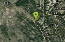
Hunts Corral
Irwin, Idaho
8.4 miles NNon-motorized use only. source: fs.usda.gov
Mountain Bike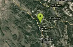
Indian Creek Campground (Palisades)
Irwin, Idaho
8.5 miles EPalisades Reservoir is a picturesque body of water in eastern Idaho on U.S. Highway 26 near the Idaho & Wyoming border and about 25 miles west of Jackson Hole Wyoming. The reservoir is nestled...
Camp, Hike, Horseback, Swim 5.6-8.3 mi
Palisades Creek Trail / Lakes and Waterfall Canyon
Irwin, Idaho
8.5 miles NPalisades Creek Trail is located about 50 miles southeast of Idaho Falls and about 60 miles west of Jackson Hole WY in Swan Valley Idaho. The four mile hike up to lower Palisades Lake or the 6.2 mile...
Backpack, Camp, Hike, Horseback, Mountain Bike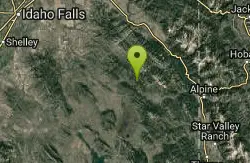
South Fork Bear Creek Trail
Wayan, Idaho
8.6 miles SWOHV trail. source: fs.usda.gov
Mountain Bike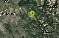
Flat Iron Trail
Swan Valley, Idaho
10.1 miles NWOHV trail. source: fs.usda.gov
Mountain Bike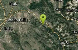
Echo/Indian Creek Trail
Swan Valley, Idaho
13.4 miles NWOHV trail. source: fs.usda.gov
Mountain Bike
Fall Creek Falls
Swan Valley, Idaho
13.5 miles NWFalls Campground is located next to the Snake River near beautiful Swan Valley, only 45 miles east of Idaho Falls, Idaho. Mixed growth cottonwood trees provide partial shade, and grassy meadows with...
Camp, Cave, Hike, Kayak, Swim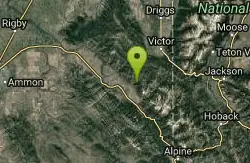
North/South Rainey Creek Trails
Irwin, Idaho
13.6 miles NMotorcycle trail. source: fs.usda.gov
Mountain Bike
South Fork Fall Creek Trail
Swan Valley, Idaho
13.6 miles NWOHV trail.
Mountain Bike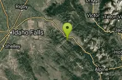
Echo Canyon aka Fall Creek
Ririe, Idaho
13.8 miles NWTrail goes to the top of Deadhorse Ridge for some amazing views. Double-track, single-track, and gravel road. Length: 15 miles
Mountain BikeNearby Campsites
Bear Creek Campground at Palisades
Irwin, Idaho
3.7 miles NPalisades Reservoir is ideal for water skiing in the summer and features many picnic spots and boat docks. The area forest service hosts nine campgrounds containing 181 family units. Boat launch...
Camp, Hike, Horseback, Mountain Bike
Calamity Campground
Irwin, Idaho
3.7 miles NCalamity Campground is located just 55 miles east of Idaho Falls, Idaho. This is the perfect area to access the Palisades Reservoir and enjoy the water activities available there. The water here is...
Camp, Canoe, Hike, Kayak, Mountain Bike, Swim 13.8 mi
Big Elk Creek
Irwin, Idaho
6.7 miles NEBig Elk Creak Campground is a very versitile campground with plenty of activities to keep busy. Campgrounds are available, with three group sites that include picnic tables and campfire rings. There...
Backpack, Camp, Canoe, Hike, Horseback, Kayak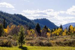
Big Elk Campground
Irwin, Idaho
6.7 miles NEBig Elk Creek Campground is a very versitile campground with plenty of activities to keep busy. Campgrounds are available, with three group sites that include picnic tables and campfire rings. There...
Camp
Indian Creek Campground (Palisades)
Irwin, Idaho
8.5 miles EPalisades Reservoir is a picturesque body of water in eastern Idaho on U.S. Highway 26 near the Idaho & Wyoming border and about 25 miles west of Jackson Hole Wyoming. The reservoir is nestled...
Camp, Hike, Horseback, Swim 5.6-8.3 mi
Palisades Creek Trail / Lakes and Waterfall Canyon
Irwin, Idaho
8.5 miles NPalisades Creek Trail is located about 50 miles southeast of Idaho Falls and about 60 miles west of Jackson Hole WY in Swan Valley Idaho. The four mile hike up to lower Palisades Lake or the 6.2 mile...
Backpack, Camp, Hike, Horseback, Mountain Bike
Alpine Campground
Alpine, Wyoming
11.0 miles SELocated two miles west of Alpine, Wyoming. Campground is situated in lodgepole pine trees, on flat terrain, and subject to wind and summer thunderstorms. Area is located near the south end of...
Camp
Falls Campground
Victor, Idaho
12.6 miles NWFalls Campground is located next to the Snake River near beautiful Swan Valley, only 45 miles east of Idaho Falls, Idaho. Mixed growth cottonwood trees provide partial shade, and grassy meadows...
Camp
Fall Creek Falls
Swan Valley, Idaho
13.5 miles NWFalls Campground is located next to the Snake River near beautiful Swan Valley, only 45 miles east of Idaho Falls, Idaho. Mixed growth cottonwood trees provide partial shade, and grassy meadows with...
Camp, Cave, Hike, Kayak, Swim
Pine Creek Campground
Victor, Idaho
20.6 miles NThe Pine Creek Campground has 10 single units and has restrooms.
Camp
Mike Harris Campground
Victor, Idaho
21.0 miles NEMike Harris Campground is located along scenic Teton Pass, just 5 miles from Victor, Idaho at an elevation of 6,200 feet. Visitors enjoy fishing, exploring local trails and sightseeing in this...
Camp
Bailey Lake
Jackson, Wyoming
26.0 miles EBailey Lake is located on the Guyandotte River in Wyoming and Mingo Counties in West Virginia, 3.3 miles (5.3 km) east of Justice. Originally referred to as Justice Reservoir, the lake was named by...
Camp, Hike, Horseback, Mountain Bike
Wolf Flats Recreation Area
Ririe, Idaho
29.3 miles NWWolf Flats is a completely free, dispersed, undeveloped camping area with 25 locations to camp. Some areas are large enough to accommodate groups of 50 people.
Camp
Darby Canyon Camping
Alta, Wyoming
29.5 miles NThere's no official campgrounds up the canyon but there are several dispersed campsites with existing fire lays. Please adhere to principles of Leave No Trace. Use existing fire lays and leave...
Camp
Moody Meadows
Driggs, Idaho
30.3 miles NWGood place for kids, they can ride bikes in the meadow, play in the stream, and camping is off of the road. Hiking, motorbiking, and horseback riding trails are abundant in the area.
Camp
Table Rock Campground
Ririe, Idaho
30.3 miles NWTable Rock / Poison Flat Campground is located at the Caribou-Targhee National Forest which occupies over 3 million acres and stretches across southeastern Idaho, from the Montana, Utah, and Wyoming...
Camp
Kelly Island Campground
Ririe, Idaho
32.3 miles NWThis is a BLM campground with 14 campsites for RVs or tents and 1 group campsite. Daily Rates $5-20 Showers No Bathrooms Vault...
Camp
Paramount Wall / Blanche Rock
Ririe, Idaho
32.7 miles NWSitting high above the road, the routes at Paramount offer great exposure and relief from the afternoon summer sun. Chuck Oddette, Steve Reiser and Jed Miller established the routes from 1989...
Camp, Horseback, Rock Climb
Big Hole Dispersed Campsites
Ririe, Idaho
33.2 miles NWA dispersed campsite is simply an unestablished and unmaintained area where people camp. Often, this means that there is a campfire or other basic campsite feature to identify the site and that's...
Camp 1.3-4.3 mi
Phelps Lake
Jackson, Wyoming
33.4 miles NEThe Phelps Lake trail, located in Teton National Park, Wyoming, is in one of the most scenic locations of the park. Usually overshadowed by nearby Jenny Lake, it can often be missed by visitors of...
Backpack, Camp, Dive, Hike, Swim


