


Batman
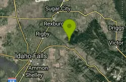
Ririe, Idaho
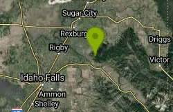
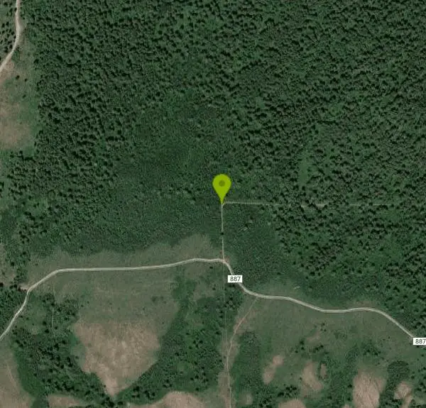
| Address: | ~Forest Rd 887, Ririe, ID 83443, USA |
| GPS: |
43°39'18.6"N 111°37'33.6"W Maps | Directions |
| State: | Idaho |
| Trail Length: | 2.00 miles |
| MTB Difficulty: | Intermediate |
| Trails/Routes: | 2.1 mi |
Mountain Bike
This trail features rolling terrain, and multiple short, steep downhill sections followed by short steep uphill sections. This trail follows the fence line. Watch out for cows (and cow droppings) as you fly past their watering trough. Access this trail from the intersection with Ken's Corner, or from the eastern terminus at the intersection with County Road 218.
Courtesy of MTBProject.com
More Information
Add ResourceNever modify trail features. Ride trails when they're dry enough that you won't leave ruts. Speak up when you see others on the trail and always yield to hikers, horses, and others coming uphill. Always ride on the established trail.
Read More- Plan Ahead and Prepare
- Travel & camp on durable surfaces
- Dispose of waste properly
- Leave what you find
- Minimize campfire impacts
- Respect wildlife
- Be considerate of other visitors
Directions
From Ririe, Idaho
- Head east on Smith St toward 1st E St (0.3 mi)
- Continue onto Archer Rd (3.6 mi)
- Turn right onto E 10000 S (1.1 mi)
- Turn right onto S Snake River Rd (335 ft)
- Continue straight to stay on S Snake River Rd (1.9 mi)
- Continue straight (0.4 mi)
- Slight left (0.2 mi)
- Turn left (0.4 mi)
- Continue onto Heise Rd (0.7 mi)
- Turn right to stay on Heise Rd (2.3 mi)
- Continue straight onto E 12000 S (0.9 mi)
- Continue straight (0.2 mi)
- Turn right (1.9 mi)
Trails
Distance ?
2.1 milesElevation Gain ?
-135 feetReal Ascent ?
351 feetReal Descent ?
486 feetAvg Grade (-1°)
-1%Grade (-14° to 14°)
-24% to 24%Elevation differences are scaled for emphasis. While the numbers are accurate, the cut-away shown here is not to scale.
Other Mountain Bike Trails Nearby
Randy's Cow Trail / Ken's Corner
Ririe, Idaho
0.1 miles SThis trail descends from the fence corner at the West end of Batman and continues down to Lyon's Creek Parking just off Lyon's road. The top of this trail is only a couple hundred yards from...
Mountain Bike
Kelly Canyon
Ririe, Idaho
0.7 miles SThe trail switchbacks up Kelly Mountain, hitting two brief red-line climbs before you get up on the top. The famed "Shale Chute" is back there somewhere (so this is part of the route for...
Mountain Bike 3.8 mi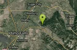
Kelly Mountain Trail
Ririe, Idaho
1.4 miles SEKelly Canyon Trail is a moderate, uphill trail that can be used by hikers, mountain bikers, and ATV riders. The trail features views of hills, mountains, trees, wildflowers, and some wildlife. Dogs...
Cross-country Ski, Hike, Mountain Bike, Snowshoe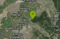
Cranky Cowboy
Herbert, Idaho
1.7 miles NMountain Bike near Herbert, Idaho
Mountain Bike 11.9 mi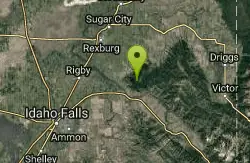
Waterfall Loop
Ririe, Idaho
1.7 miles ETrail is a mixture of single track, forest road and double track. Provides a variety of scenery. About 1400 feet of elevation change throughout the trail.GPS is a must unless you are going with...
Mountain Bike 1.7 mi
Buckskin Morgan Ridge
Ririe, Idaho
1.7 miles SECLOSED. This land is owned and managed by the US Forest Service and is not designated for use. As of July 2024, being caught mountain biking on this trail could recieve up to a $5000 fine and a...
Hike, Mountain Bike 5.7-8.1 mi
Space Cruz
Ririe, Idaho
1.7 miles SECLOSED. This land is owned and managed by the US Forest Service and the upper portions of this route are not designated for use. As of July 2024, being caught mountain biking on PINE LOOP or THE...
Cross-country Ski, Mountain Bike 1.1 mi
Hidden Vista / Pine Loop
Ririe, Idaho
1.7 miles SECLOSED. This land is owned and managed by the US Forest Service and is not designated for use. As of July 2024, being caught mountain biking on this trail could recieve up to a $5000 fine and a...
Hike, Mountain Bike
Kelly Canyon Loops
Ririe, Idaho
1.8 miles EThis mountain bike trail near Kelly Canyon Ski Area has several options available. Highlights are the views in all directions from the top of the mountain. Trails: Waterfall...
Mountain Bike 0.2-3.0 mi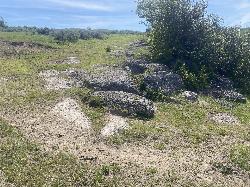
Biting Goat Trail
Ririe, Idaho
2.0 miles WPreviously known as The Cowboy Trail or the Old Cowboy Trail The Cowboy Trail is an older trail system that began revival in 2022 by Jared Klingonsmith. In 2024, it received approval to be...
Mountain Bike 1.8 mi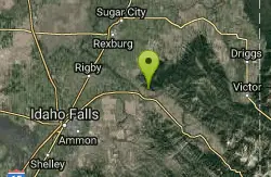
Crystal Cruise
Ririe, Idaho
2.0 miles SThis trail uses the Crystal Cruise Nordic Trail along the Kelly Canyon ski resort boundary, taking you up to Kelly Canyon proper. It's a good climb, and a quick downhill back to the parking...
Mountain Bike 1.6 mi
Skyline
Ririe, Idaho
2.4 miles SWPunchy climb out of Little Kelly Canyon. Great vistas along a narrow traverse. Fast and loose downhill. A mix of narrow singletrack and old motorized trail.
Mountain Bike
Lower Hawley Gulch Trail
Ririe, Idaho
2.4 miles SEThis is a singletrack biking trail in Ririe, Idaho. The trail is mainly flat with a few gradual slopes. You may have to carry your bike over obstacles such as fallen trees, logs, and small ponds....
Mountain Bike
Kelly Canyon/Table Rock
Ririe, Idaho
2.5 miles SEThe initial climb is soft, so you might wash out a little. There are enough roots and rocks to add some challenge to the climb and some air to the descent. The trail forks at one point,...
Mountain Bike 0.6-2.2 mi
Fish Creek Area
Ririe, Idaho
3.1 miles ECLOSED. This land is owned and managed by the US Forest Service and is not designated for use. As of July 2024, being caught mountain biking on this trail could recieve up to a $5000 fine and a...
Hike, Mountain Bike 0.5-3.5 mi
Webster's Dam
Ririe, Idaho
3.2 miles NEAlso known as Manmade Falls or the Woodmansee Dam, Webster Dam is an abandoned dam located deep in Moody Creek canyon, the dam was abandoned when sediment built up behind the dam which then...
Camp, Hike, Mountain Bike 2.7 mi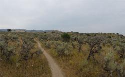
Sidewinder Trail
Ririe, Idaho
3.3 miles SSidewinder's claim to fame is that it's on a South facing hill just above the Snake River. That means that when all the other trails in the Kelly Canyon Trail network are covered with snow...
Mountain Bike 3.8 mi
Stinking Springs
Ririe, Idaho
3.3 miles SStinking Springs is a great early to late season trail. Being at the edge of the Big Hole range, it gets spring earlier and winter later than other trails in the range. It's closed from December...
Hike, Mountain Bike 4.3 mi
Leaning Fir #169
Ririe, Idaho
3.6 miles SEMountain Bike near Ririe, Idaho
Mountain Bike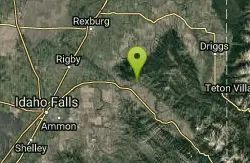
Wolverine Creek Trail
Ririe, Idaho
5.1 miles SEThe Wolverine Creek Trail is a doubletrack trail in Ririe, Idaho. It begins at South Fork Road and ends at Wolverine trailhead. It is commonly used by dirt bikes and four wheelers. This trail is...
Mountain BikeNearby Campsites

Big Hole Dispersed Campsites
Ririe, Idaho
1.6 miles NEA dispersed campsite is simply an unestablished and unmaintained area where people camp. Often, this means that there is a campfire or other basic campsite feature to identify the site and that's...
Camp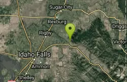
Paramount Wall / Blanche Rock
Ririe, Idaho
1.8 miles SWSitting high above the road, the routes at Paramount offer great exposure and relief from the afternoon summer sun. Chuck Oddette, Steve Reiser and Jed Miller established the routes from 1989...
Camp, Horseback, Rock Climb
Table Rock Campground
Ririe, Idaho
2.5 miles SETable Rock / Poison Flat Campground is located at the Caribou-Targhee National Forest which occupies over 3 million acres and stretches across southeastern Idaho, from the Montana, Utah, and Wyoming...
Camp
Kelly Island Campground
Ririe, Idaho
2.8 miles SWThis is a BLM campground with 14 campsites for RVs or tents and 1 group campsite. Daily Rates $5-20 Showers No Bathrooms Vault...
Camp 0.5-3.5 mi
Webster's Dam
Ririe, Idaho
3.2 miles NEAlso known as Manmade Falls or the Woodmansee Dam, Webster Dam is an abandoned dam located deep in Moody Creek canyon, the dam was abandoned when sediment built up behind the dam which then...
Camp, Hike, Mountain Bike
Wolf Flats Recreation Area
Ririe, Idaho
4.0 miles SWolf Flats is a completely free, dispersed, undeveloped camping area with 25 locations to camp. Some areas are large enough to accommodate groups of 50 people.
Camp
Twin Bridges Park
Rexburg, Idaho
7.1 miles WTwin Bridges is a campground 12 miles South East of Rexburg on S. 600 E. It is maintained by Madison County Parks Department. It is a 27 acre park of pristine land rich with wildlife on the Snake...
Camp, Canoe
Moody Meadows
Driggs, Idaho
8.3 miles EGood place for kids, they can ride bikes in the meadow, play in the stream, and camping is off of the road. Hiking, motorbiking, and horseback riding trails are abundant in the area.
Camp
Jefferson County Lake (AKA Rigby Lake)
Rigby, Idaho
14.2 miles WRigby Lake has long been a favorite swimming hole for those in the area. The county has taken it well under its wing and made it a buzzing spot on any warm summer day. Along with the long standing...
Camp, Canoe, Dive, Kayak, Sled, Swim 0.1-0.5 mi
Eagle Park
Rexburg, Idaho
15.1 miles NWEagle Park is a little urban oasis. Once you drive in to this cottonwood forest along the river, you may forget that you're still inside Rexburg city limits. You can camp, picnic, throw rocks in...
Camp, Hike, Mountain Bike, Sled
Beaver Dick Park
Rexburg, Idaho
18.2 miles NWBeaver Dick is a park 4.5 miles west of Rexburg, Idaho on Hwy 33. It's a 9.5 acre park that passes next to the west bank of the Henry Fork of the Snake River; it's a popular...
Camp, Canoe, Disc Golf, Swim 0.8-1.3 mi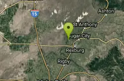
Warm Slough Campground
Rexburg, Idaho
19.2 miles NWThis is a pretty popular campsite that fills up pretty quick on busy weekends. Campsites are fairly spread out and there is no official donation box (as of July 2015). A couple of the campsites...
Airsoft, Camp, Canoe
Fall Creek Falls
Swan Valley, Idaho
19.4 miles SEFalls Campground is located next to the Snake River near beautiful Swan Valley, only 45 miles east of Idaho Falls, Idaho. Mixed growth cottonwood trees provide partial shade, and grassy meadows with...
Camp, Cave, Hike, Kayak, Swim 0.6-2.0 mi
North Menan Butte ('R' Mountain)
Menan, Idaho
20.3 miles NWThe North Menan Butte is more commonly known to the locals and college students as R Mountain. Many kids know it better as Ou'R' Mountain. The butte is a rare and unique geological area and provides...
Camp, Cave, Hike
Falls Campground
Victor, Idaho
20.3 miles SEFalls Campground is located next to the Snake River near beautiful Swan Valley, only 45 miles east of Idaho Falls, Idaho. Mixed growth cottonwood trees provide partial shade, and grassy meadows...
Camp
Pine Creek Campground
Victor, Idaho
21.8 miles EThe Pine Creek Campground has 10 single units and has restrooms.
Camp 5.6-8.3 mi
Palisades Creek Trail / Lakes and Waterfall Canyon
Irwin, Idaho
27.3 miles SEPalisades Creek Trail is located about 50 miles southeast of Idaho Falls and about 60 miles west of Jackson Hole WY in Swan Valley Idaho. The four mile hike up to lower Palisades Lake or the 6.2 mile...
Backpack, Camp, Hike, Horseback, Mountain Bike
Badger Creek
Tetonia, Idaho
27.7 miles NEBadger Creek is a stream located just 13.6 miles from Ashton, in Teton County, in the state of Idaho, United States, near France, ID. Whether you’re spinning, baitcasting or fly fishing your...
Camp, Cross-country Ski, Hike, Mountain Bike, Rock Climb
Mike Harris Campground
Victor, Idaho
28.7 miles EMike Harris Campground is located along scenic Teton Pass, just 5 miles from Victor, Idaho at an elevation of 6,200 feet. Visitors enjoy fishing, exploring local trails and sightseeing in this...
Camp
Darby Canyon Camping
Alta, Wyoming
30.3 miles EThere's no official campgrounds up the canyon but there are several dispersed campsites with existing fire lays. Please adhere to principles of Leave No Trace. Use existing fire lays and leave...
Camp


