Santa Clara River Reserve
Ivins, Utah
| Address: | ~Anasazi Trail, Ivins, UT 84738, USA |
| GPS: |
37°7'15.8"N 113°40'30.4"W Maps | Directions |
| State: | Utah |
| Trail Length: | 6.00 miles |
| MTB Difficulty: | Intermediate |
| Trail Type: | Loop |
| MTB Trail Type: | Singletrack |
| Trails/Routes: | 0.9-7.8 mi |
Mountain Bike
The Santa Clara River Reserve, located near Santa Clara, Utah and Snow Canyon State Park, is a trail system close to the Green Valley trail system that has similar trails and a connecter trail between the two systems for the hard core riders that want get as much mountain biking in as possible. With many trails rated from beginner to moderate, the Santa Clara River Reserve trails have a little something for all riders. If you are looking for an all day riding experience, there are plenty of trails to do so, or if you are looking to have a short bike ride in between other activities in the busy St. George area, there are plenty of shorter options as well. Be sure to follow all trail etiquette with other bike riders and hikers along these trails and watch for the weather to make sure you are not riding after a rainstorm when the trails are muddy. All trails in the reserve are best from April to September. Santa Clara River Reserve will wow you with the variety of trails you can both hike and bike along the beautiful bluffs of Southern Utah!
Barrel Roll is a short but difficult trail and many bikers from out of town assume that they can bike it fairly easily. Make no mistake, the Barrel Roll trail packs quite a punch in its 6 mile round trip with rocky slides and a trail that is mostly uphill, although riders get to enjoy the beautiful view of the City of St. George, Snow Canyon, and the red rock bluffs surrounding the area.
Black Brush is a 4 mile trail that takes riders up and down the red rock bluffs just outside of Snow Canyon. It is moderately trafficked and mostly used by hikers, so if you are riding your bike along this trail be sure to be courteous to the hikers in the area. The loop takes riders and hikers along the rim of one of the bluffs where wildflowers, views of St. George and Snow Canyon, and desert wildlife can be seen.
Cove Wash Access Trail is a short but steep trail that gives riders access to the entire Cove Wash trail. It is often viewed as a "warm-up" for the entirety of the Cove Wash trail and gives beginner riders a taste of what the entire trail is like. The trail itself is only a mile long and could be a great place for a short hike if you are pressed for time.
Cove Wash (East & West) trail is a heavily trafficked 10 mile trail that mountain bikers share with ATV riders. Be aware of all riders along the trail and do not attempt to pass ATV riders or mountain bikers. This trail is mostly an uphill ride until riders can coast down to the wash to end the out and back style trail. It is not one of the more popular trails in the system, but is a great option for any biker that wants to challenge themselves while riding in the trail system.
Gates Lane is one of the unique trails along the Santa Clara River Reserve. The trail head is located along a residential street and continues 1.6 miles until bikers meet up with the rest of the trail system. The trail is gradually up hill until bikers get to the large incline at the end where the trail meets up with the trail system. Gates Lane is mostly used as a connecter trail that can be great for a quick ride.
The Precipice Trail is a less than one mile trail that is most used as a connecter trail between the Sidewinder trail and Barrel Roll. but it is a challenge to all those that dare to ride it. With a steep incline and a narrow trail about half way through because of a small rock slide that happened recently because of construction in the area.
The Rim Runner loop bike trail offers a unique ride along the tabletop mesas of southern Utah. As you ride along this one of a kind trail, bikers overlook the vast desert landscape complete with rolling hills, switchbacks and lots of sand. Riders of an intermediate to beginner level would be fine on this trail to gain more experience with biking around and over large rocks, experience rough terrain, bike through sand, and through smooth washes that allow for faster biking.
The Sidewinder Trail is a 1.7 mile alternative trail to Barrel Roll that is a great shortcut, but it is not the easy trail riders are looking for. With hills, sand, and narrow trails, Sidewinder trail will keep you on your toes as you ride through this short but challenging trail.
Suicidal Tendencies is one of the more advanced trails in the Santa Clara River Reserve system as a Black Diamond level trail. This trail is 4 miles with sharp twists and turns, steep hills, narrow trails with sheer cliffs off the edge, and fast down hill areas, this trail is sure to get your blood pumping as you cruise through this trail. Suicidal Tendencies is one of the more popular trails in the system amongst the more advanced bikers. While it is fun to ride this trail quickly, be sure to be mindful of other bikers that may not be going as fast.
Mapped Route/Trail Distances
| Rim Runner Loop | 1.7 miles |
| Barrel Roll | 5.7 miles |
| Black Brush | 3.2 miles |
| Cove Wash Access Trail | 1.0 miles |
| Cove Wash East | 1.8 miles |
| Cove Wash West | 4.9 miles |
| Gates Lane | 1.5 miles |
| Precipice | 0.9 miles |
| Rim Runner Loop | 7.1 miles |
| Sidewinder | 1.7 miles |
| Stucki | 7.8 miles |
| Suicidal Tendencies | 3.9 miles |
More Information
Never modify trail features. Ride trails when they're dry enough that you won't leave ruts. Speak up when you see others on the trail and always yield to hikers, horses, and others coming uphill. Always ride on the established trail.
Read MoreDirections
From Ivins, Utah
- Head south on Main St toward E Center St (1.2 mi)
- Turn left onto E Old US Hwy 91 (1.2 mi)
- Continue onto Santa Clara Dr/
W Sunset Blvd (0.6 mi) - Turn right onto Gates Ln (0.3 mi)
- Gates Ln turns right and becomes Clary Hills Dr (0.6 mi)
- At the traffic circle, take the 2nd exit onto Colbey Loop (361 ft)

Trails
Distance ?
1.7 milesReal Ascent ?
350 feetReal Descent ?
356 feetGrade (-10° to 9°)
-18% to 16%Distance ?
5.7 milesReal Ascent ?
685 feetReal Descent ?
686 feetGrade (-19° to 11°)
-35% to 19%Distance ?
3.2 milesElevation Gain ?
-101 feetReal Ascent ?
526 feetReal Descent ?
627 feetAvg Grade (0°)
-1%Grade (-31° to 27°)
-59% to 51%Distance ?
1.0 milesElevation Gain ?
314 feetReal Ascent ?
373 feetReal Descent ?
59 feetAvg Grade (3°)
6%Grade (-9° to 15°)
-16% to 27%Distance ?
1.8 milesElevation Gain ?
-140 feetReal Ascent ?
661 feetReal Descent ?
801 feetAvg Grade (-1°)
-2%Grade (-32° to 32°)
-62% to 62%Distance ?
4.9 milesElevation Gain ?
248 feetReal Ascent ?
777 feetReal Descent ?
529 feetAvg Grade (1°)
1%Grade (-25° to 16°)
-47% to 29%Distance ?
1.5 milesElevation Gain ?
373 feetReal Ascent ?
420 feetReal Descent ?
47 feetAvg Grade (3°)
5%Grade (-4° to 16°)
-7% to 28%Distance ?
0.9 milesElevation Gain ?
138 feetReal Ascent ?
253 feetReal Descent ?
115 feetAvg Grade (2°)
3%Grade (-15° to 15°)
-27% to 27%Distance ?
7.1 milesElevation Gain ?
0 feetReal Ascent ?
1,329 feetReal Descent ?
1,329 feetAvg Grade (0°)
0%Grade (-24° to 25°)
-45% to 48%Distance ?
1.7 milesElevation Gain ?
335 feetReal Ascent ?
539 feetReal Descent ?
204 feetAvg Grade (2°)
4%Grade (-23° to 26°)
-42% to 50%Distance ?
7.8 milesElevation Gain ?
-173 feetReal Ascent ?
7,981 feetReal Descent ?
8,154 feetAvg Grade (0°)
-1%Grade (-73° to 73°)
-323% to 321%Distance ?
3.9 milesElevation Gain ?
83 feetReal Ascent ?
860 feetReal Descent ?
777 feetAvg Grade (0°)
0%Grade (-18° to 21°)
-33% to 38%Elevation differences are scaled for emphasis. While the numbers are accurate, the cut-away shown here is not to scale.
Other Mountain Bike Trails Nearby

Snake Hollow Bike Park
St. George, Utah
2.4 miles ESnake Hollow encompasses 80 acres of land in west St. George, located primarily on the west side of the park, with some additional courses on the east side along Tuweap Drive. There are hundreds of...
Mountain Bike
Paradise Rim/turtle Wall
St. George, Utah
4.0 miles EThis is a great little ride, easily accessible from town. Follow the trail downhill from the parking lot. It will curve toward town then back to the North. At the sign for the Beck...
Mountain Bike 0.5-15.1 mi
Green Valley Trail System
St. George, Utah
5.4 miles SEThe Green Valley trail system, located just outside of St. George, Utah, is a heavily trafficked trail system that features some of the more popular trails in Southern Utah. With trails such as the...
Hike, Mountain Bike
Pioneer Park
St. George, Utah
5.8 miles EThis trail is easy aerobic and intermediate/advanced technical. Look for the singletrack in the SE corner it quickly become double track follow this up hill for a short climb and then...
Mountain Bike 0.2-0.4 mi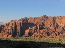
Snow Canyon State Park
St. George, Utah
6.0 miles NSnow Canyon State park is often described as a smaller version of Zion National park. While both offer similar beautiful landscapes, exciting trails for adventure seeking hikers, and family friendly...
Cave, Hike, Mountain Bike, Rock Climb
Ice House Loop
St. George, Utah
7.1 miles NEThe Ice House loop is a great trail in the St George area to try and ride. This portion of the trail is actually part of the Broken Mesa Loop, and is about 6.8 miles of the 15 mile loop. What...
Mountain Bike
Broken Mesa Rim
St. George, Utah
9.1 miles NEThe trail starts at the northern end of the Red Cliffs Desert Reserve. You'll make an initial singletrack climb up some fairly buff switchbacks. At 0.5 mile, the trail reaches a...
Mountain Bike 11.3 mi
Grapevine Trail
Washington, Utah
10.4 miles EThe Grapevine trail located near Washington, UT is a unique trail that connects to several other trails in the area such as the Prospector trail and the Church Rocks trail. What makes the Grapevine...
Hike, Mountain Bike 18.8 mi
Church Rocks
Washington, Utah
10.6 miles EThe Church Rocks hike near Hurricane, Utah, about a half hour outside of St. George, is another hidden gem outside of Zion National Park. Similar to the Slick Rock Trail in Moab, there are lots...
Hike, Mountain Bike
Prospector - Church Rocks Loop
Hurricane, Utah
15.8 miles EThe trail leaving the parking area is a wide track for about the first quarter mile until a signed intersection where you will turn left (south) onto singletrack and start your ride...
Mountain Bike
Hurricane Rim trail
Hurricane, Utah
19.9 miles EThis is fun but rocky trail along the rim above the Virgin river. There are some sections of slab rock that are awkward, and there are several areas of exposure of several hundred feet...
Mountain Bike
Gould's Rim trail
Hurricane, Utah
20.3 miles ERide the long steady double track climb for about two miles. After you reach the top of the hill, watch for the singletrack branching off to the right about 0.5 miles further...
Mountain Bike 3.4 mi
More Cowbell
Virgin, Utah
23.9 miles EThe More Cowbell loop, located outside of Hurricane, Utah, is a beginner level bike trail that gives riders a good feel for what mountain biking is like. It is a great practice run for bigger, more...
Hike, Mountain Bike 5.1 mi
Dead Ringer
Virgin, Utah
23.9 miles EThe Dead Ringer trail is one of three biking trails located just outside of Hurricane, Utah. Starting at the JEM trailhead, bikers start on a winding, up and down trail that runs parallel to the JEM...
Hike, Mountain Bike 13.0 mi
Little Creek Mesa
Hurricane, Utah
25.2 miles EThe Little Creek Mesa trail, located just outside of Hurricane, Utah, is a single track trail in the red rock mesas around the city of Hurricane. It is intermediate level but not so difficult that it...
Mountain Bike
Crypto-Goosebumps
La Verkin, Utah
25.7 miles EProceed west on the trail about 1 mile to Junction of JEM and Hurricane Rim. This is the return point on the trail. Turn right onto the Rim trail and follow it to the outhouse and...
Mountain Bike 6.9 mi
J.E.M. Trail
La Verkin, Utah
25.9 miles EThe J.E.M. trail is one of the many exciting trails located just outside of Hurricane, Utah. It is connected with the More Cowbell and Dead Ringer trails and is the longest of all three trails...
Hike, Mountain Bike 11.6 mi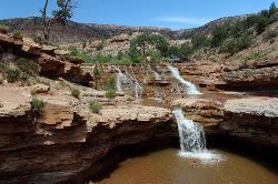
Toquerville Falls
La Verkin, Utah
26.5 miles NENothing says desert oasis quite like driving for 5.5 miles through winding sandy roads to find a favorite swimming hole with ledges, falls, and even a ladder to climb up to the best jumping spots....
Dive, Hike, Mountain Bike, Swim
Gooseberry Mesa
Hurricane, Utah
27.8 miles EThe Gooseberry Mesa trail, located near Hurricane, Utah, is one of the most scenic mountain biking trails in southern Utah. Located near the Little Creek Mesa trail, it features beautiful mesas,...
Mountain Bike 3.3 mi
Guacamole Mesa
Virgin, Utah
31.7 miles EGuacamole Mesa, also known by locals as the Whole Guacamole, is an advanced level biking trail in Virgin, Utah (just outside of Hurricane). The trail starts in a climb up the mesa that features tight...
Hike, Mountain BikeNearby Campsites
Sand Hollow State Park
Hurricane, Utah
16.1 miles ESand Hollow is the closest thing to a tropical paradise in the middle of the Utah desert, near Hurricane, Utah. It features a beach area, places to cliff jump, swim, and off-road with your ATV. There...
Camp, Canoe, Dive, Kayak, Swim
Zion National Park
Hurricane, Utah
38.5 miles EThis is a unique place in the world. Sandstone,carved from wind, water and ice have created icons to visitors. The buttes, landings, bends, mounts and mountains have all been given names over the...
Camp, Hike, Mountain Bike, Swim


