


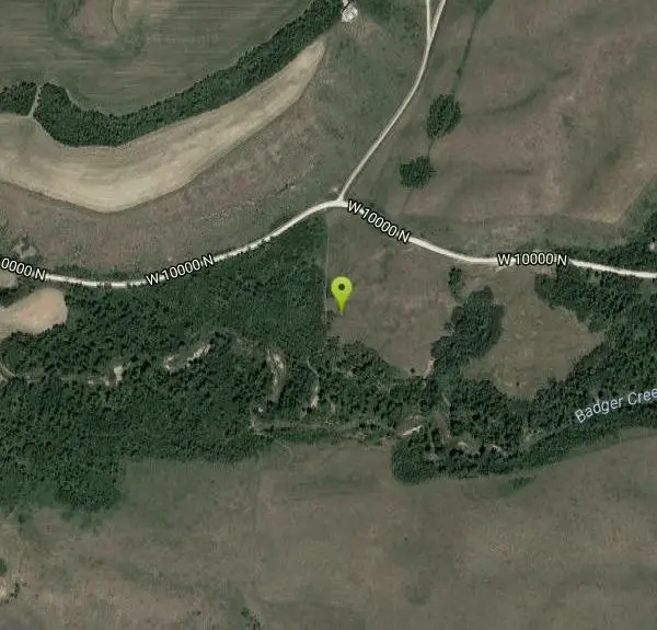
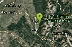
Badger Creek
Tetonia, Idaho

Camp, Cross Country Ski, Hike, Mountain Bike, and Rock Climb
Badger Creek is a stream located just 13.6 miles from Ashton, in Teton County, in the state of Idaho, United States, near France, ID. Whether you’re spinning, baitcasting or fly fishing your chances of getting a bite here are good. So grab your favorite fly fishing rod and reel, and head out to Badger Creek.
More Information
Add ResourceNever modify trail features. Ride trails when they're dry enough that you won't leave ruts. Speak up when you see others on the trail and always yield to hikers, horses, and others coming uphill. Always ride on the established trail.
Read MoreBe courteous, informed, and prepared. Read trailhead guidelines, stay on the trail, and don't feed the wildlife.
Read More- Plan Ahead and Prepare
- Travel & camp on durable surfaces
- Dispose of waste properly
- Leave what you find
- Minimize campfire impacts
- Respect wildlife
- Be considerate of other visitors
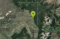
Directions
From Tetonia, Idaho
- Head north on ID-33 W/S Main St toward Central AveContinue to follow ID-33 W(0.6 mi)
- Turn right onto N 3000 W (2.8 mi)
- Turn right onto W 10000 N (0.6 mi)
Located just 13.6 miles from Ashton, in Teton County, in the state of Idaho, United States, near France, ID.
Other Rock Climbing Walls, Mountain Bike Trails, Hiking Trails, and Cross Country Ski Trails Nearby
Bitch Creek Trestle
Tetonia, Idaho
6.3 miles NAs part of the Rails to Trails project, this old railroad bridge has been transformed into a very safe little viewing experience for the whole family. You can drive right up to the bridge where...
Hike
Alta Nordic Trail
Alta, Wyoming
9.3 miles SEDistance: 6.2 miles (10km) Trail Map: Alta_Nordic_Trail_2015.pdf Grooming Report: http://tvtap.org/nordic-grooming
Cross-country Ski, Snowshoe
Driggs Nordic Trail
Driggs, Idaho
9.5 miles SDistance: 3.1 miles (5km) Trail Map: Driggs_Nordic_Track_2015.pdf Grooming Report: http://tvtap.org/nordic-grooming
Cross-country Ski, Snowshoe 3.9 mi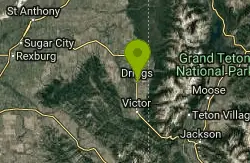
Three Wookie Trail
Driggs, Idaho
9.8 miles SMountain Bike near Driggs, Idaho
Mountain Bike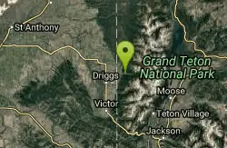
Cold Springs
Moose, Wyoming
10.1 miles SETrail is easiet down as a loop but can be done as a shuttle as well. Take a right into Teton Canyon and park at the first big parking lot on the left. About 50 yards from Ski Hill rd....
Mountain Bike 0.1-0.2 mi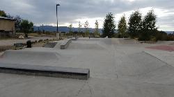
Driggs Bike and Skate Park
Driggs, Idaho
10.1 miles SThis is a great concrete skatepark and small mountain bike park with great features, both natural and wooden. There's a great pavilion right next to the skatepark and parking lot. While...
Mountain Bike, Skateboard 7.1 mi
Mill Creek Trail
Moose, Wyoming
10.7 miles SEThere are two ways to do this ride, one as a loop with the Targhee road providing the bulk of the climb, or as an out and back (up the trail and back down). Keep in mind that this trail is...
Cross-country Ski, Mountain Bike, Snowshoe 1.7 mi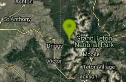
Rick's Basin
Driggs, Idaho
10.7 miles SEMountain Bike near Driggs, Idaho
Mountain Bike 4.5 mi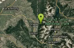
Sheep Bridge Trail
Driggs, Idaho
10.7 miles SEThis is a great easy trail for beginner hikers or mountain bikers. In the early summer, you'll find many beautiful wildflowers and large kaleidoscopes of butterflies to go with them. You...
Hike, Mountain Bike 2.1 mi
Buffalo Soldier
Moose, Wyoming
10.8 miles SETrail is a nice loop, all singletrack, with about 300' of elevation gain. Trail is about 1.8 miles one way. You can also use it as a connector to Mill Creek or lightning loop. Buffalo...
Mountain Bike 4.0 mi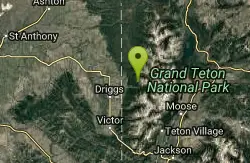
Quakie Ridge
Moose, Wyoming
10.8 miles SETrail starts at the base ski area on a service road then heads out on nice single track. Trail winds through meadows of wildflowers. Some minor altitude gain along the trail. The...
Mountain Bike 1.9 mi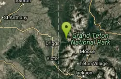
Perm-a-grin
Moose, Wyoming
10.8 miles SEPerma Grin is guaranteed to fix a smile on your face indefinitely! This swooping, flowing, smooth singletrack descends the hillside above Rick's Basin.
Mountain Bike 1.1 mi
More Cowbell
Moose, Wyoming
10.8 miles SEThis singletrack trail winds through aspens, high alpine meadows and old growth conifers.
Mountain Bike 0.6-4.0 mi
Grand Targhee XC Park
Moose, Wyoming
10.8 miles SEMountain Bike
Spring Creek Trail
Alta, Wyoming
11.0 miles SEThis trail starts at the remains of the historic Rapid Creek Ranger Station. The trail heads east following an old road. After crossing Rapid Creek, the trail climbs up to a ridge...
Mountain Bike 0.6 mi
Packsaddle Lake
Tetonia, Idaho
11.2 miles SWPacksaddle is one of the less well known lakes/trails in the area. If you've got a good offroad vehicle, you can probably make it all the way to the end of the road, otherwise, it's just an...
Dive, Hike, Mountain Bike, Snowshoe, Swim 4.5 mi
Aspen Trail
Alta, Wyoming
11.3 miles SEAspen Trail (tr 034) is single track trail for 4.35 miles along 6,800 ft contour to Darby Canyon (tr 012). Spring Creek Trail (tr 032) is double track trail for 3.68 miles to end. The trail starts...
Hike, Mountain Bike
Sharks Belly
Driggs, Idaho
11.4 miles SWTrail system can start from Channel lock or Bovine. Channel Lock is an easier climb than Bovine. This description and mileage starts at the Channel Lock trail, forest service boundary marker. Take...
Mountain Bike
Southbound
Driggs, Idaho
11.4 miles SWTrail starts by going up the Channel lock trail. At the top of Channel Lock go right onto the Southbound trail. Trail will loop back to Channel lock which you take back to your car. Trail is...
Mountain Bike
Channel Lock
Driggs, Idaho
11.4 miles SWTrail is a little over 1 mile uphill. Recommended route up to access the larger Horseshoe canyon trail system. Makes a nice downhill with twists. Gets its name from the deep ruts made from cows....
Mountain Bike
Nearby Campsites

Reunion Flat Campground
Alta, Wyoming
12.2 miles SECamp near Alta, Wyoming
Camp
Teton Canyon Campground
Alta, Wyoming
13.6 miles SETeton Canyon is the start of several great adventures, including the Alaska Basin Trail, Table Rock, Devil's Stairs, and the Teton Crest. The campground offers a perfect basecamp to get an...
Camp 3.8-6.4 mi
Table Rock / Table Mountain
Driggs, Idaho
13.7 miles SEAt 11,300 feet, Table Mountain is possibly the most beautiful climb this side of the Tetons and offers what may well be the very best view of the Grand Tetons. It's just far enough away...
Camp, Hike
Darby Canyon Camping
Alta, Wyoming
14.5 miles SEThere's no official campgrounds up the canyon but there are several dispersed campsites with existing fire lays. Please adhere to principles of Leave No Trace. Use existing fire lays and leave...
Camp
Sheep Falls on Fall River
Ashton, Idaho
15.4 miles NThe lesser known Sheep Falls on Fall River is a local treasure off of Cave Falls road. There are primitive campsites and beautiful views for a great picnic spot. The water splits and comes down in...
Camp
Porcupine Creek
Ashton, Idaho
16.0 miles NPorcupine Creek is a hunting, fishing, camping, and swimming spot near Ashton, Idaho in Fremont County within Targhee National Forest. It's surrounded by forests, meadows, and a creek...
Camp, Swim
Warm River Campground
Ashton, Idaho
19.6 miles NWWarm River Campground is located nine miles northeast of Ashton, Idaho, along the slow-moving Warm River at an elevation of 5,200 feet. Willows line the riverbanks and pine trees offer partial...
Camp
Loon Lake
Ashton, Idaho
20.0 miles NECamp, Kayak, and Swim near Ashton, Idaho
Camp, Kayak, Swim
Moody Meadows
Driggs, Idaho
20.1 miles SWGood place for kids, they can ride bikes in the meadow, play in the stream, and camping is off of the road. Hiking, motorbiking, and horseback riding trails are abundant in the area.
Camp
Pine Creek Campground
Victor, Idaho
20.2 miles SThe Pine Creek Campground has 10 single units and has restrooms.
Camp
Cave Falls of Yellowstone
Ashton, Idaho
20.8 miles NThis campgrond is situated on the banks of Fall River in Wyoming along the south border of Yellowstone National Park. Cave Falls Campground has 23 single site units and a terrific area for...
Camp, Hike
Horseshoe Lake
Ashton, Idaho
20.8 miles NHorseshoe Lake is hidden back in the Targhee National Forest. It's a beautiful lake with plenty of lily pads. The road to get there is well maintained and there are many options for pull-outs...
Camp, Canoe, Dive, Swim 0.3-0.6 mi
Bear Gulch
Ashton, Idaho
21.1 miles NBear Gulch is an abandoned ski hill out of operation since 1969. While the vegetation is beginning to take over, there's still some great sledding to be had. It's just far enough into the...
Camp, Cross-country Ski, Hike, Sled
Mike Harris Campground
Victor, Idaho
21.5 miles SMike Harris Campground is located along scenic Teton Pass, just 5 miles from Victor, Idaho at an elevation of 6,200 feet. Visitors enjoy fishing, exploring local trails and sightseeing in this...
Camp
Jenny Lake Campground
Jackson Hole, WY
22.7 miles EJenny Lake campground is a scenic beauty in the heart of Grand Teton National Park. It's understandable why it often fills before 8 AM during peak summer periods. It's nestled right at the...
Camp 1.3-4.3 mi
Phelps Lake
Jackson, Wyoming
24.9 miles SEThe Phelps Lake trail, located in Teton National Park, Wyoming, is in one of the most scenic locations of the park. Usually overshadowed by nearby Jenny Lake, it can often be missed by visitors of...
Backpack, Camp, Dive, Hike, Swim 17.5 mi
Tear Drop Lake
Ashton, Idaho
25.1 miles NNestled in the Targhee National Forest just off of Ashton's Fish Creek Road, this tear drop shaped lake is a family adventure waiting to happen. The lake isn't very big but it is teeming with...
Camp, Canoe, Hike, Kayak, Mountain Bike, Swim 0.5-3.5 mi
Webster's Dam
Ririe, Idaho
25.2 miles SWAlso known as Manmade Falls or the Woodmansee Dam, Webster Dam is an abandoned dam located deep in Moody Creek canyon, the dam was abandoned when sediment built up behind the dam which then...
Camp, Hike, Mountain Bike
Big Hole Dispersed Campsites
Ririe, Idaho
26.3 miles SWA dispersed campsite is simply an unestablished and unmaintained area where people camp. Often, this means that there is a campfire or other basic campsite feature to identify the site and that's...
Camp
Table Rock Campground
Ririe, Idaho
27.2 miles SWTable Rock / Poison Flat Campground is located at the Caribou-Targhee National Forest which occupies over 3 million acres and stretches across southeastern Idaho, from the Montana, Utah, and Wyoming...
Camp


