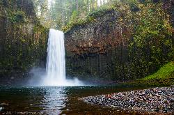
Abiqua Falls
Scotts Mills, Oregon
| Address: | Abiqua Falls Trailhead, Crooked Finger Rd NE, Scotts Mills, OR 97375, USA |
| GPS: |
44°55'51.6"N 122°34'3.3"W Maps | Directions |
| State: | Oregon |
| Trail Length: | 1.10 miles |
| Trail Type: | Out & Back |
| Hike Difficulty: | Advanced |
| Elevation Gain: | 250 feet |
Waterfalls Streams Rocks
Hike
This rough hiking trail will be well worth your effort and time. Although the trail is unmarked, there is a rope to steady yourself on the steep parts of the hike and guide you through the forest. Don't rely on your GPS to get you to the waterfall because you likely won't have cell reception. The waterfall is located on private land but is currently available to visitors who take the "trail". Finding the trailhead may be a bit problematic and will take a bit of off-roading to find, so again, don't completely rely on your GPS to find it for you. If you see a white sign on a tree or some arrows carved into a tree, you're going the right way.
This is a very steep hiking trail and becomes very slick, especially in the colder and rainier months. Some areas are very rocky and will require you to climb over big rocks and a few fallen trees. The trail ends at a basalt bowl with the breathtaking Abiqua Falls plunging into it. This is a hidden gem that is similar to the fall formations at Silver Falls State Park. Many people love taking pictures of this beautiful area. Facing the 92-foot waterfall, you will feel as if you are enclosed in a deep, mossy canyon. Also, if it's warm enough, people wade into the chilly water and get closer to the falls. Depending on the time of year, the water can be deep enough to swim in.
It is not recommended to bring small children or dogs on this hike because the climb back up is very steep and is difficult enough for the average person to just pull themselves up the ascent by the ropes.
Due to the difficulty of this hike, the fantastic destination at the end will surely feel very rewarding!
More Information
Be courteous, informed, and prepared. Read trailhead guidelines, stay on the trail, and don't feed the wildlife.
Read MoreDirections
From Scotts Mills, Oregon
- Head east on 4th St toward Grandview Ave (0.1 mi)
- Turn right onto Crooked Finger Rd NE (10.7 mi)
- Turn right (1.0 mi)
Other Hiking Trails Nearby
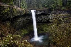
Silver Falls State Park
Sublimity, Oregon
5.7 miles SWSilver Falls State Park is a forested canyon that features 10 amazing waterfalls throughout the park. It is the largest state park in Oregon and one of the most popular, both nationally and...
Camp, Hike, Horseback, Swim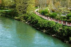
Willamette River Trail
Canby, Oregon
24.6 miles NThe Willamette River trail is a mix of both paved and natural surface trails. It is a relatively flat trail that would be perfect if you want to take a leisurely bike ride and you're not up...
Hike, Mountain Bike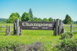
Champoeg State Park
Saint Paul, Oregon
27.0 miles NWChampoeg State Park (commonly pronounced SHAM-poo-EE) is a historic pioneer site as well as a beautiful outdoor recreational area. The Native Americans originally pronounced it CHAM-po-EGG, but it...
Camp, Disc Golf, Hike, Mountain Bike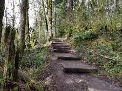
Tryon Park
Portland, Oregon
35.6 miles NImagine stepping into a lush forest, where woodpeckers forage, squirrels leap from limb to limb, owlets wait quietly for their next meal, beavers work busily by the creek, bats bury deep...
Backpack, Hike, Horseback
Wildwood Recreation Site
Mount Hood Village, Oregon
40.7 miles NEWildwood Recreation Site is located along the Mount Hood Scenic Byway near the town of Welches, Oregon. Mount Hood, Oregon's tallest mountain, beckons travelers through a forested corridor to...
Hike, Mountain Bike, Swim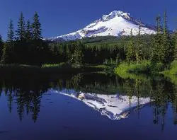
Mirror Lake Trail
Government Camp, Oregon
45.8 miles NEThis family-friendly hiking trail leads to the beautiful Mirror Lake. It gets the name because it reflects Mount Hood in the still, glacier cirque lake. You will walk through a dense forest and...
Hike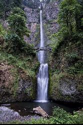
Multnomah Falls
Cascade Locks, Oregon
49.7 miles NEMultnomah Falls is a 620-foot waterfall in Oregon located on the side of the Columbia River Gorge, located east of Troutdale, between Corbett and Dodson, along the Historic Columbia River...
HikeNearby Campsites

Silver Falls State Park
Sublimity, Oregon
5.7 miles SWSilver Falls State Park is a forested canyon that features 10 amazing waterfalls throughout the park. It is the largest state park in Oregon and one of the most popular, both nationally and...
Camp, Hike, Horseback, Swim
Champoeg State Park
Saint Paul, Oregon
27.0 miles NWChampoeg State Park (commonly pronounced SHAM-poo-EE) is a historic pioneer site as well as a beautiful outdoor recreational area. The Native Americans originally pronounced it CHAM-po-EGG, but it...
Camp, Disc Golf, Hike, Mountain Bike


