


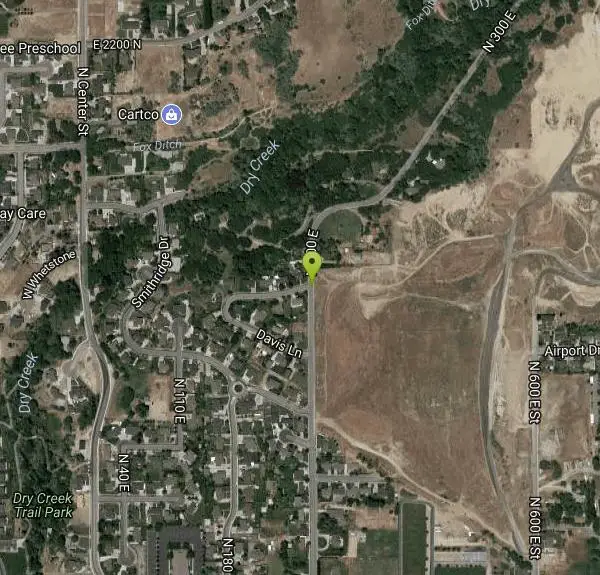
300 East Lehi Lot
Lehi, Utah
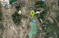
| Address: | 1900 N 300 E, Lehi, UT 84043, USA |
| GPS: |
40°24'40.4"N 111°50'41.1"W Maps | Directions |
| State: | Utah |
Sled
This is a huge lot with a lot of terrain. There's a couple of easily accessible hills and plenty more that could be played on.
More Information
Add Resource- Plan Ahead and Prepare
- Travel & camp on durable surfaces
- Dispose of waste properly
- Leave what you find
- Minimize campfire impacts
- Respect wildlife
- Be considerate of other visitors
Directions
From Lehi, Utah
- Head south on N 100 W St toward W 300 N St (95 ft)
- Turn right at the 1st cross street onto W 300 N St (0.2 mi)
- Turn right at the 2nd cross street onto N 300 W (0.9 mi)
- Turn right onto N 600 W St/N Frontage Rd (0.1 mi)
- Turn left onto Cedar Hollow Rd (387 ft)
- Continue onto W 1450 N (0.4 mi)
- Turn left onto N 300 E St (0.4 mi)
Parking isn't awesome but you should be able to find a decent spot along the road.
Other Sledding Hills Nearby
Shelley Elementary
American Fork, Utah
2.7 miles SESled near American Fork, Utah
Sled
Evergreen Park
American Fork, Utah
4.1 miles SESled near American Fork, Utah
Sled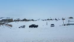
Silver Lake Ampitheater
Eagle Mountain, Utah
6.7 miles SWA clear favorite in Eagle Mountain right off Pony Express Parkway.
Sled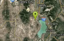
Sandpiper Hill
Eagle Mountain, Utah
8.4 miles SWThis is a great hill big enough to deal with just about any crowd it might get. It's a long slope that'll keep your kids going but doesn't get too insanely fast that you need to worry...
Sled
Oak Canyon Junior High
Lindon, Utah
9.3 miles SESled near Lindon, Utah
Sled
Orem Cemetary
Orem, Utah
10.9 miles SESled near Orem, Utah
Sled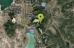
Tibble Fork Reservoir
Provo, Utah
11.6 miles NEThere isn't one specific sledding run at this location. There's a great parking lot and hills above and below. It all depends on what kind of speed and excitement you're looking for....
Sled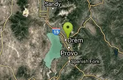
Cascade Park
Orem, Utah
11.8 miles SEThis is a small hill great for mom's looking to escape the crowd and let their little ones have a good time. It's pretty short but really wide so there's plenty to share.
Sled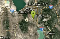
Daybreak Elementary
South Jordan, Utah
12.0 miles NWSled near South Jordan, Utah
Sled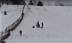
Flat Iron Mesa Park
Sandy, Utah
12.8 miles NSled near Sandy, Utah
Sled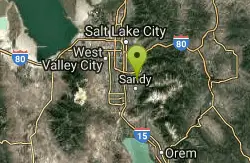
Willow Creek Park
Sandy, Utah
13.0 miles NThese are pretty short slopes for sledding. One is steeper than the other.
Sled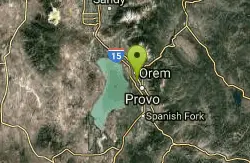
Cherry Hill Park
Orem, Utah
13.0 miles SEJust south of Cherry Hill Elementary, this is a small hill for small children great and moms who are looking to avoid a well populated hill. The hill is to the south of the playground and most...
Sled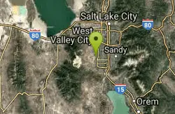
Vermillion Park
South Jordan, Utah
13.3 miles NWSled near South Jordan, Utah
Sled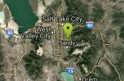
Bella Vista Elementary School'
Cottonwood Heights, Utah
14.8 miles NSled near Cottonwood Heights, Utah
Sled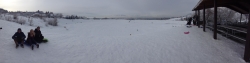
Rock Canyon Park
Provo, Utah
14.9 miles SEThis is the biggest park in Provo, Utah, with lots to do. The hills are great for sledding.
Sled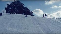
Murray Park
Murray, Utah
17.1 miles NSled near Murray, Utah
Sled
Bennion Park
Salt Lake City, Utah
17.6 miles NThe park is open from 7:00 a.m. to 10:00 p.m. It's a pretty flat and straight hill that's smaller on the North side but gets pretty big as it goes South.
Sled
Bicentennial Park
Provo, Utah
17.6 miles SEBicentennial Park is a favorite among disc golfers and families in the Provo area. The park has a 16-hole golf course, a duck pond, a playground, and a nature trail which features natural springs...
Disc Golf, Hike, Sled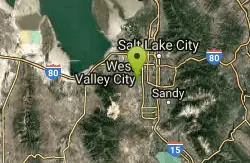
Western Hills Elementary
Kearns, Utah
19.0 miles NWSled near Kearns, Utah
Sled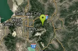
Spruces Campground
Salt Lake City, Utah
19.2 miles NECamping isn't free. See USDA.gov for details. If you know the coordinates of the sledding hill here, please comment.
Camp, SledNearby Campsites

Mount Timpanogas
Provo, Utah
10.9 miles EMt. Timp, as the locals call it, is the 2nd highest mountain in the Wasatch range (only Mt. Nebo is higher). What sets "Timp" apart is its location. It towers over the Provo, Orem, Pleasant...
Camp, Hike, Horseback, Swim
Y-Mountain Summit Trail
Provo, Utah
16.9 miles SEY Mountain is located directly east of Brigham Young University (BYU) in Provo, Utah, United States. The Slide Canyon/Y Mountain Trail leads to a large block Y located 1.2 miles (1.9 km) from a...
Camp, Hike
Spruces Campground
Salt Lake City, Utah
19.2 miles NECamping isn't free. See USDA.gov for details. If you know the coordinates of the sledding hill here, please comment.
Camp, Sled
Mill Creek Canyon
Salt Lake City, Utah
21.1 miles NMill Creek is an out and back with over 1000 ft of elevation gain. The lower section of the ski trail gets a lot of foot traffic, but the upper section (above Elbow Fork) is generally very quiet....
Camp, Cross-country Ski, Snowshoe
Holbrook Trailhead
Bountiful, Utah
32.5 miles Nairsoft feaild woth bunkers
Airsoft, Backpack, Camp, Paintball, Snowshoe 4.7 mi
Fifth Water Hot Springs
Provo, Utah
34.3 miles SEAKA Diamond Fork Hot Springs A beautiful drive and a 2.5 mile hike along the river will end you at an amazing set of hot springs that's well worth the trip. There's a variety of...
Backpack, Camp, Hike, Hot Springs, Mountain Bike, Swim 5.6 mi
Antelope Island Lakeside Trail
Syracuse, Utah
47.3 miles NWThe Lakeside Trail is a kid-friendly trail with great views and many bugs. This is a gorgeous scenic hike winding around part of the Great Salt Lake. The trail on Antelope Island that runs about...
Camp, Hike, Horseback
Antelope Island State Park
Syracuse, Utah
47.4 miles NWLocated just 41 miles north of Salt Lake City, Antelope Island State Park encompasses a vast selection of outdoor activities and spectacular scenery providing a peaceful nature experience. Experience...
Backpack, Camp, Hike, Horseback, Mountain Bike


